

Mapping lesson

Presentation
•
Geography
•
2nd - 5th Grade
•
Practice Problem
•
Hard

Sarah Buckley
FREE Resource
16 Slides • 20 Questions
1
2
Multiple Choice
Which of the following is NOT a common use of maps?
Finding directions to a new place
Understanding the layout of a city
Cooking a recipe
Planning a trip
3
Open Ended
What are some situations in your daily life where you might use a map?
4
Multiple Choice
How do OS maps help people understand the landscape?
By using colors to show temperature
By including symbols in a key to represent human and physical features
By showing only roads and cities
By providing satellite images
5
Multiple Choice
What is the main purpose of Ordnance Survey (OS) maps?
To show weather patterns
To depict the landscape’s human and physical features
To display population statistics
To show political boundaries
6
7

8
9
Fill in the Blanks
10
11
Open Ended
Describe a situation where you would need a map that shows all the smaller streets and footpaths in a town.
12
Multiple Select
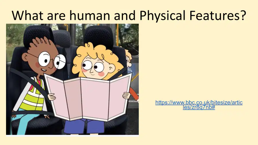
Which of the following features are considered human features on a map?
Forest
School
River
Post office
13

14

15
Multiple Choice

Which of the following is the starting point for the Wirral Coastal Walk?
Fort Perch Rock
Floral Pavilion, New Brighton
Marine Lake, West Kirby
Leasowe Lighthouse
16

17
Open Ended
Compare the types of information shown on the Chester & Ellesmere Port network map and the suggested walks map. How do these maps serve different purposes for users?
18
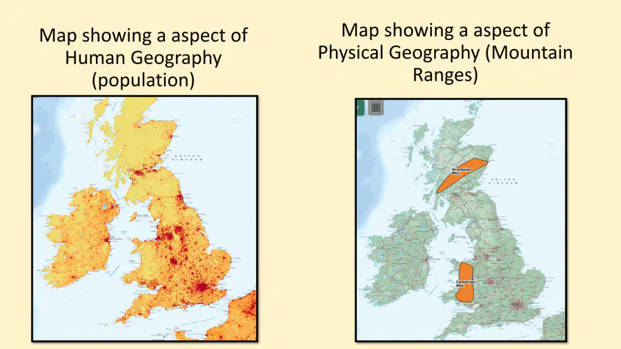
19
Multiple Select
Which map shows an aspect of human geography and which shows an aspect of physical geography? Select all that apply.
Left map: Human geography
Left map: Physical geography
Right map: Human geography
Right map: Physical geography
20

21
Open Ended
Ordnance Survey maps use symbols to represent features. Give one example each of a human feature and a physical feature that might be shown using a symbol on an OS map.
22
Fill in the Blanks
23

24
Open Ended
Explain one advantage of using an Ordnance Survey (OS) map over a satellite view when planning a walking route.
25

26
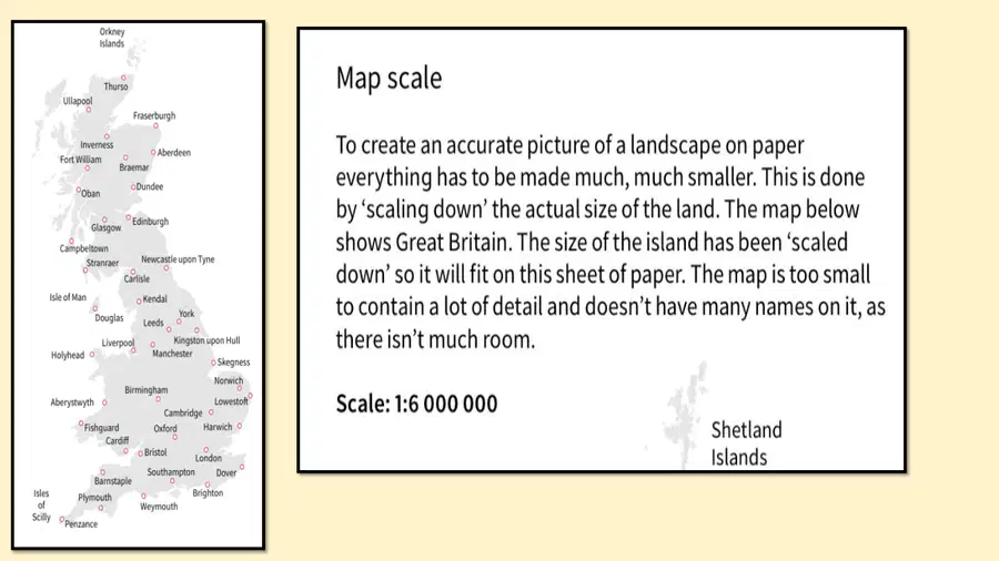
27
Multiple Choice
What does the scale 1:6 000 000 on a map mean?
The map is 6 million times larger than the real world
The map is 6 million times smaller than the real world
The map shows 6 million places
The map covers 6 million square kilometers
28

29
Fill in the Blanks
30
Multiple Select
Which of the following are true about map scales as shown in the images?
A 1:50 000 scale map shows more detail than a 1:6 000 000 scale map
A 1:25 000 scale map is more zoomed in than a 1:50 000 scale map
A 1:6 000 000 scale map is more detailed than a 1:25 000 scale map
A 1:50 000 scale map is less detailed than a 1:25 000 scale map
31

32
33
Multiple Choice
Which type of map would be most useful for planning a train journey across a city?
Ordnance Survey map
Network map
Satellite map
Physical map
34
Multiple Choice
What is one main difference between the two satellite images shown?
One shows more labels and places than the other
One is in black and white
One is upside down
One shows a different city
35
Open Ended
What materials did you use during the lesson on map skills, and how did they help you learn?
36
Open Ended
Explain the difference between a thematic map and an Ordnance Survey (OS) map, using examples from the images.
Show answer
Auto Play
Slide 1 / 36
SLIDE
Similar Resources on Wayground

29 questions
Lab Safety Is Common Sense
Presentation
•
KG
26 questions
Partes de la Casa y Muebles
Presentation
•
1st - 5th Grade
31 questions
ALJABAR
Presentation
•
KG
32 questions
Nucleosynthesis
Presentation
•
KG
31 questions
UNIT 7 - GETTING STARTED
Presentation
•
KG
29 questions
Electricity
Presentation
•
2nd - 5th Grade
30 questions
IBS Wizard World Camp
Presentation
•
1st - 6th Grade
30 questions
FIGURATIVE LANGUAGE
Presentation
•
3rd Grade
Popular Resources on Wayground
10 questions
HCS SCI 03 Summer School Assessment 1

Quiz
•
3rd Grade
15 questions
HCS SCI 05 Summer School Assessment 1 Review
Quiz
•
5th Grade
22 questions
Day 9 Equations and Inequalities Review
Quiz
•
9th Grade
10 questions
Writing and Identifying Ratios Practice
Quiz
•
5th - 6th Grade
7 questions
PYRAMID PERSPECTIVES part 1
Presentation
•
9th - 12th Grade
12 questions
Understanding the Fourth of July
Quiz
•
9th Grade
15 questions
Soccer World Cup Quiz Questions
Quiz
•
7th Grade