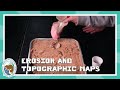
Exploring Erosion and Topographic Maps
Interactive Video
•
Science
•
6th - 10th Grade
•
Practice Problem
•
Hard
+2
Standards-aligned

Sophia Harris
FREE Resource
Standards-aligned
Read more
10 questions
Show all answers
1.
MULTIPLE CHOICE QUESTION
30 sec • 1 pt
What is the main topic of the video presented by Dr. Mike?
Weather patterns
Erosion
Plant growth
Animal habitats
Tags
NGSS.MS-ESS2-5
NGSS.MS-ESS2-6
2.
MULTIPLE CHOICE QUESTION
30 sec • 1 pt
What were you asked to do during the demonstration?
Write a summary
Draw your predictions
Collect samples
Record a video
3.
MULTIPLE CHOICE QUESTION
30 sec • 1 pt
What should you note in your science notebook after the water flows down the stream?
The temperature of the water
The color of the water
The speed of the water
Your observations
Tags
NGSS.MS-LS2-3
4.
MULTIPLE CHOICE QUESTION
30 sec • 1 pt
What happens to erosion when water moves faster?
Erosion stops
Erosion remains the same
Erosion decreases
Erosion increases
Tags
NGSS.MS-ESS2-2
5.
MULTIPLE CHOICE QUESTION
30 sec • 1 pt
What is a topographic map?
A map showing plant distribution
A map showing animal habitats
A map showing weather patterns
A map showing elevations
6.
MULTIPLE CHOICE QUESTION
30 sec • 1 pt
What does an elevation of 10,000 feet mean?
The height of a building
The depth of a river
The height above sea level
The distance between two points
7.
MULTIPLE CHOICE QUESTION
30 sec • 1 pt
What do closer lines on a topographic map indicate?
A flat area
A valley
A gentle slope
A steep slope
Access all questions and much more by creating a free account
Create resources
Host any resource
Get auto-graded reports
Continue with Google

Continue with Email
Continue with Classlink
Continue with Clever
or continue with
Microsoft
%20(1).png)
Apple
Others
Already have an account?
