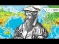
The Genius of Mercator Projections
Interactive Video
•
English
•
6th - 10th Grade
•
Practice Problem
•
Hard
+10
Standards-aligned

Sophia Harris
FREE Resource
Standards-aligned
Read more
8 questions
Show all answers
1.
MULTIPLE CHOICE QUESTION
30 sec • 1 pt
Where was Gerardus Mercator born?
Germany
Flanders
Italy
France
Tags
CCSS.RI.6.5
CCSS.RI.7.3
CCSS.RI.8.3
CCSS.RI.9-10.3
CCSS.RI.9-10.5
2.
MULTIPLE CHOICE QUESTION
30 sec • 1 pt
What subjects did Gerardus Mercator study in school?
Geography and History
Science and Mathematics
Religion and Arithmetic
Art and Literature
Tags
CCSS.RI.11-12.10
CCSS.RI.6.10
CCSS.RI.7.10
CCSS.RI.8.10
CCSS.RI.9-10.10
3.
MULTIPLE CHOICE QUESTION
30 sec • 1 pt
What profession did Gerardus Mercator take up during his travels?
Merchant
Engraver and Instrument Maker
Sailor
Cartographer
Tags
CCSS.RI.11-12.5
CCSS.RI.6.5
CCSS.RI.7.5
CCSS.RI.8.5
CCSS.RI.9-10.5
4.
MULTIPLE CHOICE QUESTION
30 sec • 1 pt
What was the main problem with maps before Mercator's innovation?
They were difficult to read
They were often inaccurate
They were too expensive
They were not detailed enough
Tags
CCSS.RI.11-12.5
CCSS.RI.6.5
CCSS.RI.7.5
CCSS.RI.8.5
CCSS.RI.9-10.5
5.
MULTIPLE CHOICE QUESTION
30 sec • 1 pt
What is a key feature of the Mercator projection?
Accurate representation of land masses
Straight latitude and longitude lines
Curved longitude lines
3D representation of the Earth
6.
MULTIPLE CHOICE QUESTION
30 sec • 1 pt
Why is the Mercator projection particularly useful for sailors?
It provides detailed coastal maps
It makes navigation using a compass easier
It includes weather patterns
It shows ocean currents
7.
MULTIPLE CHOICE QUESTION
30 sec • 1 pt
What is a major drawback of the Mercator projection?
It is too complex for general use
It is not useful for navigation
It cannot accurately represent land masses far from the equator
It is difficult to produce
Access all questions and much more by creating a free account
Create resources
Host any resource
Get auto-graded reports
Continue with Google

Continue with Email
Continue with Classlink
Continue with Clever
or continue with
Microsoft
%20(1).png)
Apple
Others
Already have an account?
