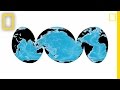
Understanding World Map Projections
Interactive Video
•
Mathematics, Geography
•
7th - 10th Grade
•
Practice Problem
•
Hard

Aiden Montgomery
FREE Resource
Read more
5 questions
Show all answers
1.
MULTIPLE CHOICE QUESTION
30 sec • 1 pt
What is a major drawback of the Mercator projection?
It is not useful for sea navigation.
It makes Greenland appear smaller than it is.
It inaccurately represents the size of landmasses.
It distorts the shape of the oceans.
2.
MULTIPLE CHOICE QUESTION
30 sec • 1 pt
Who developed the elliptical projection that accurately compares land areas?
John Harrison
Ptolemy
Carl Mvii
Gerardus Mercator
3.
MULTIPLE CHOICE QUESTION
30 sec • 1 pt
What is a key feature of the elliptical projection by Carl Mvii?
It accurately compares land areas.
It centers on the Atlantic Ocean.
It is ideal for sea navigation.
It distorts the size of continents.
4.
MULTIPLE CHOICE QUESTION
30 sec • 1 pt
What is the focus of the interrupted map used for the ocean floor?
It centers on the Atlantic Ocean.
It divides the seas rather than the land.
It centers on the Pacific Ocean.
It shows the continents with maximum distortion.
5.
MULTIPLE CHOICE QUESTION
30 sec • 1 pt
How does the interrupted map projection benefit the representation of oceans?
It divides the oceans rather than the land.
It shows the oceans with maximum distortion.
It allows the three main oceans to be shown in their entirety.
It centers on the Atlantic Ocean.
Access all questions and much more by creating a free account
Create resources
Host any resource
Get auto-graded reports
Continue with Google

Continue with Email
Continue with Microsoft
or continue with

%20(1).png)
Apple
Others
Already have an account?
