Understanding the Conflict in Darfur
Interactive Video
•
Geography, History, Social Studies
•
9th - 12th Grade
•
Practice Problem
•
Easy

Lucas Foster
Used 3+ times
FREE Resource
Read more
10 questions
Show all answers
1.
MULTIPLE CHOICE QUESTION
30 sec • 1 pt
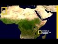
Which geographical feature marks the boundary where Sudan is located?
The Great Barrier Reef
The Amazon Rainforest
The Sahara Desert
The Rocky Mountains
2.
MULTIPLE CHOICE QUESTION
30 sec • 1 pt
In what year did Sudan gain its independence?
1945
1963
1956
1971
3.
MULTIPLE CHOICE QUESTION
30 sec • 1 pt
What is the size of the Darfur region compared to a European country?
Spain
Germany
Italy
France
4.
MULTIPLE CHOICE QUESTION
30 sec • 1 pt
What does the name 'Darfur' mean?
Land of the Desert
Land of the Free
Land of the Brave
Land of the Four
5.
MULTIPLE CHOICE QUESTION
30 sec • 1 pt
Which two groups are primarily involved in the land clashes in Darfur?
Herders and Traders
Farmers and Herders
Fishermen and Traders
Farmers and Miners
6.
MULTIPLE CHOICE QUESTION
30 sec • 1 pt
What environmental issues have contributed to the tensions in Darfur?
Floods and Hurricanes
Droughts and Desertification
Volcanic Eruptions and Landslides
Earthquakes and Tsunamis
7.
MULTIPLE CHOICE QUESTION
30 sec • 1 pt
What was the government's response to the rebel groups in Darfur?
Built New Villages
Negotiated Peace
Organized Armed Militias
Supported the Farmers
Access all questions and much more by creating a free account
Create resources
Host any resource
Get auto-graded reports
Continue with Google

Continue with Email
Continue with Classlink
Continue with Clever
or continue with
Microsoft
%20(1).png)
Apple
Others
Already have an account?
