Mapping Our World: Understanding Different Types of Maps
Interactive Video
•
Geography, Science, Social Studies
•
3rd - 5th Grade
•
Practice Problem
•
Hard

Patricia Brown
FREE Resource
Read more
10 questions
Show all answers
1.
MULTIPLE CHOICE QUESTION
30 sec • 1 pt
What do physical maps primarily display?
Weather patterns
Man-made boundaries
Population density
Natural features like mountains and rivers
2.
MULTIPLE CHOICE QUESTION
30 sec • 1 pt
Which color on a physical map typically represents flat lands and plains?
Blue
Brown
Yellow
Green
3.
MULTIPLE CHOICE QUESTION
30 sec • 1 pt
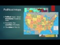
What is the main purpose of a political map?
To show natural features
To highlight population density
To display weather patterns
To indicate man-made boundaries
4.
MULTIPLE CHOICE QUESTION
30 sec • 1 pt
Which type of map would you use to find state boundaries?
Political map
Cartogram
Physical map
Weather map
5.
MULTIPLE CHOICE QUESTION
30 sec • 1 pt
What is a thematic map also known as?
Physical map
Special-purpose map
Political map
Cartogram
6.
MULTIPLE CHOICE QUESTION
30 sec • 1 pt
What does a cartogram map typically show?
Man-made boundaries
Natural features
Population size by country
Weather patterns
7.
MULTIPLE CHOICE QUESTION
30 sec • 1 pt
Which continent is not part of the mnemonic 'Aunt Alice always eats nasty apple soup'?
Antarctica
Asia
Europe
North America
Access all questions and much more by creating a free account
Create resources
Host any resource
Get auto-graded reports
Continue with Google

Continue with Email
Continue with Classlink
Continue with Clever
or continue with
Microsoft
%20(1).png)
Apple
Others
Already have an account?
