Geography of the British Isles
Interactive Video
•
Geography, History, Social Studies
•
4th - 5th Grade
•
Practice Problem
•
Hard

Patricia Brown
FREE Resource
Read more
10 questions
Show all answers
1.
MULTIPLE CHOICE QUESTION
30 sec • 1 pt
What is the capital city of England?
Dublin
Cardiff
Edinburgh
London
2.
MULTIPLE CHOICE QUESTION
30 sec • 1 pt
Which emblem represents Scotland?
Thistle
Rose
Leek
Shamrock
3.
MULTIPLE CHOICE QUESTION
30 sec • 1 pt
What is the capital of Wales?
London
Dublin
Cardiff
Belfast
4.
MULTIPLE CHOICE QUESTION
30 sec • 1 pt
Which country is located to the north of England?
Scotland
Northern Ireland
Wales
Ireland
5.
MULTIPLE CHOICE QUESTION
30 sec • 1 pt
What is the emblem of Northern Ireland?
Rose
Shamrock
Leek
Thistle
6.
MULTIPLE CHOICE QUESTION
30 sec • 1 pt
Which countries form the United Kingdom?
England, Scotland, Wales, Northern Ireland
England, Wales, Ireland, Northern Ireland
England, Scotland, Ireland, Wales
Scotland, Wales, Ireland, Northern Ireland
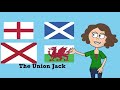
7.
MULTIPLE CHOICE QUESTION
30 sec • 1 pt
What is the name of the flag that represents the United Kingdom?
St. George's Cross
St. Andrew's Cross
Union Jack
St. Patrick's Cross
Access all questions and much more by creating a free account
Create resources
Host any resource
Get auto-graded reports
Continue with Google

Continue with Email
Continue with Classlink
Continue with Clever
or continue with
Microsoft
%20(1).png)
Apple
Others
Already have an account?
