Understanding Political and Physical Maps
Interactive Video
•
Geography
•
4th - 5th Grade
•
Practice Problem
•
Hard

Patricia Brown
FREE Resource
Read more
10 questions
Show all answers
1.
MULTIPLE CHOICE QUESTION
30 sec • 1 pt
Which of the following is an example of a map that helps develop map reading skills?
Where's Waldo
Monopoly
Chess
Scrabble
2.
MULTIPLE CHOICE QUESTION
30 sec • 1 pt
What do political maps primarily show?
Natural landscapes
Weather patterns
Human-made boundaries
Animal habitats
3.
MULTIPLE CHOICE QUESTION
30 sec • 1 pt
Why do political maps need to be updated frequently?
Animal migration
Wars and ethnic conflicts
Shifts in natural landscapes
Changes in weather
4.
MULTIPLE CHOICE QUESTION
30 sec • 1 pt
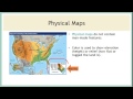
What is a key feature of physical maps?
They show city names
They indicate political boundaries
They highlight natural features
They display road networks
5.
MULTIPLE CHOICE QUESTION
30 sec • 1 pt
Which type of map would a hiker find most useful?
Physical map
Political map
Weather map
Economic map
6.
MULTIPLE CHOICE QUESTION
30 sec • 1 pt
What does the color on a physical map typically represent?
Population density
Elevation and relief
Political boundaries
Climate zones
7.
MULTIPLE CHOICE QUESTION
30 sec • 1 pt
If you are driving to a new city, which map would be most helpful?
Physical map
Political map
Topographic map
Climate map
Access all questions and much more by creating a free account
Create resources
Host any resource
Get auto-graded reports
Continue with Google

Continue with Email
Continue with Classlink
Continue with Clever
or continue with
Microsoft
%20(1).png)
Apple
Others
Already have an account?
