
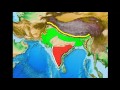
Geography of South Asia

Interactive Video
•
Geography
•
9th - 10th Grade
•
Practice Problem
•
Hard

Patricia Brown
FREE Resource
Read more
10 questions
Show all answers
1.
MULTIPLE CHOICE QUESTION
30 sec • 1 pt
Which river is considered the heart of India due to its significant population density along its banks?
Ganges River
Yamuna River
Brahmaputra River
Indus River
2.
MULTIPLE CHOICE QUESTION
30 sec • 1 pt
Which river flows through both India and Bangladesh, contributing to dense population areas?
Indus River
Ganges River
Yamuna River
Brahmaputra River
3.
MULTIPLE CHOICE QUESTION
30 sec • 1 pt
Where does the Indus River originate?
Bangladesh
East Asia
Pakistan
India
4.
MULTIPLE CHOICE QUESTION
30 sec • 1 pt
What is the primary characteristic of the Indo-Gangetic Plain that supports agriculture?
Flat topography
Dense rainforest
High elevation
Arid climate
5.
MULTIPLE CHOICE QUESTION
30 sec • 1 pt
Which two mountain ranges are located on the Indian subcontinent's coastline?
Aravalli and Nilgiri
Vindhya and Satpura
Western Ghats and Eastern Ghats
Himalayas and Karakoram
6.
MULTIPLE CHOICE QUESTION
30 sec • 1 pt
What is the Deccan Plateau known for in recent times?
Desertification
Dense forests
Mining activities
High-tech industry growth
7.
MULTIPLE CHOICE QUESTION
30 sec • 1 pt
What is the desert called on the Indian side of the border with Pakistan?
Sahara Desert
Kalahari Desert
Gobi Desert
Great Indian Desert
Access all questions and much more by creating a free account
Create resources
Host any resource
Get auto-graded reports

Continue with Google

Continue with Email

Continue with Classlink

Continue with Clever
or continue with

Microsoft
%20(1).png)
Apple

Others
Already have an account?

