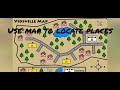
Understanding Map Concepts and Locations
Interactive Video
•
Geography
•
4th - 5th Grade
•
Practice Problem
•
Hard

Patricia Brown
FREE Resource
Read more
10 questions
Show all answers
1.
MULTIPLE CHOICE QUESTION
30 sec • 1 pt
What is the primary focus when using maps to locate places?
Identifying the weather conditions
Understanding the concept of relative location
Calculating the distance between two points
Determining the population of an area
2.
MULTIPLE CHOICE QUESTION
30 sec • 1 pt
Which words are typically used to describe relative location?
Hot, cold, warm
Big, small, medium
Near, behind, above
Fast, slow, quick
3.
MULTIPLE CHOICE QUESTION
30 sec • 1 pt
What is the key characteristic of absolute location?
It is based on weather conditions
It provides an exact address
It uses comparative words
It is a general description
4.
MULTIPLE CHOICE QUESTION
30 sec • 1 pt
Why is it important to provide an exact address for absolute location?
To ensure accurate delivery
To describe the weather
To compare with other locations
To calculate travel time
5.
MULTIPLE CHOICE QUESTION
30 sec • 1 pt
How can relative and absolute locations be used together?
To provide a clearer understanding of a location
To calculate the distance between two points
To describe the weather conditions
To confuse the delivery person
6.
MULTIPLE CHOICE QUESTION
30 sec • 1 pt
What is a map?
A 3D model of the Earth
A flat picture showing locations
A list of addresses
A weather forecast tool
7.
MULTIPLE CHOICE QUESTION
30 sec • 1 pt
What do symbols on a map represent?
Different locations
Population density
Traffic patterns
Weather conditions
Access all questions and much more by creating a free account
Create resources
Host any resource
Get auto-graded reports
Continue with Google

Continue with Email
Continue with Classlink
Continue with Clever
or continue with
Microsoft
%20(1).png)
Apple
Others
Already have an account?
