Geoscience Education Tools and Concepts
Interactive Video
•
Science
•
9th - 10th Grade
•
Practice Problem
•
Hard

Patricia Brown
FREE Resource
Read more
10 questions
Show all answers
1.
MULTIPLE CHOICE QUESTION
30 sec • 1 pt
What is the primary goal of the Geode project?
To develop new geological survey methods
To transform Geoscience education with interactive models
To create a new geological database
To study the history of plate tectonics
2.
MULTIPLE CHOICE QUESTION
30 sec • 1 pt
Why has Earth Science been treated differently in education compared to other sciences?
It is not part of the standard curriculum
It requires understanding complex, invisible processes
It does not involve lab work
It is considered too easy
3.
MULTIPLE CHOICE QUESTION
30 sec • 1 pt
What is a key challenge in teaching plate tectonics in schools?
Lack of historical data
Students are not taught to think of it as a system
Too much focus on practical experiments
Insufficient teaching materials
4.
MULTIPLE CHOICE QUESTION
30 sec • 1 pt
What potential do Geo tools hold for students?
They simplify geological equations
They replace traditional textbooks
They provide ways to explore data and understand causal mechanisms
They allow students to memorize geological terms
5.
MULTIPLE CHOICE QUESTION
30 sec • 1 pt
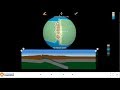
What does the Seismic Explorer tool primarily visualize?
Weather patterns
Mountain formation
Earthquake and volcanic eruption data
Ocean currents
6.
MULTIPLE CHOICE QUESTION
30 sec • 1 pt
How does the Seismic Explorer tool help students understand plate boundaries?
By offering quizzes on plate tectonics
By allowing manipulation of data in three dimensions
By providing historical data
By showing videos of earthquakes
7.
MULTIPLE CHOICE QUESTION
30 sec • 1 pt
What is unique about the Tectonic Explorer tool?
It is a static model
It allows students to build their own planet
It only shows data from the US
It is a text-based tool
Access all questions and much more by creating a free account
Create resources
Host any resource
Get auto-graded reports
Continue with Google

Continue with Email
Continue with Classlink
Continue with Clever
or continue with
Microsoft
%20(1).png)
Apple
Others
Already have an account?
Similar Resources on Wayground

6 questions
CLEAN : Famous Manhattan deli bustling amid pandemic as Jews observe Passover
Interactive video
•
9th - 10th Grade
6 questions
Chemistry Regents Exam Review HW 9 (Precipitation Reactions)
Interactive video
•
10th Grade
11 questions
Mitosis and Cell Cycle Concepts
Interactive video
•
9th - 10th Grade
7 questions
Deep Sea Research and Observations
Interactive video
•
9th - 12th Grade
10 questions
Exploring Cave Research Insights
Interactive video
•
9th - 12th Grade
11 questions
Metamorphic Rocks and Processes
Interactive video
•
9th - 10th Grade
9 questions
Grand Canyon Formation and Theories
Interactive video
•
9th - 10th Grade
6 questions
Nacen dos cachorros de leon en un parque de animales en el sur de Guatemala
Interactive video
•
9th - 10th Grade
Popular Resources on Wayground
15 questions
Fractions on a Number Line
Quiz
•
3rd Grade
10 questions
Probability Practice
Quiz
•
4th Grade
15 questions
Probability on Number LIne
Quiz
•
4th Grade
20 questions
Equivalent Fractions
Quiz
•
3rd Grade
25 questions
Multiplication Facts
Quiz
•
5th Grade
22 questions
fractions
Quiz
•
3rd Grade
6 questions
Appropriate Chromebook Usage
Lesson
•
7th Grade
10 questions
Greek Bases tele and phon
Quiz
•
6th - 8th Grade
Discover more resources for Science
25 questions
Naming Ionic and Covalent Compounds
Quiz
•
9th Grade
10 questions
Exploring Weathering, Erosion, and Deposition Processes
Interactive video
•
6th - 10th Grade
26 questions
Unit 8b Review
Quiz
•
9th Grade
14 questions
Natural Selection and Adaptation
Lesson
•
9th - 12th Grade
10 questions
Exploring Water Pollution and Conservation
Interactive video
•
6th - 10th Grade
10 questions
Exploring the Human Respiratory System
Interactive video
•
6th - 10th Grade
30 questions
Unit 2C Progress Check (Biosphere 3)
Quiz
•
9th - 12th Grade
14 questions
Genetics Practice (Mendelian & Non-mendelian)
Quiz
•
10th Grade