Free Printable Atmospheric Circulation and Weather Systems Worksheets for Year 6
Year 6 atmospheric circulation and weather systems worksheets from Wayground help students master air pressure patterns, wind systems, and climate formation through engaging printables, practice problems, and comprehensive answer keys.
Explore printable Atmospheric Circulation and Weather Systems worksheets for Year 6
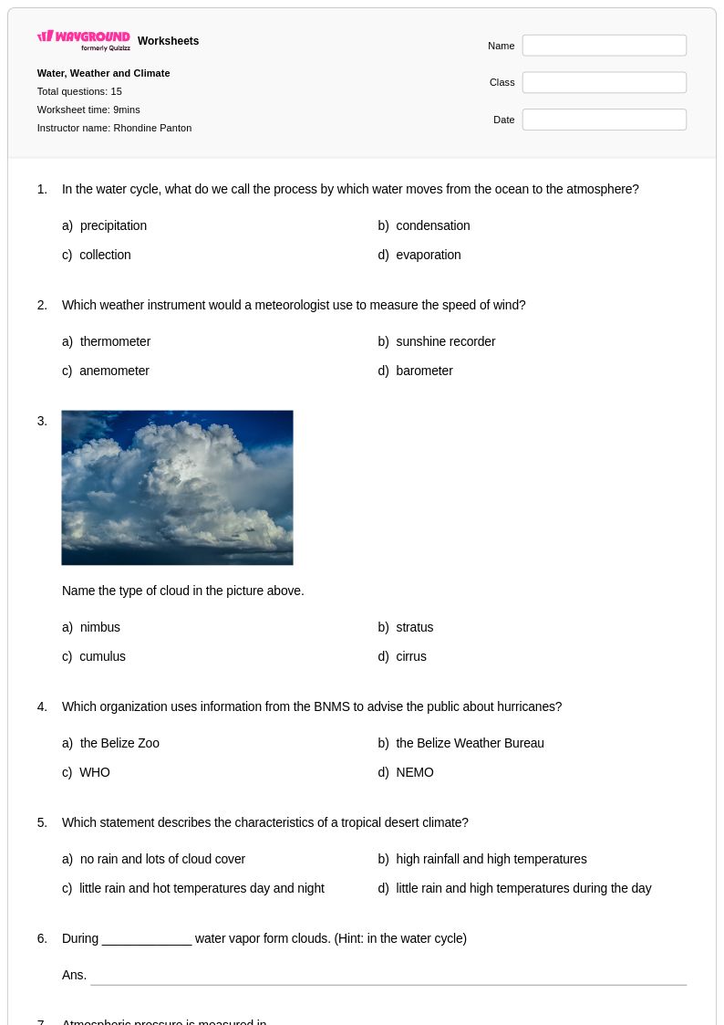
Atmospheric circulation and weather systems form a cornerstone of Year 6 geography curriculum, and Wayground's comprehensive worksheet collection provides students with essential tools to master these complex meteorological concepts. These carefully designed worksheets guide sixth-grade learners through the fundamental principles of global wind patterns, pressure systems, and weather formation processes that shape our planet's climate. Students engage with practice problems that explore topics ranging from the Coriolis effect and trade winds to high and low pressure systems and their impact on local weather conditions. Each worksheet includes detailed answer keys that support independent learning and self-assessment, while the free printable format ensures accessibility for diverse classroom environments. The PDF resources strengthen critical thinking skills as students analyze weather maps, interpret atmospheric data, and connect circulation patterns to real-world weather phenomena.
Wayground's extensive library of millions of teacher-created resources empowers educators to deliver comprehensive atmospheric circulation and weather systems instruction through robust search and filtering capabilities that quickly locate grade-appropriate materials. Teachers can easily differentiate instruction by selecting from worksheets that range from foundational wind pattern identification to advanced weather prediction activities, with standards-aligned content that supports curriculum requirements across different educational frameworks. The platform's flexible customization tools allow educators to modify existing worksheets or combine multiple resources to create targeted practice sets for remediation or enrichment purposes. Whether delivered in traditional printable format or accessed digitally through PDF distribution, these atmospheric circulation worksheets streamline lesson planning while providing reliable skill practice opportunities that help students develop meteorological literacy and geographic reasoning abilities essential for understanding Earth's dynamic weather systems.
FAQs
How do I teach atmospheric circulation and weather systems to middle or high school students?
Start by anchoring instruction in pressure differentials — students need to understand that air moves from high to low pressure before they can make sense of global wind patterns, jet streams, or cyclone formation. Use weather maps as primary sources, having students trace air movement and identify pressure systems before connecting those patterns to regional climate outcomes. Building from local weather observations toward global circulation models helps students see atmospheric science as cumulative rather than abstract.
What exercises help students practice identifying global wind patterns and pressure systems?
Effective practice exercises include weather map analysis tasks where students identify high and low pressure centers, predict wind direction, and infer likely weather conditions for a given region. Problems that ask students to explain the role of the Coriolis effect on wind deflection, or to trace the path of a mid-latitude cyclone across a synoptic chart, build both procedural and conceptual fluency. Worksheets that combine data interpretation with short-answer explanation prompts are especially useful for reinforcing the cause-and-effect relationships between pressure, temperature, and moisture.
What misconceptions do students commonly have about atmospheric circulation?
One of the most persistent misconceptions is that wind moves from cold to warm areas rather than from high to low pressure — students conflate temperature and pressure without distinguishing them as separate variables. Many students also misunderstand the Coriolis effect, believing it causes objects to curve because of a physical force rather than Earth's rotation changing the frame of reference beneath a moving air mass. A third common error is treating cyclones and anticyclones as opposites in a simple sense, without recognizing that their rotation direction and associated weather patterns differ systematically by hemisphere.
How can I differentiate atmospheric circulation worksheets for students at different skill levels?
For students who are still building foundational understanding, reduce the complexity of weather maps used and provide labeled diagrams with partially completed annotations before asking students to work independently. Advanced learners benefit from open-ended analysis tasks that ask them to connect jet stream positioning to seasonal weather anomalies or evaluate real atmospheric data sets. On Wayground, teachers can apply accommodations including reduced answer choices to lower cognitive load for individual students, or enable read-aloud support for students who need it, without affecting how other students experience the same assignment.
How do I use Wayground's atmospheric circulation and weather systems worksheets in my classroom?
Wayground's atmospheric circulation and weather systems worksheets are available as printable PDFs for traditional classroom use and in digital formats for technology-integrated environments, giving teachers flexibility depending on their classroom setup. Teachers can also host worksheets directly as a quiz on Wayground, allowing for streamlined digital assignment and student progress monitoring. Each worksheet includes a complete answer key, supporting both independent student practice and efficient teacher assessment without additional preparation time.
How does atmospheric circulation connect to the weather patterns students observe locally?
Regional weather is largely determined by where a location sits relative to global circulation cells, persistent pressure systems, and seasonal shifts in the jet stream. For example, areas under frequent high-pressure dominance tend to experience clear, dry conditions, while regions regularly influenced by low-pressure systems see more precipitation and variable temperatures. Connecting large-scale circulation features to locally observable weather helps students see atmospheric science as directly relevant rather than purely theoretical, which strengthens retention and analytical reasoning.