Free Printable Global Wind Patterns Worksheets for Class 12
Explore Class 12 Global Wind Patterns through Wayground's comprehensive collection of free worksheets and printables, featuring practice problems and answer keys to help students master atmospheric circulation systems.
Explore printable Global Wind Patterns worksheets for Class 12
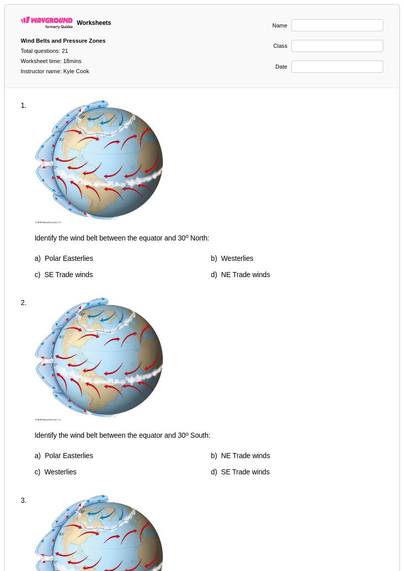
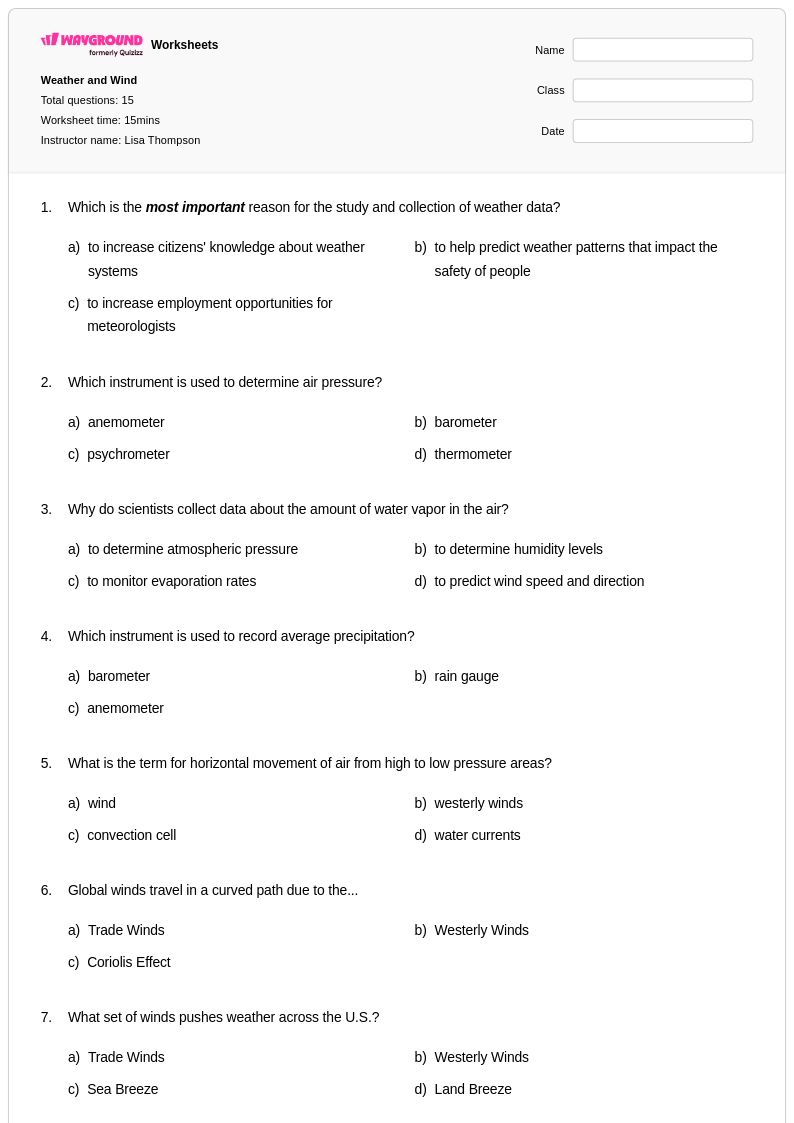
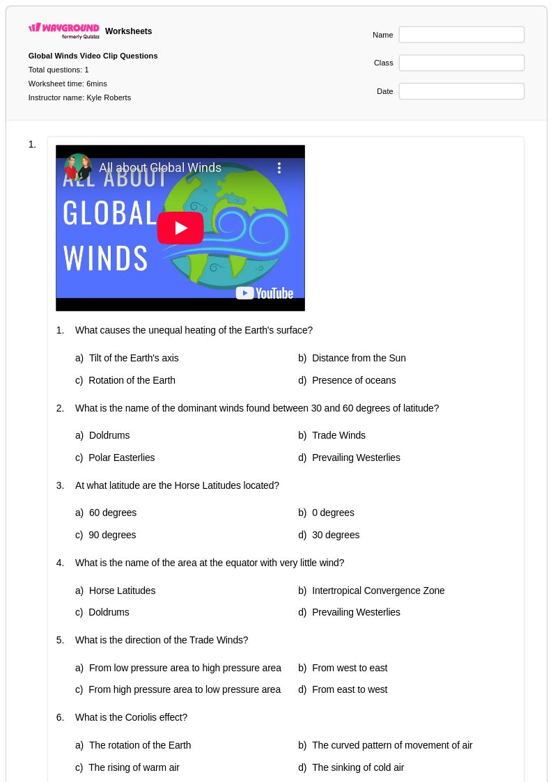
Class 12 global wind patterns worksheets available through Wayground (formerly Quizizz) provide comprehensive coverage of atmospheric circulation systems that drive weather and climate across Earth. These expertly designed resources help students master complex concepts including the Coriolis effect, pressure gradient forces, and the formation of major wind belts such as trade winds, westerlies, and polar easterlies. Students develop critical analytical skills by examining how temperature differentials, Earth's rotation, and geographic features influence large-scale air movement patterns that connect local weather phenomena to global atmospheric dynamics. The collection includes detailed practice problems with answer keys, free printable worksheets in pdf format, and interactive exercises that strengthen students' ability to interpret meteorological data, analyze atmospheric pressure maps, and predict wind behavior based on scientific principles.
Wayground (formerly Quizizz) supports educators with millions of teacher-created resources specifically designed for Class 12 global wind patterns instruction, featuring robust search and filtering capabilities that align with national science standards and state curriculum requirements. Teachers can easily differentiate instruction by accessing worksheets at varying complexity levels, from foundational concept reinforcement to advanced atmospheric modeling exercises available in both printable pdf formats and digital interactive versions. The platform's flexible customization tools enable educators to modify existing materials or combine multiple resources to address diverse learning needs, supporting effective lesson planning for initial instruction, targeted remediation of misconceptions about atmospheric circulation, and enrichment activities for advanced students. These comprehensive worksheet collections streamline the process of providing consistent skill practice while ensuring students develop the quantitative reasoning and scientific literacy essential for understanding Earth's interconnected climate systems.
FAQs
How do I teach global wind patterns to middle or high school students?
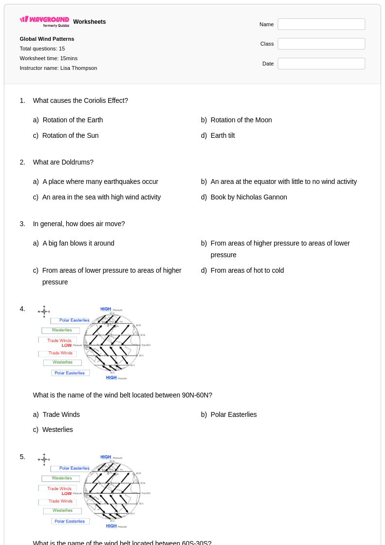
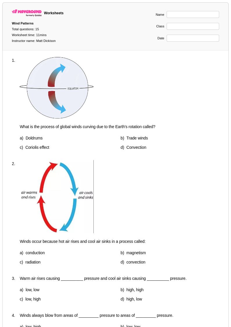
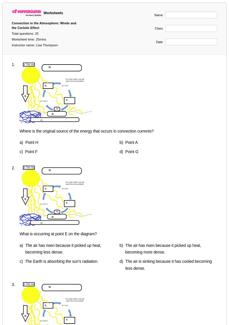
Start by grounding students in the unequal heating of Earth's surface, which drives atmospheric circulation. From there, introduce the three major wind belts — trade winds, westerlies, and polar easterlies — and explain how the Coriolis effect deflects moving air masses. Using pressure maps and labeled diagrams alongside direct instruction helps students visualize why these patterns are predictable and globally consistent.
What exercises help students practice identifying global wind patterns?
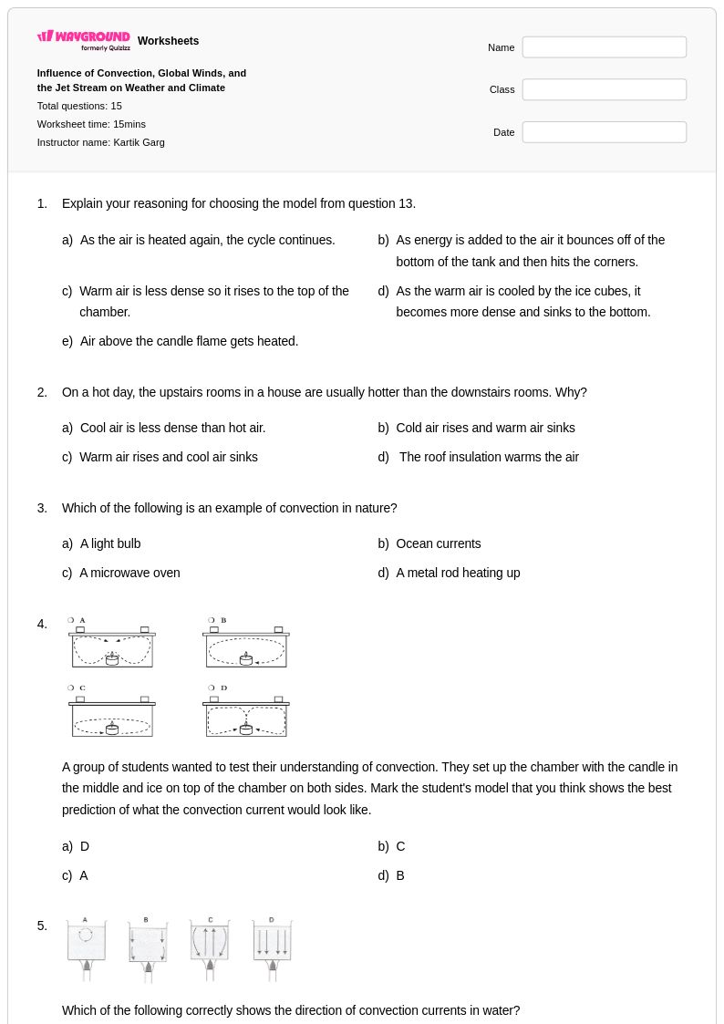
Effective practice exercises include labeling blank Earth diagrams with wind belt locations, interpreting atmospheric pressure maps to predict wind direction, and analyzing how the Coriolis effect influences air movement in each hemisphere. Connecting wind pattern identification to real-world climate characteristics — such as why trade winds bring moisture to tropical coastlines — deepens conceptual understanding and moves students beyond rote memorization.
What misconceptions do students commonly have about global wind patterns?
A frequent misconception is that wind simply moves from hot regions to cold regions in a straight line, overlooking the role of Earth's rotation and the Coriolis effect. Students also often confuse the direction of deflection between the Northern and Southern Hemispheres. Another common error is treating the three wind belts as isolated systems rather than understanding them as part of a continuous, interconnected atmospheric circulation driven by pressure gradients.
How does the Coriolis effect relate to global wind patterns, and how do I explain it clearly?
The Coriolis effect causes moving air masses to deflect to the right in the Northern Hemisphere and to the left in the Southern Hemisphere due to Earth's rotation. This deflection is what gives trade winds, westerlies, and polar easterlies their characteristic directions rather than flowing directly north or south. A useful classroom strategy is to have students trace airflow paths on a rotating globe model or diagram, which makes the deflection tangible and easier to internalize than a verbal explanation alone.
How can I use global wind patterns worksheets to differentiate instruction for different skill levels?
For students who need additional support, begin with structured worksheets that provide labeled diagrams and guided questions focused on identifying the three main wind belts and their locations. More advanced students can work with atmospheric pressure map analysis and open-ended questions that ask them to connect global wind patterns to regional climate phenomena. On Wayground, teachers can also apply accommodations such as read aloud, reduced answer choices, or extended time to individual students when assigning digital versions of these worksheets, ensuring every learner can access the material at an appropriate level.
How do I use Wayground's global wind patterns worksheets in my classroom?
Wayground's global wind patterns worksheets are available as printable PDFs for traditional classroom use and in digital formats for technology-integrated environments, giving teachers flexibility for in-class activities, homework, and assessment prep. In digital mode, teachers can host worksheets as a quiz directly on Wayground, enabling instant feedback and streamlined grading. Answer keys are included with every worksheet, supporting both teacher-led review and independent student self-assessment.