Explore Wayground's comprehensive collection of free US States worksheets and printables that help students master American geography through engaging practice problems, interactive activities, and complete answer keys.
US States worksheets available through Wayground (formerly Quizizz) provide comprehensive educational resources that strengthen students' geographical knowledge and spatial reasoning skills across all grade levels. These expertly crafted materials focus on essential concepts including state capitals, boundaries, regional characteristics, physical features, and cultural landmarks that define America's diverse political geography. Students engage with practice problems that reinforce memorization of state locations, develop map reading abilities, and explore connections between geography and historical development. Each worksheet collection includes detailed answer keys and is available as free printables in convenient pdf format, allowing educators to seamlessly integrate state-focused geography instruction into their curriculum while supporting various learning styles and academic needs.
Wayground (formerly Quizizz) empowers educators with millions of teacher-created US States resources that feature robust search and filtering capabilities, comprehensive standards alignment, and flexible differentiation tools. Teachers can easily customize worksheets to match specific grade-level requirements and learning objectives, with materials available in both printable pdf and interactive digital formats to accommodate diverse classroom environments. The platform's extensive collection supports effective lesson planning by providing ready-to-use resources for skill practice, targeted remediation for struggling learners, and enrichment opportunities for advanced students. This comprehensive approach ensures that educators have immediate access to high-quality geography materials that can be adapted for individual student needs, small group instruction, or whole-class activities focused on mastering US States knowledge.
FAQs
How do I teach US states and capitals effectively?
Teaching US states and capitals is most effective when you combine map-based activities with repeated retrieval practice. Start by grouping states regionally so students build spatial context before memorizing individual names and capitals. Layering in cultural landmarks, physical features, and historical connections helps students retain information beyond rote memorization.
What activities help students practice identifying US states on a map?
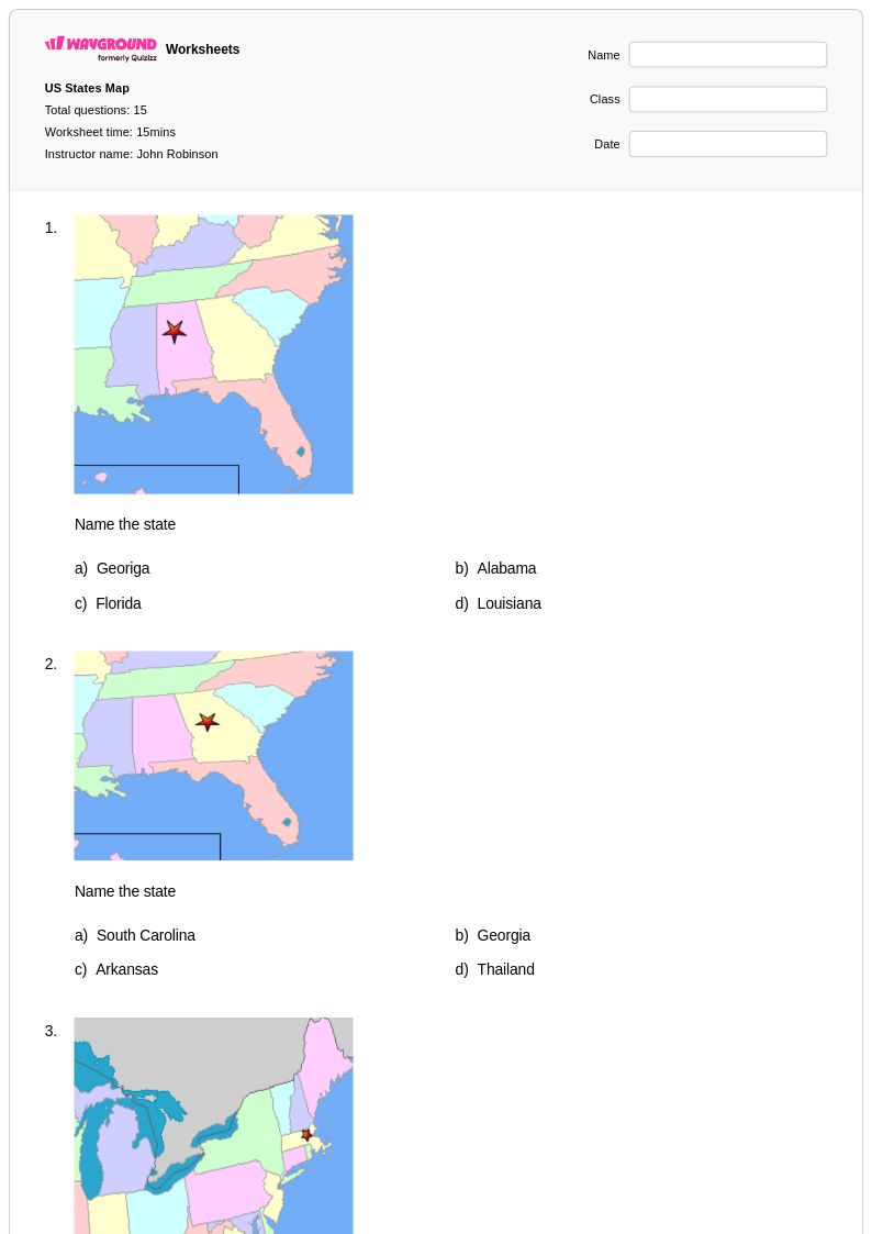
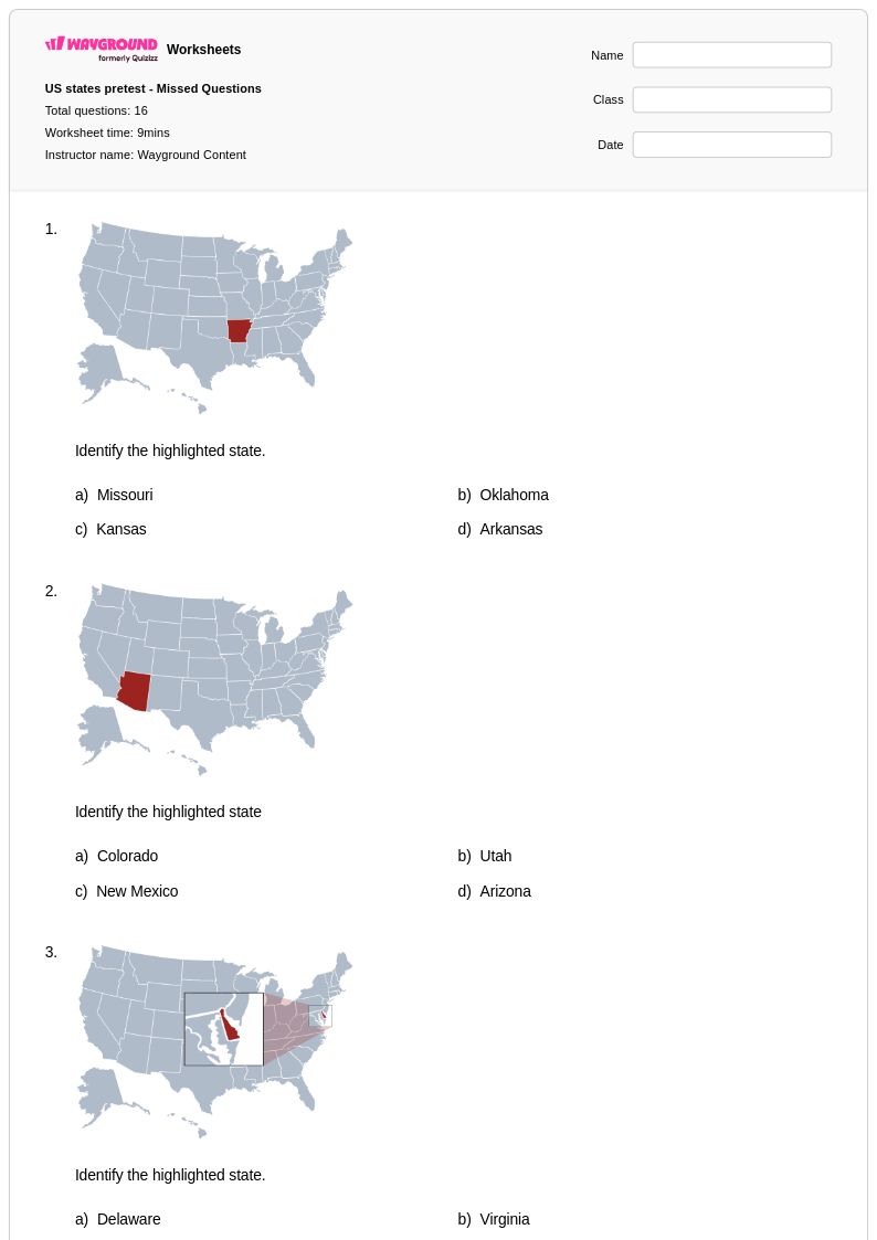
Blank map exercises where students label state names, capitals, and regional boundaries are among the most effective tools for building geography fluency. Worksheets that pair map reading with questions about physical features or neighboring states reinforce spatial reasoning alongside factual recall. Repeated low-stakes practice with immediate feedback accelerates mastery of state locations.
What are common mistakes students make when learning US states and capitals?
Students frequently confuse states that are geographically close or have similar-sounding names, such as distinguishing between states in the Midwest or the mid-Atlantic region. Capitals are another common stumbling block because many students assume the largest city is the capital, which is often incorrect. Targeted practice on these high-error pairs helps correct misconceptions before they become ingrained.
How can I differentiate US states worksheets for students at different skill levels?
For struggling learners, provide word banks or partially labeled maps to reduce cognitive load while still requiring active engagement with the content. Advanced students benefit from open-response prompts that ask them to connect state geography to historical events or economic characteristics. On Wayground, teachers can also apply individual accommodations such as read aloud support, reduced answer choices, and extended time to meet diverse student needs within the same assignment.
How do I use Wayground's US States worksheets in my classroom?
Wayground's US States worksheets are available as printable PDFs for traditional classroom use and in digital formats for technology-integrated environments, including the option to host them as a quiz directly on Wayground. Teachers can use them for whole-class instruction, small group remediation, or independent practice. Each worksheet includes a complete answer key, making them practical for both guided lessons and self-paced work.
How do I assess whether students have mastered US states geography?
Effective assessment goes beyond asking students to name all 50 states and should include map-based tasks where students identify state locations, match capitals, and describe regional characteristics. Look for whether students can accurately place states relative to neighbors and physical landmarks, not just recall isolated facts. Reviewing patterns in student errors, such as consistent confusion in a specific region, helps you target follow-up instruction precisely.