Free Printable Earth Science Maps Worksheets for Grade 8
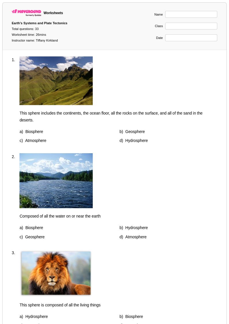
Grade 8 Earth Science Maps worksheets from Wayground help students master topographic maps, geological surveys, and spatial analysis through comprehensive printables with practice problems and answer keys.
Explore printable Earth Science Maps worksheets for Grade 8
Grade 8 Earth Science Maps worksheets from Wayground (formerly Quizizz) provide comprehensive practice with essential cartographic skills that form the foundation of earth science literacy. These carefully designed resources help students master the interpretation of topographic maps, geological surveys, weather maps, and seismic data visualizations while developing critical spatial reasoning abilities. Students work through practice problems that challenge them to read contour lines, identify landforms, analyze geological formations, and interpret scientific data presented in map format. Each worksheet includes detailed answer keys that support both independent study and classroom instruction, with free printable options available in convenient pdf format to accommodate diverse learning environments and teaching preferences.
Wayground's extensive collection draws from millions of teacher-created resources specifically developed for middle school earth science instruction, offering educators powerful search and filtering capabilities to locate materials perfectly suited to their curriculum needs. The platform's standards-aligned worksheets support differentiated instruction through customizable difficulty levels and multiple format options, enabling teachers to provide targeted remediation for struggling students while offering enrichment opportunities for advanced learners. Whether delivered as traditional printables or interactive digital assignments, these earth science mapping resources integrate seamlessly into lesson planning workflows and provide flexible tools for skill-building practice, formative assessment, and comprehensive review of essential cartographic concepts that prepare students for more advanced geological and atmospheric studies.
FAQs
How do I teach students to read topographic maps in Earth science?
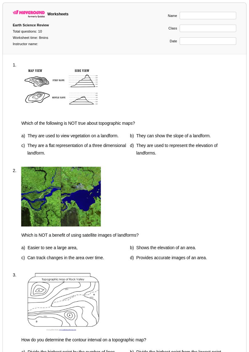
Start by teaching contour lines as the foundational concept — students need to understand that each line represents a constant elevation and that spacing between lines indicates slope steepness. Use a physical 3D model alongside a flat topographic map so students can visually connect the two representations. From there, progress to identifying specific landforms such as ridges, valleys, and depressions before introducing elevation profiles and cross-sections. Building this sequence from concrete to abstract helps students internalize spatial reasoning rather than just memorizing symbols.
What exercises help students practice interpreting contour lines and elevation changes?
Structured practice problems that move from basic map reading to more complex spatial analysis are most effective. Students benefit from exercises where they identify landforms, calculate elevation change between contour intervals, and draw or trace elevation profiles across a given transect. Worksheets that include real or realistic topographic maps give students authentic practice with the kinds of spatial relationships they'll encounter in assessments and field contexts.
What mistakes do students commonly make when reading geological and topographic maps?
One of the most frequent errors is misreading contour intervals — students often assume every line represents the same fixed value rather than reading the map's legend. Another common misconception is confusing closely spaced contour lines with broadly spaced ones, leading to inverted conclusions about slope steepness. Students also struggle to correlate geographic surface features with underlying geological processes, treating map reading as a visual exercise rather than a scientific interpretation task. Targeted practice with answer key explanations helps students catch and correct these reasoning errors independently.
How do I teach students to use coordinate systems in Earth science mapping?
Begin with grid-based coordinate systems before introducing latitude and longitude, since rectangular grids provide a more intuitive entry point for spatial location. Once students can reliably plot and read grid coordinates, introduce the geographic coordinate system with real map examples so the abstract degree-based notation has visible meaning. Practice should include both locating a point from given coordinates and identifying coordinates from a marked location, since these are distinct skills that require separate reinforcement.
How can I use Earth Science Maps worksheets to support different skill levels in my class?
Earth Science Maps worksheets work well for differentiation because the skill progression from basic coordinate plotting to multi-layer scientific map interpretation naturally scaffolds across ability levels. Assign foundational map-reading exercises to students who need reinforcement of core vocabulary and contour line concepts, while directing advanced students toward problems involving weather maps, seismic charts, or cross-referential geographic analysis. On Wayground, teachers can also apply individual accommodations such as read aloud, reduced answer choices, and extended time to specific students, so the same worksheet can serve the whole class without requiring separate versions.
How do I use Wayground's Earth Science Maps worksheets in my classroom?
Wayground's Earth Science Maps worksheets are available as printable PDFs for traditional classroom use and in digital formats for technology-integrated environments, making them flexible for in-person, hybrid, or remote instruction. Teachers can also host worksheets directly as a quiz on Wayground, enabling real-time student responses and immediate progress monitoring. Each worksheet includes a complete answer key, supporting both teacher-led review and independent student practice without additional prep.