Grade 5 World Map worksheets from Wayground help students master global geography through engaging printable activities, free practice problems, and comprehensive answer keys in convenient PDF format.
Explore printable World Map worksheets for Grade 5
World map worksheets for Grade 5 students available through Wayground (formerly Quizizz) provide comprehensive geographic literacy practice that builds essential spatial reasoning and global awareness skills. These expertly crafted printables challenge fifth-grade learners to identify continents, oceans, major countries, and geographical features while developing map reading proficiency and understanding of scale, direction, and coordinate systems. Students engage with diverse practice problems that range from labeling exercises and location identification tasks to more complex activities involving latitude and longitude coordinates, time zones, and comparative geography studies. Each worksheet collection includes detailed answer keys and is available as free pdf downloads, making them accessible resources for both classroom instruction and independent study that reinforce foundational geographic concepts through hands-on learning experiences.
Wayground (formerly Quizizz) empowers educators with millions of teacher-created world map worksheet resources that streamline lesson planning and support differentiated instruction for Grade 5 geography curricula. The platform's robust search and filtering capabilities allow teachers to quickly locate materials aligned with specific learning standards and customize worksheets to match varying skill levels within their classrooms. These flexible digital and printable resources, including comprehensive pdf collections, enable educators to provide targeted remediation for struggling learners while offering enrichment opportunities for advanced students through progressively challenging map-based activities. Teachers can seamlessly integrate these world map worksheets into their instructional sequences, using them for formative assessment, skill practice sessions, homework assignments, or review activities that reinforce geographic knowledge and spatial thinking abilities essential for elementary social studies mastery.
FAQs
How do I teach students to read a world map?
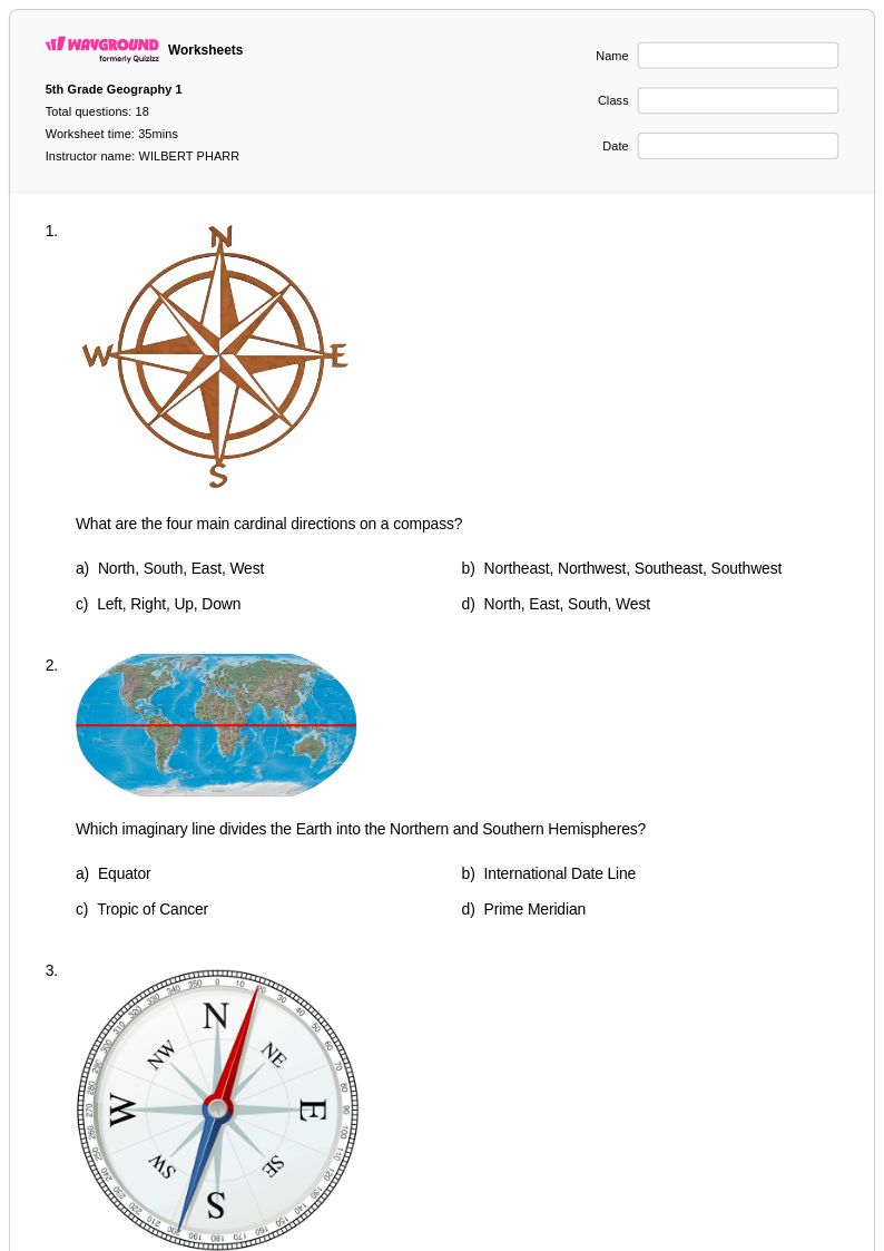
Start by orienting students to the map's key components: the compass rose, scale, legend, and grid lines. From there, build spatial awareness progressively by first introducing the seven continents and five oceans before moving to country-level identification. Using labeled and blank map activities together reinforces both recognition and recall, which are distinct skills that require separate practice.
What activities help students practice world map skills?
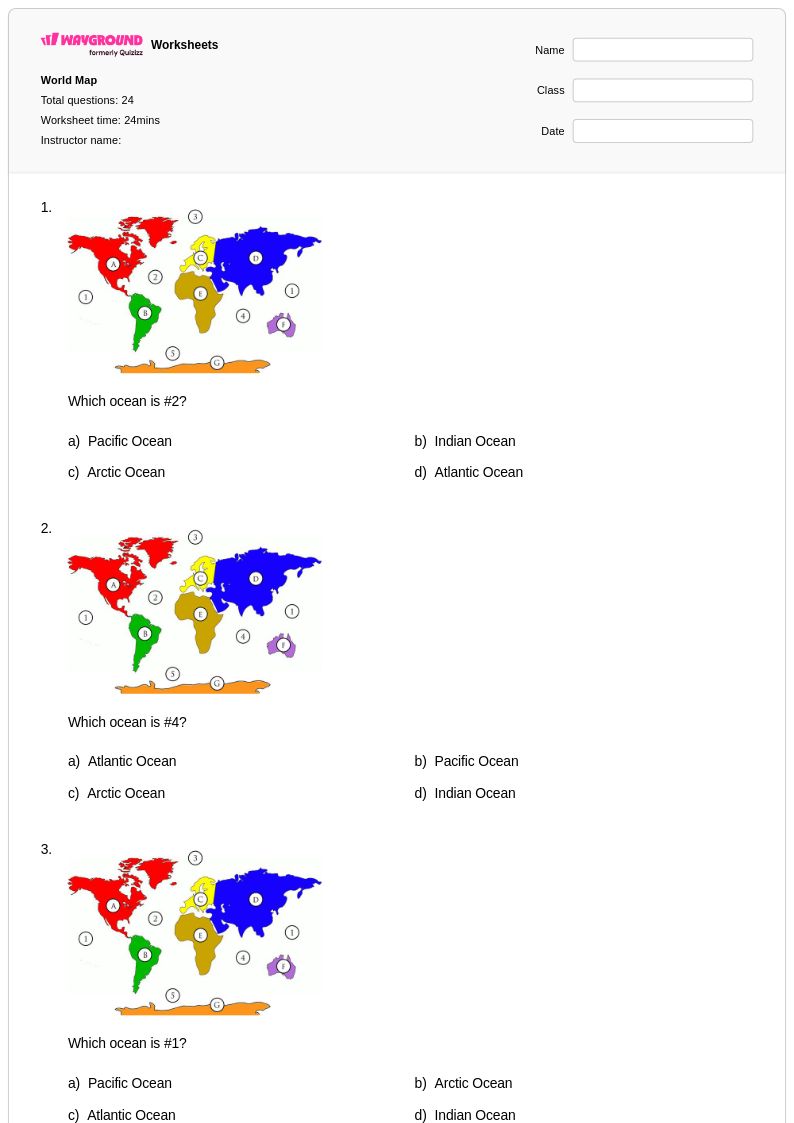
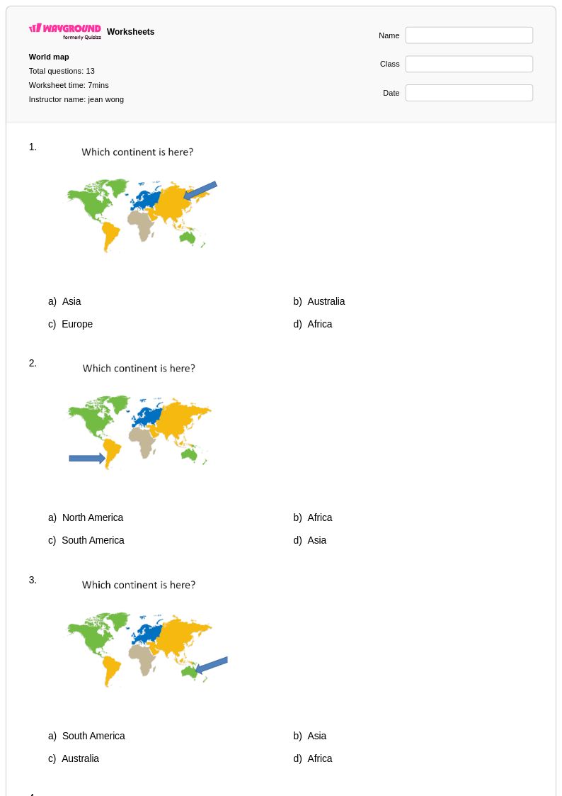
Labeling exercises are the most effective entry point — blank maps where students must identify and write in continents, oceans, and major countries build both recognition and memory. For more advanced practice, political and physical geography challenges that ask students to distinguish features like mountain ranges, river systems, or national borders push spatial reasoning further. Mixing guided labeling with independent recall tasks across multiple sessions reinforces retention over time.
What mistakes do students commonly make when working with world maps?
One of the most frequent errors is confusing the relative size and position of continents due to map projection distortions — students often assume the Mercator projection reflects true landmass proportions. Students also commonly misidentify oceans bordering specific continents, particularly the Arctic and Southern Oceans, which receive less instructional emphasis. Another persistent issue is conflating physical and political geography, such as labeling a mountain range where a country border is expected.
How do I use world map worksheets to support different skill levels in my class?
For foundational learners, start with continent and ocean labeling worksheets that provide a word bank or partially completed map as scaffolding. On Wayground, teachers can apply accommodations such as read aloud for students who need audio support or reduced answer choices to lower cognitive load for students who find open-ended map tasks overwhelming. Advanced learners can be challenged with political and physical geography worksheets that require identifying countries, capitals, and major landforms without scaffolding.
How do I use Wayground's world map worksheets in my classroom?
Wayground's world map worksheets are available as printable PDFs for traditional classroom use and in digital formats for technology-integrated environments, including the option to host them as a quiz directly on Wayground. Printable versions work well for hands-on labeling practice, while the digital format enables real-time feedback and easier tracking of student responses. Each worksheet includes a complete answer key, which reduces grading time and makes the materials viable for independent practice or homework as well.
How do world map worksheets align with geography education standards?
World map worksheets address core geography standards centered on spatial awareness, geographic literacy, and cartographic interpretation — skills explicitly identified in national and state geography frameworks from elementary through middle school. Exercises covering continents, oceans, political boundaries, and physical features map directly onto standards requiring students to use geographic tools and representations accurately. Using a variety of worksheet formats, from basic labeling to complex physical geography tasks, ensures coverage across multiple standard benchmarks within a single unit.