Free Printable Reading a Map Worksheets for Class 5
Enhance Class 5 students' map reading skills with Wayground's comprehensive collection of free worksheets and printables, featuring engaging practice problems and complete answer keys in PDF format.
Explore printable Reading a Map worksheets for Class 5
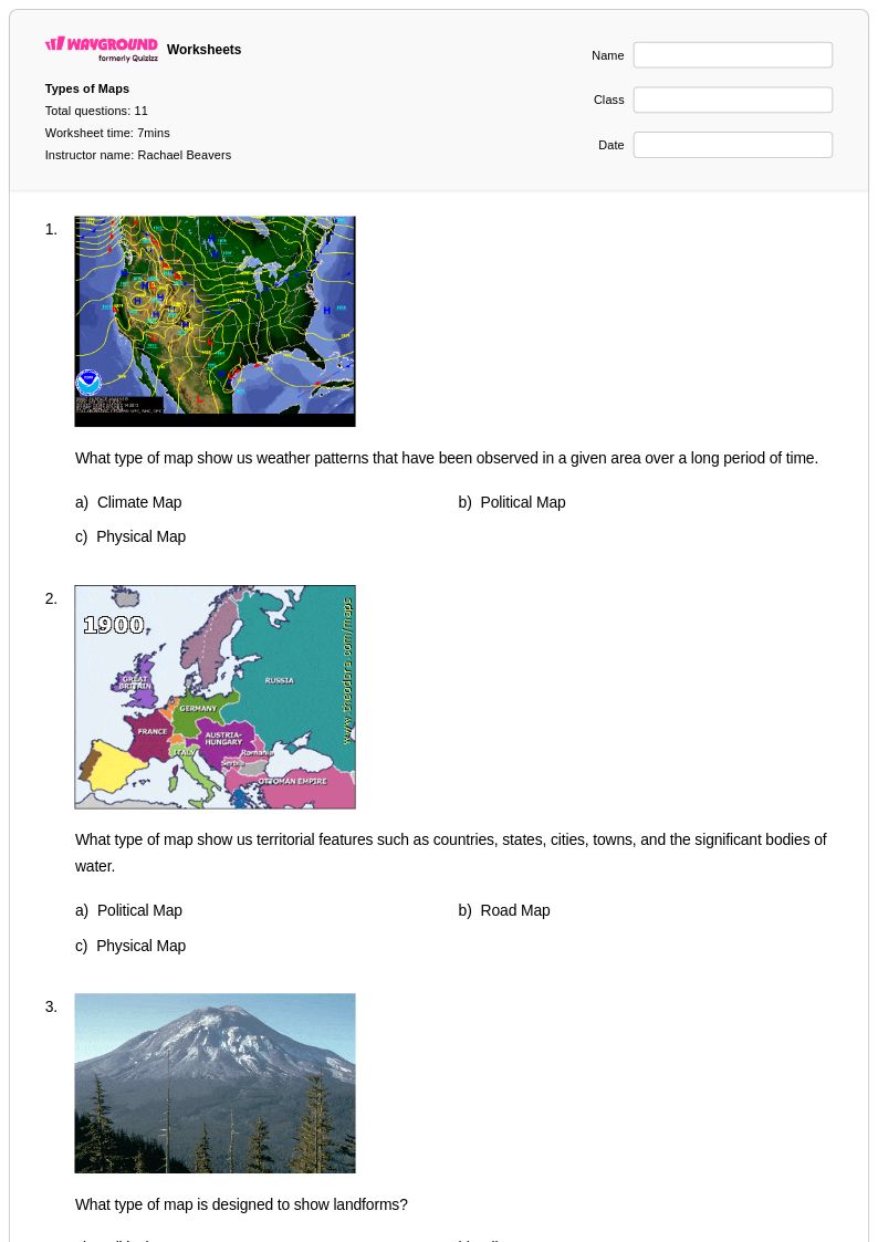
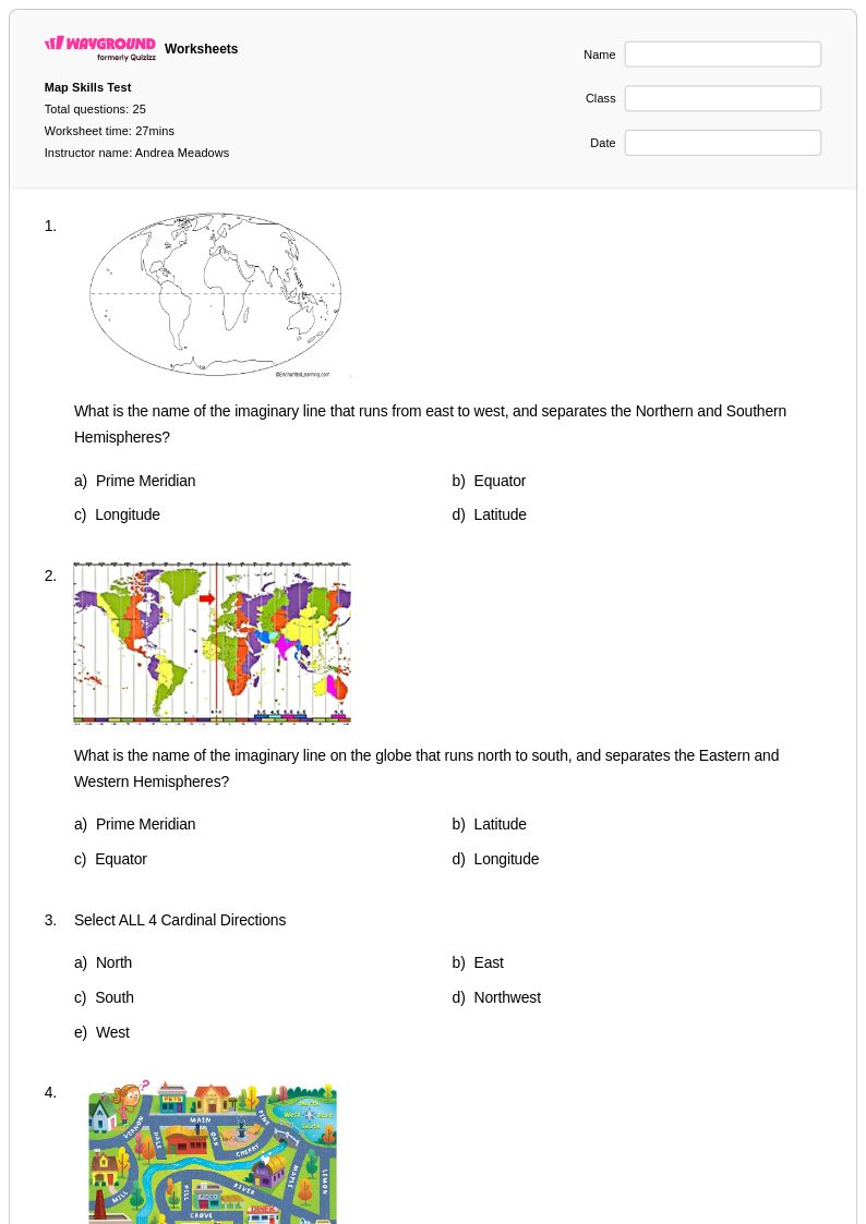
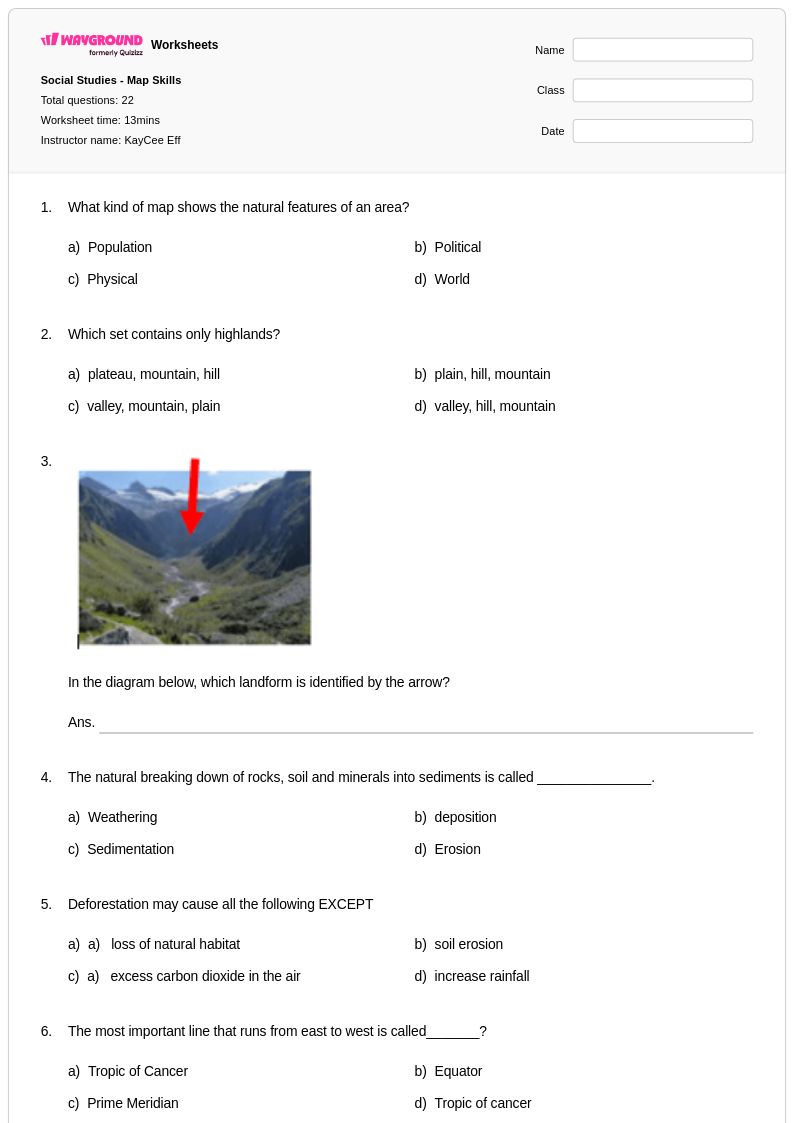
Reading a map worksheets for Class 5 students available through Wayground (formerly Quizizz) provide comprehensive skill-building exercises that develop essential cartographic literacy and spatial reasoning abilities. These carefully designed practice problems guide fifth-grade learners through fundamental map interpretation skills including understanding scale, reading compass directions, identifying symbols and legends, calculating distances, and analyzing topographical features. The printable resources feature progressively challenging activities that strengthen students' ability to extract meaningful information from various map types, from simple neighborhood layouts to complex physical and political maps. Each worksheet collection includes detailed answer keys and free pdf downloads, enabling educators to seamlessly integrate map reading instruction into their geography curriculum while providing students with structured opportunities to master these critical analytical skills.
Wayground (formerly Quizizz) supports educators with an extensive library of millions of teacher-created map reading resources, offering robust search and filtering capabilities that allow instructors to quickly locate materials aligned with specific learning standards and student needs. The platform's differentiation tools enable teachers to customize worksheets for varying skill levels, ensuring that both struggling learners and advanced students receive appropriate challenges in developing their cartographic interpretation abilities. These versatile resources are available in both printable and digital formats, including convenient pdf downloads, making them ideal for classroom instruction, homework assignments, remediation sessions, and enrichment activities. The comprehensive collection supports effective lesson planning by providing educators with ready-to-use materials that can be seamlessly integrated into geography units, helping students build confidence and proficiency in essential map reading skills through consistent, targeted practice.
FAQs
How do I teach map reading skills to students?
Start by introducing the five key map elements: title, legend, compass rose, scale, and grid. Begin with simple political maps before progressing to physical and topographic maps, giving students repeated exposure to interpreting symbols, measuring distance using scale, and identifying cardinal and intermediate directions. Scaffolding these skills in sequence helps students build spatial reasoning gradually rather than being overwhelmed by complex cartographic information all at once.
What exercises help students practice reading a map?
Effective map reading practice includes exercises where students decode legend symbols to identify features, calculate real-world distances using a map scale, locate places using grid coordinates, and trace routes using directional language. Worksheets that incorporate political, physical, and topographic maps side by side help students understand how different map types represent the same geographic information in different ways, reinforcing versatility in spatial interpretation.
What mistakes do students commonly make when reading a map?
A frequent error is ignoring the map scale, leading students to misjudge distances or assume all maps are drawn at the same proportion. Students also confuse cardinal and intermediate directions, especially when the compass rose is rotated or absent. Another common misconception is treating the legend as optional, causing students to misidentify physical features, boundaries, or thematic data that are only defined there.
How do I differentiate map reading instruction for diverse learners?
For students who struggle with visual complexity, reduce the number of map features introduced at one time and use large-print or high-contrast maps. On Wayground, teachers can enable Read Aloud so questions and directions are read to students with decoding difficulties, and can apply reduced answer choices to lower cognitive load for selected students. Extended time settings are also available per student, ensuring that those who need more processing time can complete map activities without penalization.
How do I use Wayground's reading a map worksheets in my classroom?
Wayground's reading a map worksheets are available as printable PDFs for traditional classroom use and in digital formats for technology-integrated learning environments, accommodating a range of instructional setups and student preferences. Teachers can also host the worksheets as a quiz directly on Wayground, making it easy to assign map reading practice as a formative assessment, a station activity, or independent work. Answer keys are included with every worksheet, enabling quick grading and immediate student feedback.
How do I assess whether students can accurately read a map?
Look for students' ability to correctly interpret legend symbols, apply scale to calculate distances, use the compass rose to describe relative location, and identify geographic features on both physical and thematic maps. Common assessment tasks include asking students to plan a route using directional language, identify elevation changes on a topographic map, or compare data across a thematic map. Errors in these tasks typically reveal whether gaps exist in symbol literacy, spatial reasoning, or scale comprehension.