Free Printable Regions of Georgia Worksheets for Class 4
Class 4 students can explore Georgia's diverse regions with our free printable social studies worksheets, featuring practice problems and answer keys to help master state geography concepts.
Explore printable Regions of Georgia worksheets for Class 4
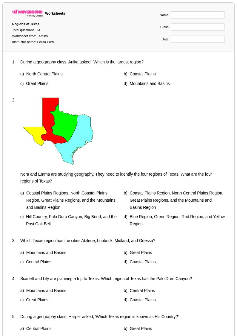
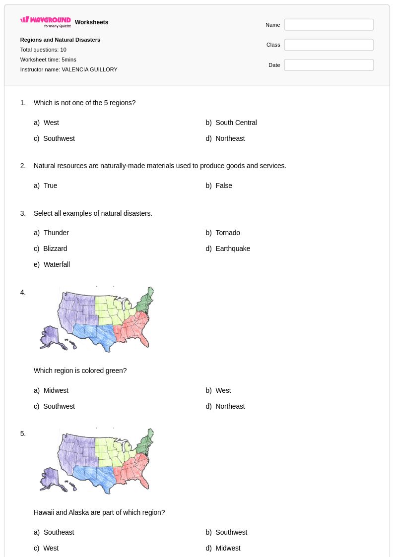
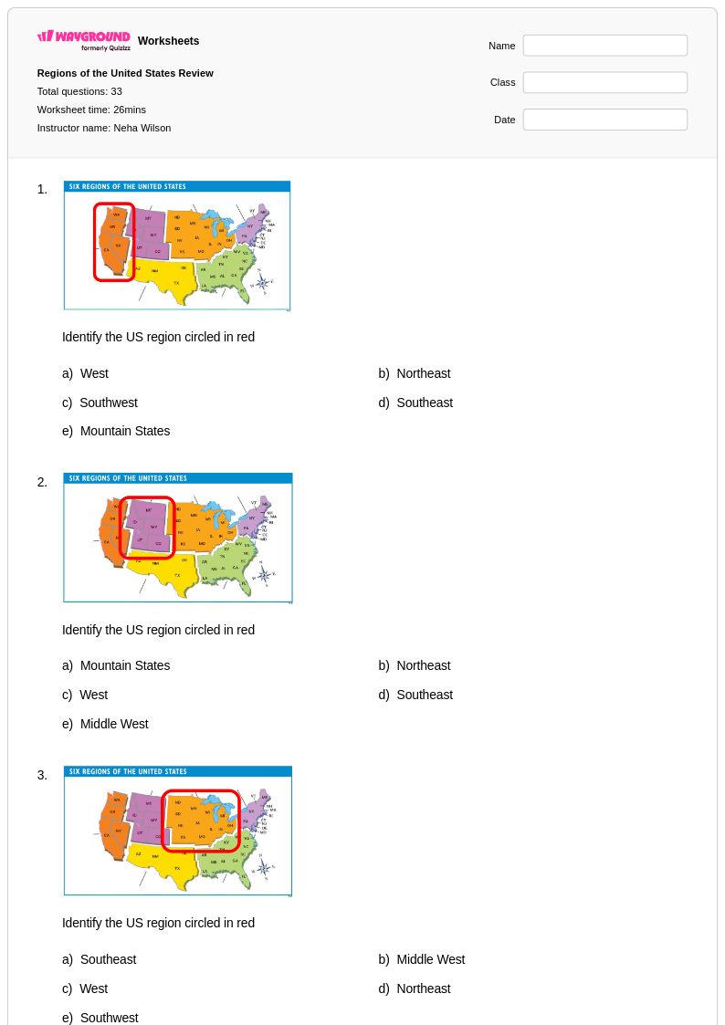
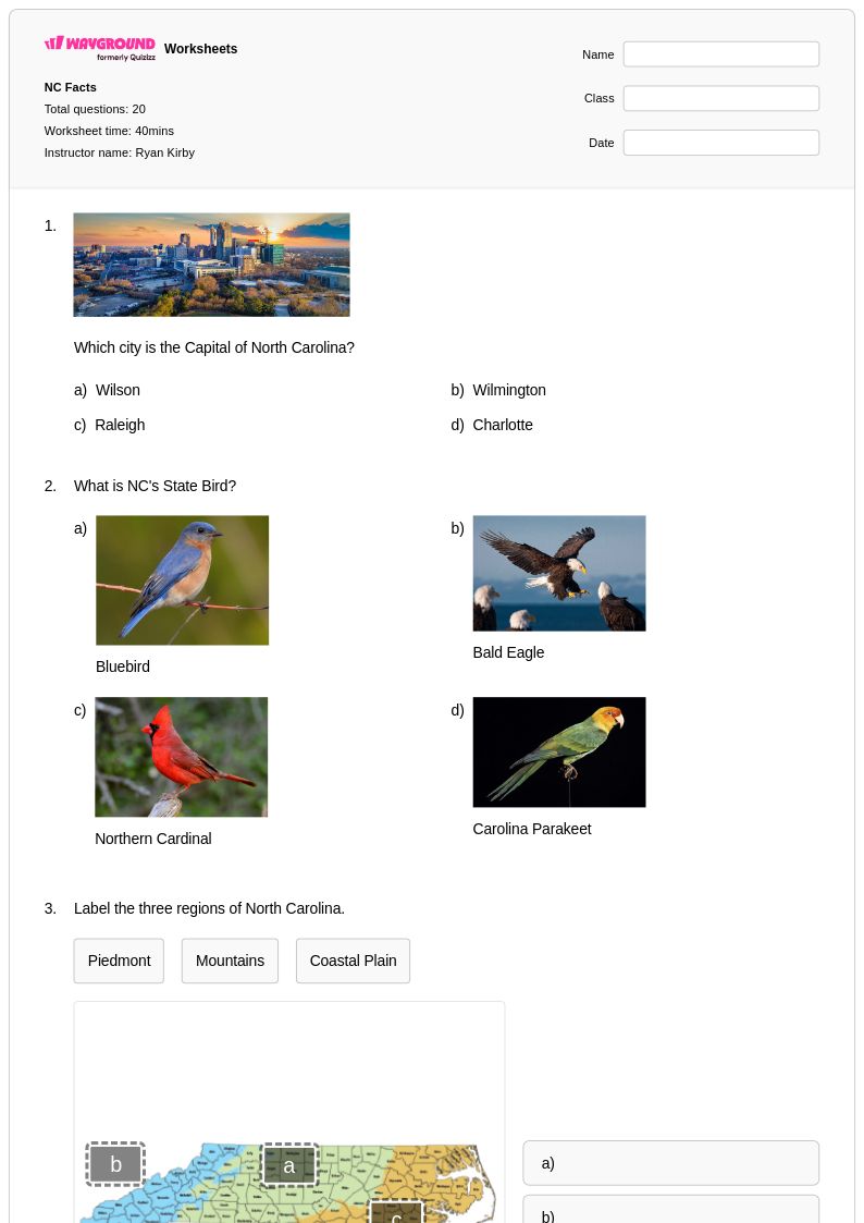
Regions of Georgia worksheets for Class 4 students provide comprehensive exploration of the state's five distinct geographic regions through Wayground's extensive collection of educational materials. These carefully designed worksheets guide fourth-grade learners through the Mountains, Piedmont, Coastal Plain, Ridge and Valley, and Blue Ridge regions, helping students understand the unique physical features, climate patterns, natural resources, and economic activities that define each area. The practice problems incorporate map skills, critical thinking exercises, and comparative analysis activities that strengthen students' ability to identify regional characteristics and understand how geography influences human settlement and industry. Each worksheet collection includes detailed answer keys and is available as free printables in pdf format, making it easy for educators to implement targeted geography instruction that builds foundational knowledge about Georgia's diverse landscape.
Wayground, formerly Quizizz, supports teachers with millions of teacher-created resources specifically focused on Georgia's regional geography, offering robust search and filtering capabilities that align with state social studies standards for Class 4. The platform's differentiation tools allow educators to customize worksheets based on individual student needs, providing options for remediation and enrichment that accommodate diverse learning styles and abilities. Teachers can access materials in both printable and digital formats, including downloadable pdf versions, enabling flexible lesson planning whether instruction occurs in traditional classrooms or remote learning environments. These comprehensive worksheet collections streamline the planning process by offering ready-to-use activities for skill practice, formative assessment, and reinforcement of key geographic concepts essential for fourth-grade mastery of Georgia's regional characteristics.
FAQs
How do I teach the regions of Georgia to elementary or middle school students?
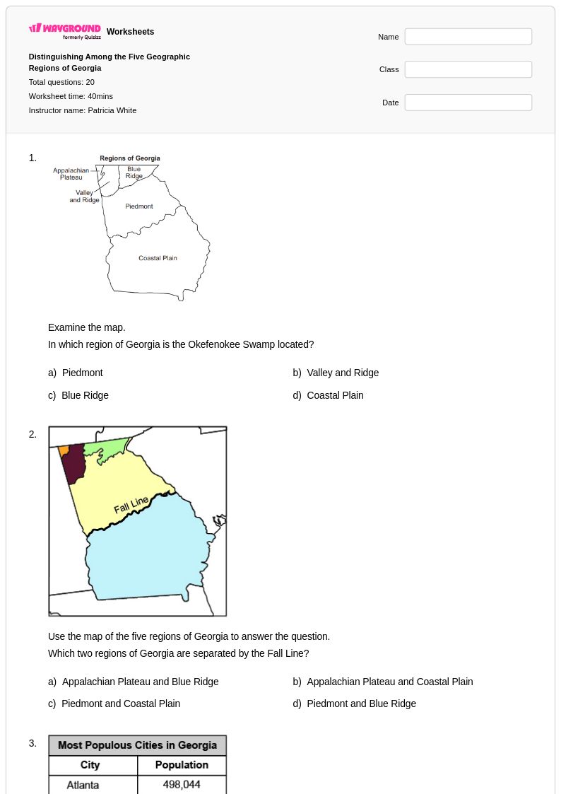
Start by anchoring instruction in the five regions: Appalachian Plateau, Ridge and Valley, Blue Ridge, Piedmont, and Coastal Plain. Use physical maps to help students visualize how topography, climate, and natural resources differ across each region before moving to human settlement patterns. Comparing regions side by side is more effective than teaching each in isolation, because it builds relational thinking about why people live and work where they do in Georgia.
What exercises help students practice identifying and comparing Georgia's regions?
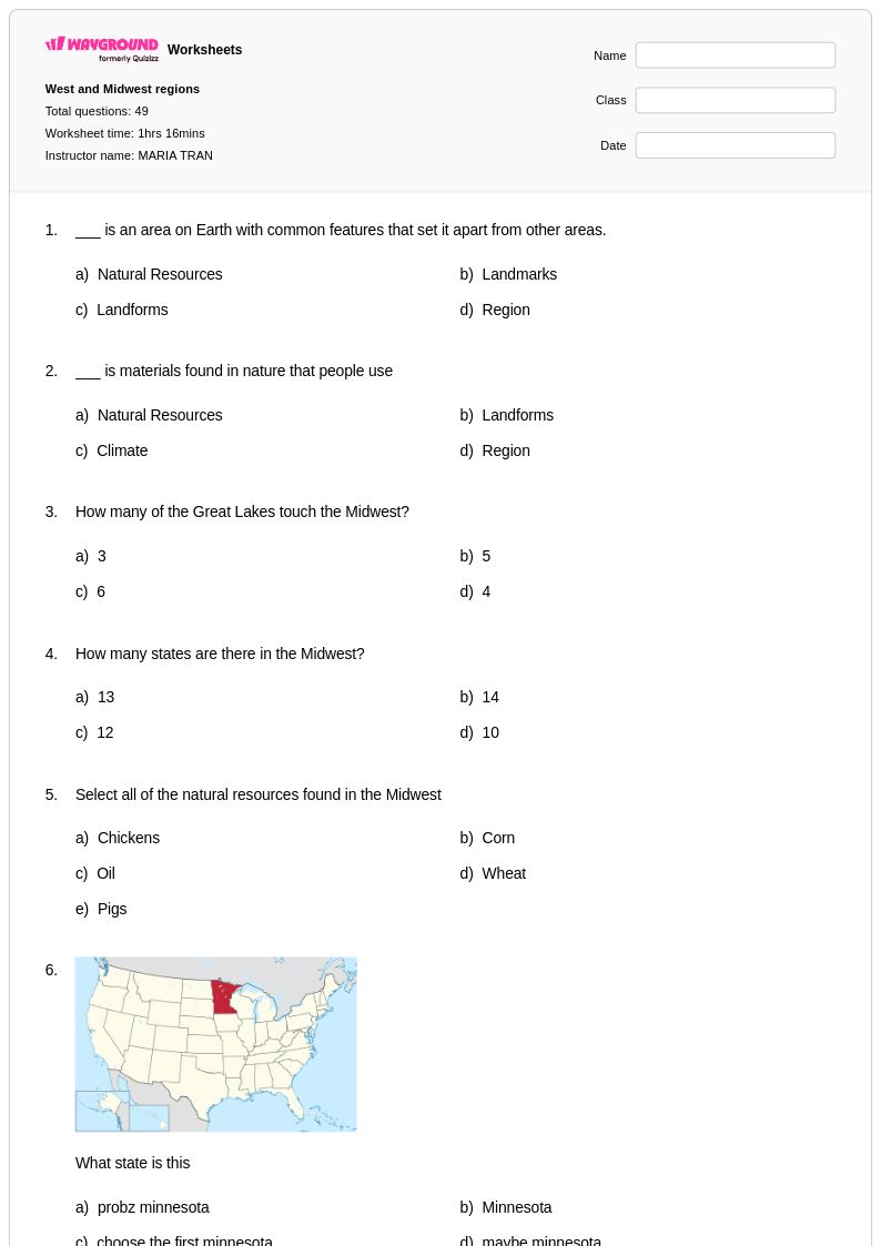
Map labeling activities, region-matching tasks, and compare-and-contrast graphic organizers are highly effective for reinforcing Georgia's five regions. Practice problems that ask students to connect physical features, such as the Blue Ridge Mountains or the Coastal Plain's wetlands, to economic activities and settlement patterns help deepen comprehension beyond simple memorization. Worksheets that require interpreting geographic data or regional maps strengthen the analytical skills students need for state social studies assessments.
What mistakes do students commonly make when learning about Georgia's regions?
A frequent error is confusing the Ridge and Valley region with the Blue Ridge, since both involve elevated terrain in northern Georgia. Students also tend to treat regions as having hard boundaries rather than understanding them as zones with transitioning characteristics. Another common misconception is assuming the Coastal Plain is limited to the coastline itself, when in fact it covers a large portion of southern Georgia and includes significant inland areas.
How can I use Regions of Georgia worksheets in my classroom?
Regions of Georgia worksheets on Wayground are available as printable PDFs for traditional classroom use and in digital formats for technology-integrated or hybrid learning environments. Teachers can also host them as a quiz directly on Wayground, making it easy to assign to students and collect responses in one place. All worksheets include answer keys, so they work equally well for guided instruction, independent practice, or homework assignments.
How do I differentiate Regions of Georgia instruction for students at different skill levels?
For struggling learners, scaffolded worksheets that focus on one region at a time with visual supports, such as labeled maps or word banks, reduce cognitive load while maintaining grade-level content. Advanced students benefit from tasks that require synthesizing information across regions, such as analyzing how geography influenced Georgia's economic development. On Wayground, teachers can apply accommodations like reduced answer choices or read-aloud settings to individual students, ensuring differentiated support without disrupting the rest of the class.
How do Georgia's five regions connect to broader state social studies standards?
Georgia's state social studies standards require students to understand how physical geography shapes human activity, economic development, and cultural identity across the state's regions. The five regions, Appalachian Plateau, Ridge and Valley, Blue Ridge, Piedmont, and Coastal Plain, each offer distinct case studies in how landforms, natural resources, and climate influence where people settle and how communities develop. Teaching regional geography builds the foundational literacy students need to analyze Georgia's history and economics in later grades.