Free Printable Topographic Map Reading Worksheets for Class 10
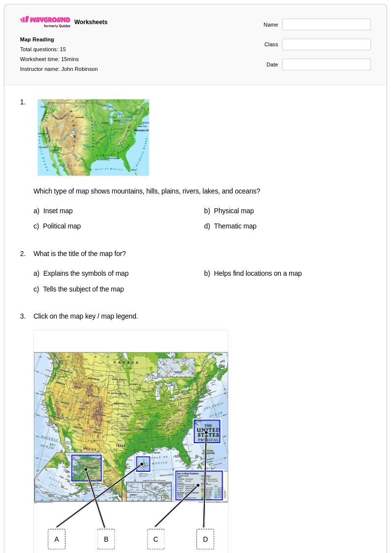
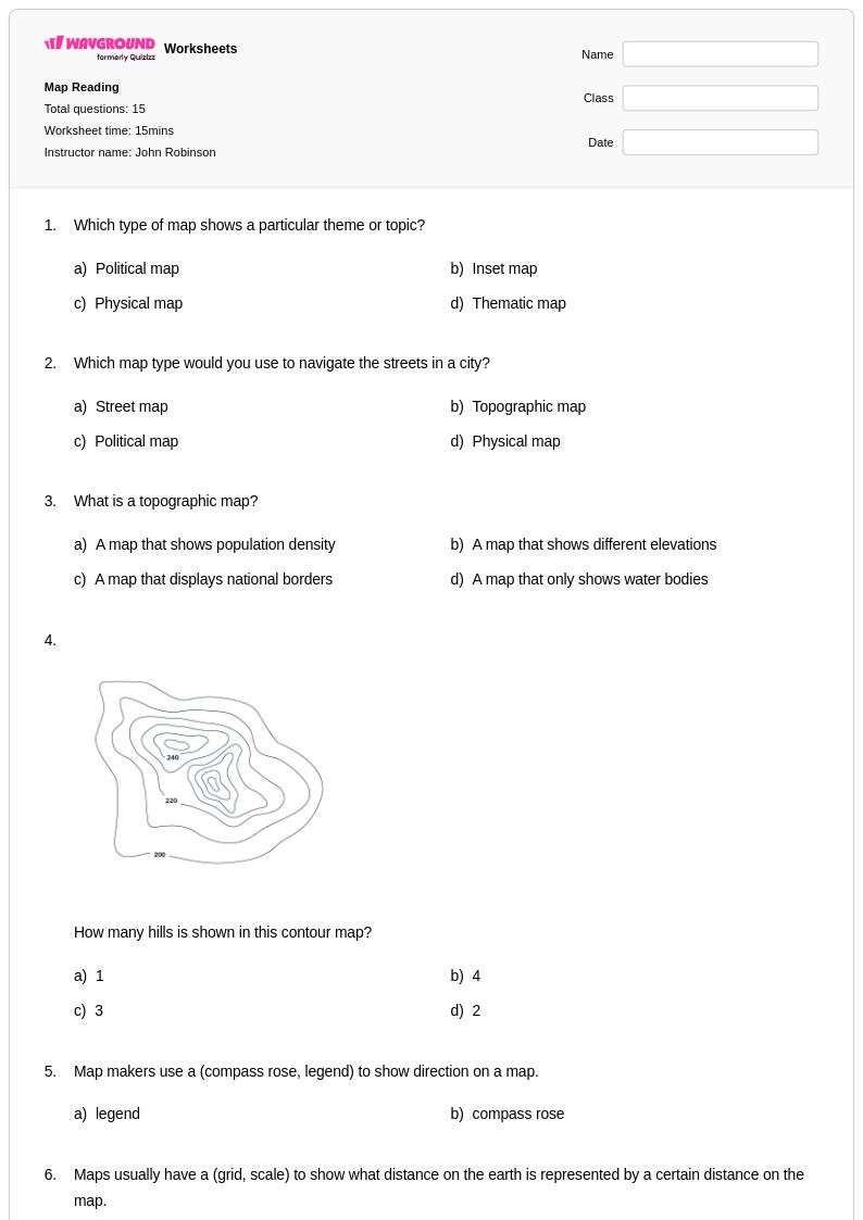
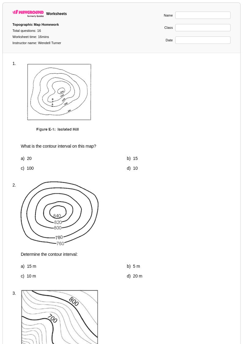
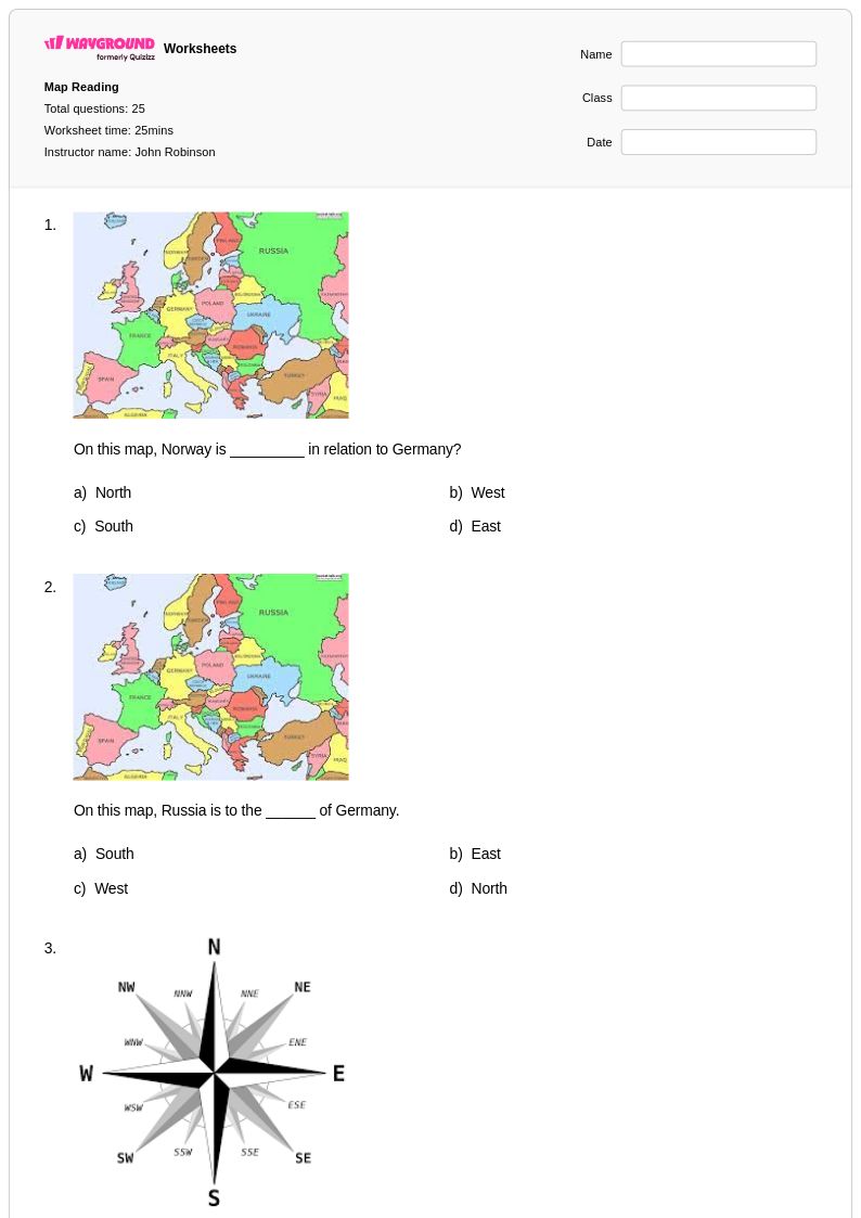
Class 10 topographic map reading worksheets from Wayground help students master elevation interpretation, contour line analysis, and terrain visualization through comprehensive printables, practice problems, and answer keys.
Explore printable Topographic Map Reading worksheets for Class 10
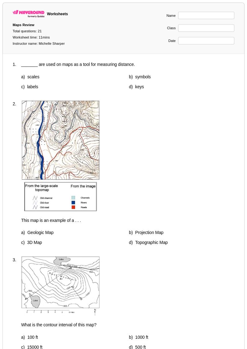
Topographic map reading worksheets for Class 10 students available through Wayground provide comprehensive practice in interpreting elevation data, contour lines, and three-dimensional terrain representation on two-dimensional maps. These carefully designed educational resources strengthen critical spatial reasoning skills while teaching students to analyze landforms, calculate slopes, identify ridges and valleys, and determine elevation changes across varied landscapes. The worksheet collections include detailed answer keys that support independent learning and self-assessment, while printable pdf formats ensure accessibility across different classroom environments. Students develop proficiency in reading contour intervals, understanding topographic symbols, and applying scale calculations through structured practice problems that progress from basic contour line identification to complex terrain analysis scenarios.
Wayground supports educators with an extensive library of millions of teacher-created topographic map reading resources that can be easily located through robust search and filtering capabilities designed specifically for Class 10 geography instruction. Teachers benefit from standards-aligned worksheet collections that accommodate diverse learning needs through built-in differentiation tools, allowing for seamless adaptation of content difficulty and complexity. The platform's flexible customization options enable instructors to modify existing materials or combine multiple resources to create targeted lesson supplements, while both printable and digital pdf formats provide versatility for traditional classroom settings and technology-enhanced learning environments. These comprehensive tools streamline lesson planning while offering targeted resources for remediation, enrichment activities, and systematic skill practice that builds student confidence in interpreting topographic information across various geographic contexts.
FAQs
How do I teach students to read topographic maps for the first time?
Start by helping students understand that contour lines connect points of equal elevation, and that the spacing between lines indicates slope steepness. Introduce the concept of contour intervals before asking students to identify specific landforms like ridges, valleys, and depressions. A layered approach works well: begin with reading the legend and identifying symbols, then progress to calculating elevation changes, and finally move to visualizing three-dimensional terrain from two-dimensional representations.
What exercises help students practice interpreting contour lines and elevation?
Effective practice exercises include calculating the elevation of specific points using contour intervals, identifying whether a slope is gentle or steep based on contour line spacing, and tracing the path of water drainage across a terrain map. Students also benefit from drawing cross-section profiles between two points on a topographic map, which directly builds the skill of translating two-dimensional contour data into a three-dimensional mental model.
What common mistakes do students make when reading topographic maps?
The most frequent error is misreading contour intervals, with students assuming all maps use the same interval value rather than checking the legend first. Students also commonly confuse closely spaced contour lines with crowded labeling rather than recognizing them as steep slopes. Another persistent misconception is misidentifying valleys and ridges: on a topographic map, V-shaped contours pointing uphill indicate a valley, while V-shapes pointing downhill indicate a ridge, and students frequently reverse these.
How do I help students visualize 3D terrain from 2D topographic maps?
Having students construct topographic profiles, or cross-sections, is one of the most effective bridging activities between two-dimensional maps and three-dimensional thinking. Pairing map analysis with physical or digital terrain models reinforces the connection between contour patterns and real landform shapes. Relief shading exercises, where students shade areas by elevation band, also strengthen spatial reasoning before moving on to slope gradient calculations.
How can I use Wayground's topographic map reading worksheets in my classroom?
Wayground's topographic map reading worksheets are available as printable PDFs for traditional classroom use and in digital formats for technology-integrated learning environments, and can also be hosted as a quiz directly on Wayground. Teachers can search and filter resources by specific skill focus or difficulty level, making it straightforward to sequence lessons from basic contour line identification through to advanced terrain analysis. Each worksheet includes a complete answer key, reducing prep time and supporting efficient formative assessment.
How do I differentiate topographic map reading instruction for students at different skill levels?
For students who need additional support, begin with simplified maps that use wide contour intervals and clearly labeled landforms before introducing complex terrain. Wayground's platform supports individual student accommodations including reduced answer choices to lower cognitive load, read-aloud functionality for students who need text support, and extended time settings that can be configured per student. These accommodations are saved and reusable across sessions, so teachers can consistently support diverse learners without rebuilding settings each time.