Free Printable World Map Worksheets for Kindergarten
Explore Wayground's free kindergarten world map worksheets and printables that help young learners discover continents, oceans, and countries through engaging practice problems with complete answer keys.
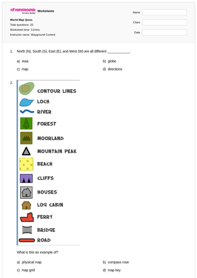
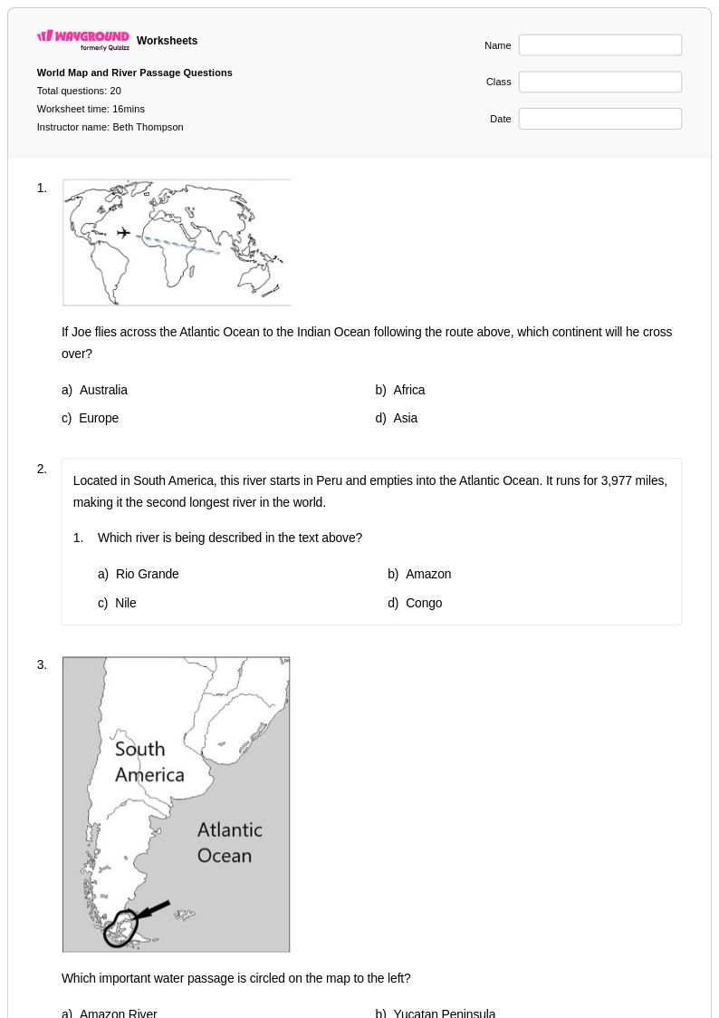
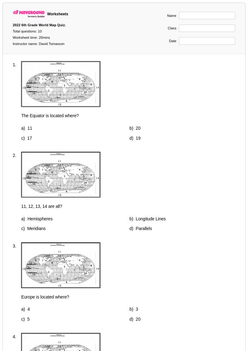
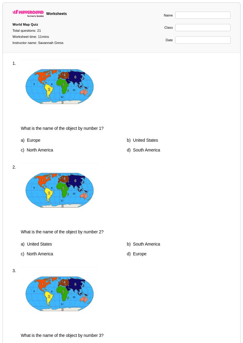
Explore printable World Map worksheets for Kindergarten
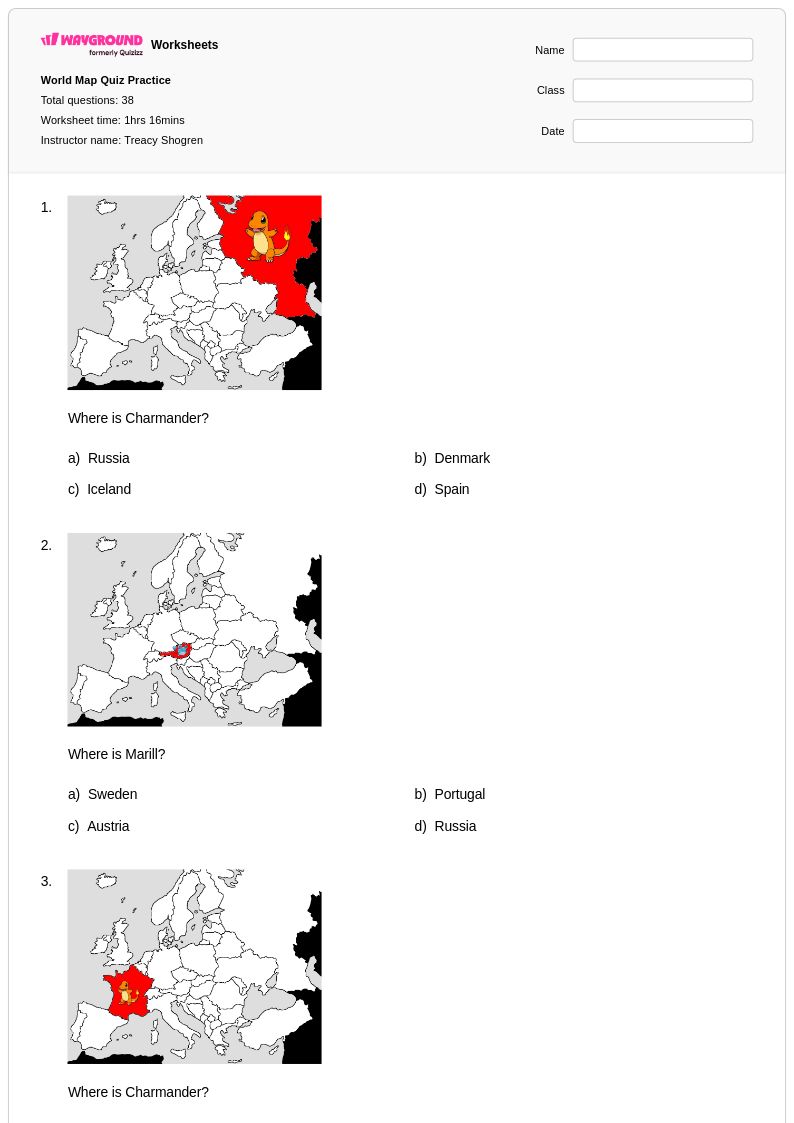
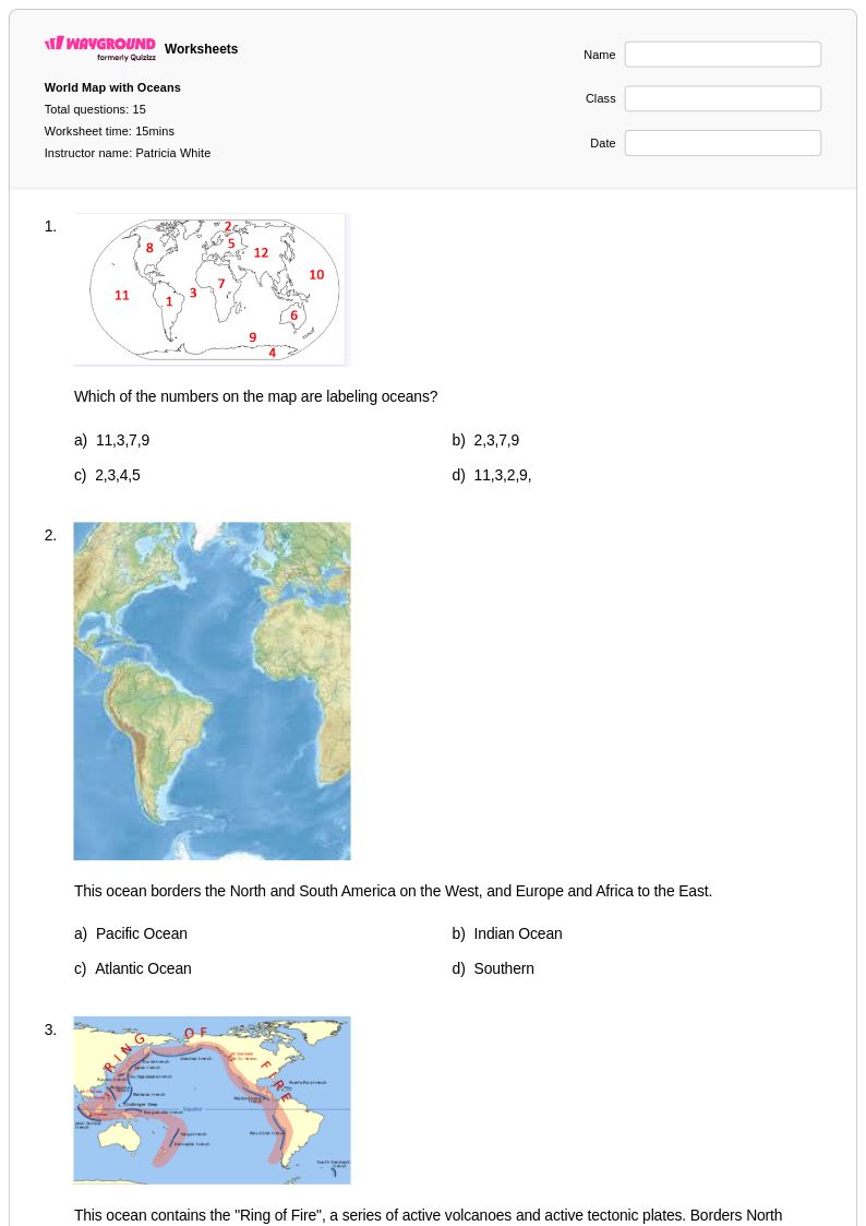
World map worksheets for kindergarten students available through Wayground (formerly Quizizz) introduce young learners to fundamental geographic concepts through age-appropriate visual activities and hands-on exploration. These carefully designed printables help kindergarteners develop spatial awareness, basic directional skills, and an understanding of continents and oceans while building essential pre-reading and observation abilities. The collection features engaging practice problems that encourage students to identify major landmasses, recognize simple map symbols, and understand the difference between land and water on our planet. Each worksheet includes a comprehensive answer key to support accurate assessment, and the free pdf format ensures easy classroom distribution and home practice opportunities.
Wayground (formerly Quizizz) empowers educators with millions of teacher-created world map resources specifically tailored for kindergarten geography instruction. The platform's robust search and filtering capabilities allow teachers to quickly locate worksheets that align with curriculum standards and match their students' developmental needs. Advanced differentiation tools enable instructors to customize content for varied learning levels, while the flexible format options support both digital classroom integration and traditional printable distribution. These comprehensive features streamline lesson planning by providing immediate access to skill practice materials, remediation activities for struggling learners, and enrichment opportunities for advanced students, ensuring every kindergartener can successfully engage with foundational world geography concepts.
FAQs
How do I teach students to read a world map?
Start by orienting students to the map's key components: the compass rose, scale, legend, and grid lines. From there, build spatial awareness progressively by first introducing the seven continents and five oceans before moving to country-level identification. Using labeled and blank map activities together reinforces both recognition and recall, which are distinct skills that require separate practice.
What activities help students practice world map skills?
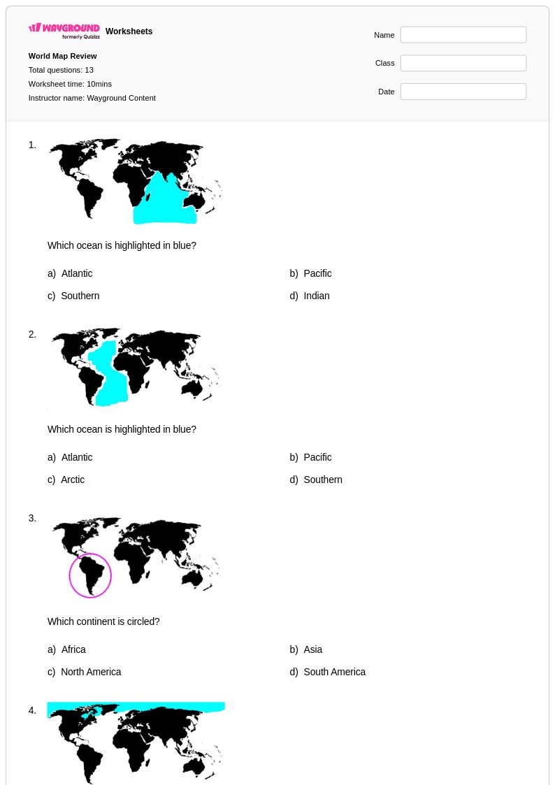
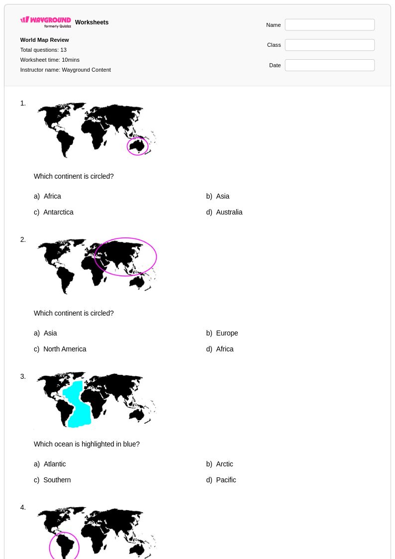
Labeling exercises are the most effective entry point — blank maps where students must identify and write in continents, oceans, and major countries build both recognition and memory. For more advanced practice, political and physical geography challenges that ask students to distinguish features like mountain ranges, river systems, or national borders push spatial reasoning further. Mixing guided labeling with independent recall tasks across multiple sessions reinforces retention over time.
What mistakes do students commonly make when working with world maps?
One of the most frequent errors is confusing the relative size and position of continents due to map projection distortions — students often assume the Mercator projection reflects true landmass proportions. Students also commonly misidentify oceans bordering specific continents, particularly the Arctic and Southern Oceans, which receive less instructional emphasis. Another persistent issue is conflating physical and political geography, such as labeling a mountain range where a country border is expected.
How do I use world map worksheets to support different skill levels in my class?
For foundational learners, start with continent and ocean labeling worksheets that provide a word bank or partially completed map as scaffolding. On Wayground, teachers can apply accommodations such as read aloud for students who need audio support or reduced answer choices to lower cognitive load for students who find open-ended map tasks overwhelming. Advanced learners can be challenged with political and physical geography worksheets that require identifying countries, capitals, and major landforms without scaffolding.
How do I use Wayground's world map worksheets in my classroom?
Wayground's world map worksheets are available as printable PDFs for traditional classroom use and in digital formats for technology-integrated environments, including the option to host them as a quiz directly on Wayground. Printable versions work well for hands-on labeling practice, while the digital format enables real-time feedback and easier tracking of student responses. Each worksheet includes a complete answer key, which reduces grading time and makes the materials viable for independent practice or homework as well.
How do world map worksheets align with geography education standards?
World map worksheets address core geography standards centered on spatial awareness, geographic literacy, and cartographic interpretation — skills explicitly identified in national and state geography frameworks from elementary through middle school. Exercises covering continents, oceans, political boundaries, and physical features map directly onto standards requiring students to use geographic tools and representations accurately. Using a variety of worksheet formats, from basic labeling to complex physical geography tasks, ensures coverage across multiple standard benchmarks within a single unit.