
Font size
 Worksheets
WG #6: Europe, & Russia, Australia, & Oceania
Total questions: 133
Worksheet time: 1hrs 29mins


Which two places do the Ural Mountains act as a natural barrier between?
Europe & the United States
Spain & Portugal
Italy & France
Europe & Asia

What is the name of the peninsula that is made up almost totally by the country of Denmark?
Italian Peninsula
Jutland Peninsula
Balkan Peninsula
Iberian Peninsula
Why is the North Atlantic Drift significant to Europe?
Because it causes there to be very little storms, which is a pull factor
Because it makes the fish disappear every 4 years and affects local economies
Because the warm ocean current and prevailing winds make it warmer in Europe than it should be based on its latitude
Because it provides protection from attacking armies
Which of of the following best describes the effect of the Mediterranean Sea on Europe's people and culture over time.
The Mediterranean Sea creates tornadoes which affects people on the coasts
The Mediterranean Sea gives countries the ability to trade and for people to freely move around the European continent
The Mediterranean Sea gets very cold every four years and affects the fishing industry in the region
The Mediterranean Sea has glaciers that are melting and making sea level rise
What is the name of the peninsula that includes Spain & Portugal?
Jutland Peninsula
Balkan Peninsula
Iberian Peninsula
Scandinavian Peninsula
What is the name of the dark black soil that is found in Eastern Europe and the Northern European plain that makes it a good place for farming and for people to settle?
Polder
Chernozem
Fjord
Topsoil
How have avalanches shaped the way people live in Europe?
People live at the top of mountains so the snow doesn't fall on them
People never live near mountains because of the danger of avalanches
People have to decide if it is worth the risk living near mountains because there are also pull factors like the beautiful landscape
People live in the middle of mountains and hope that an avalanche falls on them
The Pyranees Mountains act as a natural border between what two places?
The Iberian Peninsula & The Scandinavian Peninsula
France & Italy
Eastern Europe & Asia
The Iberian Peninsula & the rest of Europe
What is the name of the peninsula that includes Norway, Sweden & Finland in northern Europe?
Jutland Peninsula
Iberian Peninsula
Scandinavian Peninsula
Balkan Peninsula
A long, narrow & deep inlet of a sea that is created by glaciers cutting through a mountain, then melting away
Canal
Polder
Fjord
Glaicer
What is the name for a group of islands, like the many islands that exist in the Mediterranean Sea?
Antilles
Archipelago
Alps
Appalachians
What is the name of the peninsula that is made up of Greece at the southern end, and includes other countries of Eastern Europe?
Jutland Peninsula
Iberian Peninsula
Scandinavian Peninsula
Balkan Peninsula
Which of the following best describes how glaciation has affected Europe?
Glaciation cases many floods in Europe, especially in the Netherlands
Glaciation created fjords in Scandinavia that allow for fishing and transport, and today, global warming is a concern because it could cause sea level to rise as glaciers melt
Glaciation is a great tourist attraction because people love to go on vacation where there are glaciers and this is good for the economy
Glaciation caused many indigenous people to go extinct because they quickly covered cities and wiped out entire civilizations
The Adriatic Sea lies directly to the east of which European country?
Finland
Italy
Spain
United Kingdom
Why is the Strait of Gibraltar an important water form in Europe?
Because it is the only water passage from the Atlantic Ocean to the Mediterranean and gives access to most European countries to trade in the Atlantic
Because it is a great tourist attraction that brings money to Europe's economy
Because it there is a lot of geothermal energy created there, which helps the people of the region
Because fish are attracted to it because of its cold ocean currents and this is a major industry in the area
Why is the Northern European Plain an important place in Europe?
It provides mountains for tourism and rain shadows
It provides geothermal energy because of its geysers
It is great for fishing because of its many fjords and archipelagos
It is great for farming because of its rich, fertile soil
Why are geothermal & hydroelectric energy important?
Because they are major money makers for the European economy in many countries
Because they are clean & renewable energy sources that allow people to create energy for themselves in many countries in Europe
Because they allow countries detect earthquakes & tsunamis earlier
Because they bring in lots of tourists to view the dams and geothermal factories
Which country has the longest Deforestation
North Korea
Asia
Europe
South America
What is the North Atlantic Drift
warm water from the tropics to the Europe's east coast
warm water from the tropics to the Europe's west coast
warm water from the tropics to the Europe's north coast
warm water from the tropics to the Europe's south coast
Where are the most likely places where people will settle?
The Ruhr valley developed as an industrial and transportation center because of its
large forested areas.
mineral deposits.
smooth, flat plains.
warm, sunny climate
The Po River Valley is important because of its development as
An industrial center.
A religious pilgrimage site.
An agricultural center
A seaport.
Which of the following is NOT a major product of countries along the Mediterranean Sea?
olives
grapes
corn
citrus fruits
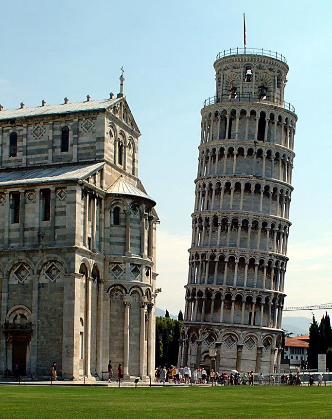

Eiffel Tower
Elizabeth Tower
Buckingham Palace
Vatican City

Colosseum
Parthenon
Leaning Tower of Pisa
Hagia Sophia

Parthenon
The Kremlin
The Berlin Wall
Colosseum

the Louvre
Stonehenge
La Alhambra
Neuschwanstein Castle
What is the name of the leaders of Russia for hundreds of years before it became the Soviet Union?
Kings
Presidents
Bolsheviks
Czars
What was the purpose of Glasnost & Perestroika?
To convince the people of Soviet Russia to change to a market economy
To convince the people of Soviet Russia to adopt a new kind of government
To convince the people of Soviet Russia that they could trust the government to be open & honest with them and to change the economic system for the better
To convince the people of Soviet Russia that they could win the cold war
How is chernozem useful to people?
It helps prevent pollution
It helps them grow cash crops
It helps them in the timber industry
It helps them transport goods
What was the effect of the Chernobyl disaster on the people of in this city in the Ukraine?
The people lost all of their money
The people were hurt badly by the radioactive material
The people made more money because of tourism
The people were not affected in a meaningful way
Which of the following activities does permafrost affect negatively the most?
Transport of goods
Continentality
Farming
Industrial Pollution
Why was NATO formed?
To keep Western Germany in Soviet control
To provoke Russia into starting a war
To protect the U.S. and other countrie after the Warsaw Pact was formd
To bring peaceful missions to places all over the world
What does the hammer represent in the Soviet Flag?
The command economy
The working class
The Warsaw Pact
The fighter of the Soviet Union

What is the capital of Russia?
Moscow
St. Petersburg
Nizhny Novgorod
Vladivostok

From 1917 to 1991, Russia had a different name. It was called what?
Union of Russian Soviets (URS)
Russian Federation (RF)
Confederation of Russian States (CRS)
Soviet Union (USSR)

If you want to cross Russia by railway, what is the name of the famous railway that will take you across Russia?
Trans-Siberian Railway
Russian Railroad
Russian Express
Shinkansen

From 1917-1991, Russia was the Soviet Union. What economic system did they follow?
Communism
Capitalism
Socialism
Fascism

What is the name of this famous Eastern Orthodox cathedral in Russia?
St. Basil's Cathedral
St. Peter's Basilica
St. Paul's Cathedral
Taj Mahal

What is the official state religion of Russia?
Eastern Orthodox (Christianity)
Roman Catholic (Christianity)
Islam
Judaism
Which energy source's waste is extremely dangerous?
nuclear
wind
solar
natural gas

This region is too dry to support a forest, but not dry enough to be a desert. It is often mistaken for a prairie; however, it cannot support the tall grasses found there. What is the region in the photograph above?
Steppe
Rain forest
Tundra
Savanna
In the Russia and Central Asia region, which of the following is NOT an architectural structure that is past of the cultural landscape?
Minarets
Floating markets
Russian Orthodox churches
Apartment blocks

What area is known as the "Sleeping Land"?
Russia
Uzbekistan
The Urals
Siberia
What explains the outcome of the Chernobyl accident?
A. An oil spill along the main pipeline.
B. Radiation exposure and contamination.
C. Collapse of a coal mine from an explosion.
D. Pesticide dumped into the local water.

Chernozem means---
River complex
Black forest
Rich soil
Mountain range

What is the nickname given to Russia and Central Asia's best farming land?
Fertile Crescent
Fertile Triangle
The great fertile zone
Bermuda Triangle

One of the reasons Russia's natural resources have not been fully developed because of---
Climate
Fighting among local leaders
Lack of need
Political infrastructure

Which body of water separates Russia from Alaska?
Arctic Ocean
Volga River
Amur River
Bering Strait

Which country represents number 3?
Turkmenistan
Russia
Uzbekistan
Kazakhstan
The farming & industry of the region is concentrated in what is known as the---
Fertile Crescent
Bermuda Triangle
Fertile Triangle
Fertile Circle

This is of one of Russia's most famous artifacts. What is the name of the famous gift?
Faberge Eggs
Araucanian Egg
Czar Nicholas I Egg
Czarian Egg
The current president of Russia
Lenin
Putin
Stalin
Gorbachev
Which factor accounts for the language patterns evident in Central Asia?
Diffusion along historic trade routes
Former Russian control of the region
Introduction of Internet technologies
Adoption of Islam as the official religion
Which human modification is most responsible for drying up the Aral Sea?
Redirecting water to grow crops in the desert
Polluting from nearby mining operations
Constructing dams on the rivers feeding the lake
Which cultural attraction would you most likely visit on a tour of Central Asia?
Hockey Game
Cathedral
Mosque

Where was this image likely taken and how does the character of this place reveal its location?
eastern Siberia because of the wide-open, grassy fields
Central Asia because of the long history of nomadic life in the area
Caucasus because the region has a long history of breeding horses
western Russia because the environment lacks resources for stone or wood buildings
From your notes on Physical Geography of Russia:
What does the Volga River provide?
fish and water
hydroelectric power and fish
hydroelectric power and a source of irrigation
nothing it's in South America

What city is near 60 N ?
St Petersburg
China
Barnual
Orenburg
Landlock countries have a hard time accessing --
resources
birds (because they aren't real lol)
electricity
culture

The Aral sea is Evaporating because
Too much rain fall.
Not enough Irrigation is used
Large dams keep the water in
Farms and human access it without replenishment.
What river flows into the Arctic Ocean?
Ob
Volga
Amur
Danube

Look at the picture below and select the correct term for this cultural icon of the region
Faberge Eggs
Taiga
Matryoshka Dolls
Samovar


Identify the displayed item, which is popular in Central Asia?
Vase
Samovar
Urn
Hookah

Large, coniferous forest located just south of the tundra, which makes up most of Russia's landscape is called —
savanna
taiga
steppe
permafrost
Which dwelling dots the landscape of Central Asia?


These priests serve the ________________________ Christian religion, the common religion of Russia and Eastern Europe.
Catholic
Protestant
Orthodox
Latter Day Saints
The language family of many central Asian countries is
English
Arabic
Russian
Turkic

The item in this picture is called ______________.
Oriental Carpet
Area rug
Tapestries
Religious buildings associated with Islam are called ________.
Churches
Mosques
Temples
Pagodas

What type of religious building is St. Basil's?
Mosque
Minaret
Temple
Cathedral
The major resources in Central Asia are oil and
lumber.
silver.
natural gas.
uranium.

city in Russia is.....


What cultural characteristics of New Zealand reflects Maori traditions?
Hula Dance
Haka Dance
Line Dance
Kiwi Dance

How does the Australian Outback influence human settlement patterns?
there are many towns in the Outback
the Outback is heavily populated
the Outback is lightly populated with a few towns
there is no population in the Outback

When thinking about food, how have humans living in Oceania adapted to the environment?
depend on fishing
live near water
became vegetarians
don't eat fish

Aboriginal communities have this type of economy-
unlimited economy
closed economy
limited economy
traditional economy

The physical geography of Oceania has caused societies in the region to -
disappear
become separated from one another
become isolated on various islands
grow larger in number

Which physical process is responsible for the formation of islands in the Pacific Ocean?
land tremors
Coastal shifts
Continental Drift
Plate Tectonics

Where are most Australian Urban Centers located?
Along the Coast
In the Outback
Only in the nation's capital
there are not any urban centers

Why is there a higher rate of skin cancer in Australia, compared to the US or the UK?
fewer doctors to treat the cancer
the sun is hotter
no sunscreen
ozone holes in the atmosphere in area

Which geographic formation is pictured in this aerial photo? And is created from a coral reef?
Atoll
Barrier Island
Archipelago
Isthmus

Which geographic formation is shown in the picture? and is located off the coast of Queensland, Australia.
The Outback
Aurora Australis
Ayers Rock
The Great Barrier Reef

Located in the Southern Hermisphere
Is a continent and a nation
Neighboring countries include Indonesia & New Guinea
Bordered by oceans on all sides
WHICH COUNTRY FITS THE DESCRIPTION ABOVE
FIJI
AUSTRALIA
NEW ZEALAND
HAWAII


What do you call plants and animals that are in danger of dying in the immediate future?
exotic species
koala bears
endangered species
native species

Aborigine means
a) indigenous people
b) native to the region
c) first people in a region
all the above

What season is it in Australia in December
fall
spring
winter
summer

