
Font size
 Worksheets
Chap 10 - 13
Total questions: 45
Worksheet time: 44mins
The process by which precipitation that has fallen on land trickles into the ground and becomes groundwater is known as what?
aeration
saturation
infiltration
porosity

Organize the materials in order from best able to hold water to least able to hold water.
A, B, C
B, C, A
C, A, B
A, C, B

Water is able to flow more easily through the aquifer because its material has a ___________.
low permeability
low porosity
high porosity
high permeability

In the diagram, the area labeled A is called the __________.
zone of infiltration
recharge zone
zone of saturation
zone of permeability
The top of an aquifer is known as:
the water table.
an artesian well.
the hydraulic gradient.
a geyser.
Which of the following are wells used for? CHOOSE ALL THAT APPLY!
Wells are used to determine the height of the water table.
Wells are used to obtain water for crop irrigation.
Wells are used to obtain water for human consumption.
Wells are used to create barriers between aquifers, called aquatards.
What does the quantity of groundwater that can be stored depend upon?
It depends upon the porosity of the underground rock.
It depends upon the pH of the groundwater.
It depends upon the underground depth of the storage system.
It depends upon the temperature of the underground rock.
A place where the water table intersects the ground surface and where a natural flow of groundwater results is called:
a spring.
a geyser.
an aquatard.
a fissure.
Geologically, groundwater is important as an agent of:
erosion
deposition
lithification
subduction
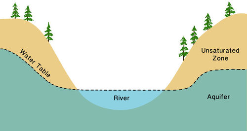
What is the best definition of a water table?
The level to which a river rises when it floods
The boundary between the land and the ocean
The top of the saturated zone in an aquifer
The bottom of the saturated zone in an aquifer
The top of the unsaturated zone in an aquifer

What would cause the water table to lower?
High rates of evaporation and transpiration
Low rates of evaporation and transpiration
Increasing amounts of runoff
A heavy rainstorm with a lot of precipitation
What is infiltration?
The process by which water sinks into the ground
The zone where there are still air spaces left between the particles.
The process by which water vapor turns into liquid water and forms fog or clouds.
The process by which water does not sink into the ground, but rather travels along the surface.

What process transforms the water vapor in the atmosphere to the liquid water in a cloud?
evaporation
infiltration
precipitation
transpiration
condensation

What process causes liquid water to evaporate from plant leaves and enter the atmosphere as water vapor?
evaporation
infiltration
precipitation
transpiration
condensation
What is capillarity?
When water cannot infiltrate a substance
Water being held onto by rock or sediment
The ability of water to move upward against gravity in a material
The percentage of empty space in a material

These containers have the same volume of beads which are representing soil particles. What is the relative porosity and permeability of each?
The container on the left has the higher permeability and porosity
The container on the right has the higher permeability and porosity
The container on the left has the higher permeability, but they both have the same porosity
The container on the right has the higher permeability, but they both have the same porosity


What is a high tide?
Sea pulled TOWARD the moon where Earth is CLOSEST to the moon
Sea pulled AWAY from the moon where Earth is FARTHEST to the moon
Sea pulled AWAY from the moon where Earth is CLOSEST to the moon


Wha type of tide would this arrangement of earth-moon-sun create?
full moon tide
new moon tide
neap tide
spring tide

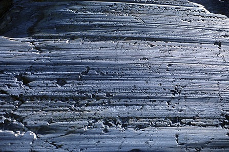


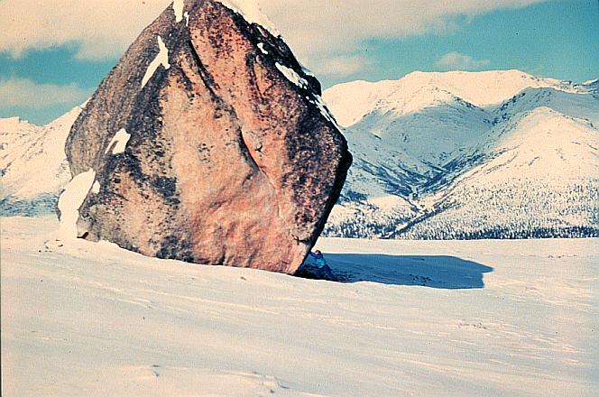
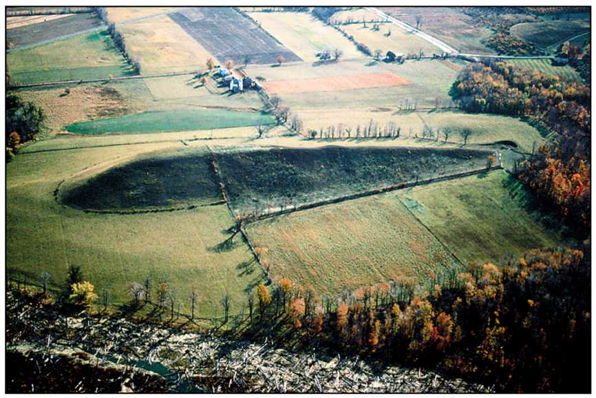
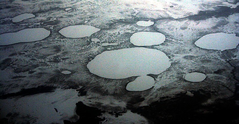

The cross sections show a three-stage sequence in the development of a glacial feature. Which glacial feature has formed by the end of stage 3?
kettle lake
finger lake
drumlin
parallel scratches
Which landscape feature was most likely formed by glacial activity?
an eroded plateau
a flat floodplain
a U-shaped valley
a V-shaped valley
The Catskills are commonly called mountains, but are actually part of the Allegheny Plateau. The Catskills are classified as a plateau because of their
low elevation
bedrock structure
bedrock age
high degree of metamorphism
The only dinosaur fossils found in New York State are footprints found on 210-million-year old bedrock. In which New York State landscape region were these dinosaur fossils found?
Newark Lowlands
Tug Hill Plateau
Allegheny Plateau
Adirondack Mountains
Which landscape region is a flat plain consisting mainly of unsorted clays, gravels, sands, scratched pebbles, boulders, and cobbles?
The Manhattan Prong
The Adirondacks
The Catskills
Long Island
Which statement best explains why 18,000 years ago the coastline was at a different location than it is today?
North America had just separated from Africa, and the Atlantic Ocean was forming.
The east coast of North America was being subducted under the Eurasian Plate
large amount of Earth's water was stored in large continental ice sheets.
The climate of Earth was extremely hot and dry.
What are the names of the different landscape regions in New York?
Allegheny Plateau, The Catskills, Tug Hill Plateau, Erie-Ontario Lowlands, St. Lawrence Lowlands
Allegheny Plateau, Erie-Ontario Lowlands, Hudson-Mohawk Lowlands, Taconic Mountains
Allegheny Plateau, The Catskills, Tug Hill Plateau, Erie-Ontario Lowlands, St. Lawrence Lowlands, Hudson-Mohawk Lowlands, Taconic Mountains, Newark Lowlands, Adirondack Mountains, St. Champlain Lowlands
Remember to use your study guides :)
Ok
Why?
No
Sure

