
 Worksheets
Unit 1 Practice
Total questions: 48
Worksheet time: 27mins
What map would you use to locate the largest body of fresh water in the world?
Political
Physical
Resource
Road
What type of map would you use if you wanted to find the countries bordering Egypt?
Political
Physical
Road
Topographic
A map showing mountains, rivers, oceans, valleys, and deserts is what type of map?
Political
Physical
Population
Climate

This map is an example of a . . .
Physical Map
Road Map
Population Map
Climate Map

What type of map is this?
Physical
Political
Resource
Topographic
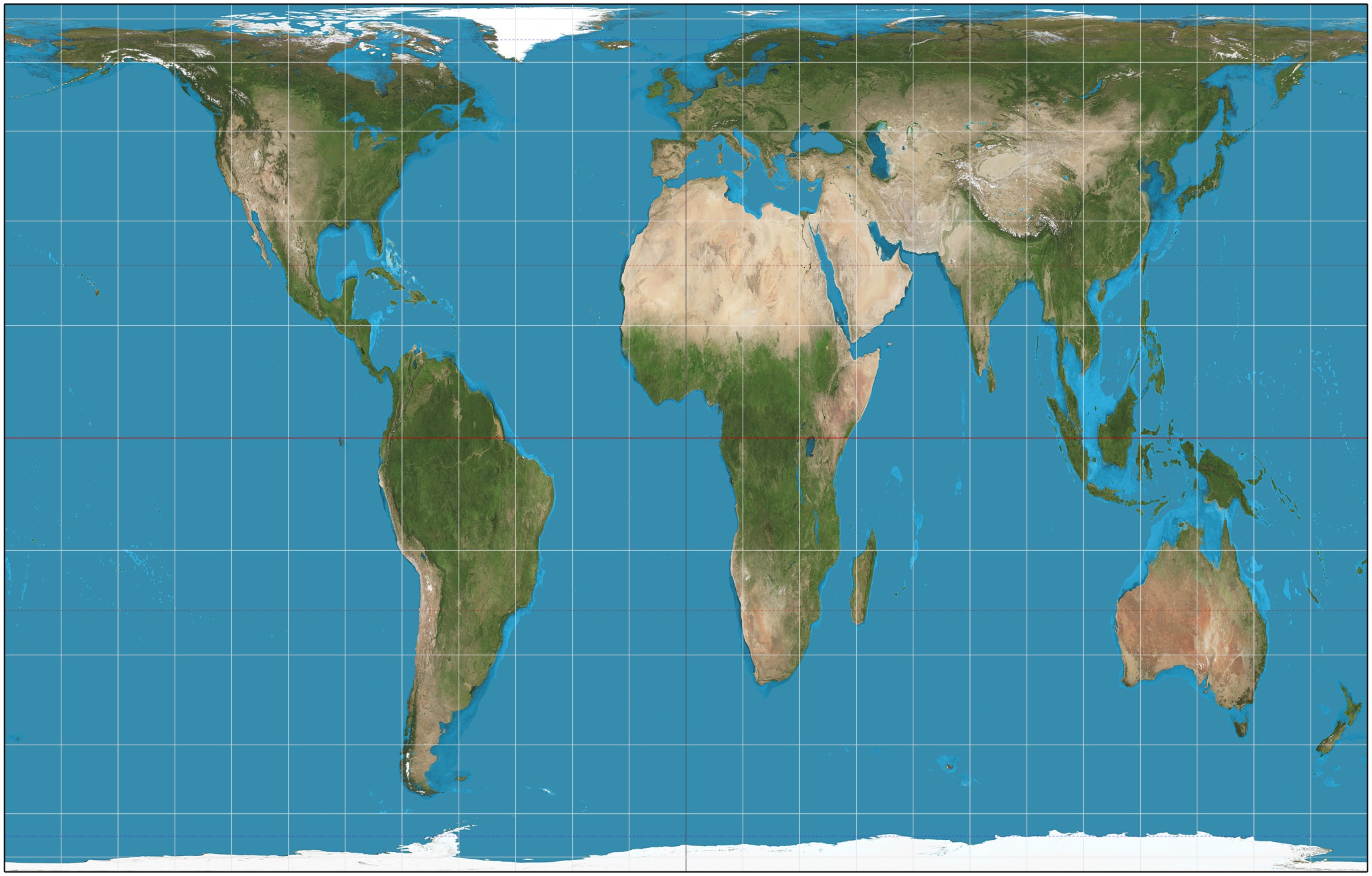


True or false: All world map projections create distorted images of the Earth to some degree. These distortions relate to size, shape, direction, and distance.
True
False
"Smartphones, each one with a tiny GPS pinging, have revolutionized cartography. Matthew Zook, a geographer at the University of Kentucky, has partnered with data scientists there to create what they call the DOLLY Project - it's a searchable repository of every geotagged tweet since December of 2011, meaning Zook and his team have compiled billions of interrelated sentiments, each with a latitude and longitude attached."
Why are geographers interested in the information in DOLLY?
It provides information about spatial distribution of people's reactions to events.
It provides an opportunity for geographers to work with data scientists.
Geographers focus on the sentiments of people more than do other scientists.
The data is searchable, and most geographic information is hard to organize.
Geographers are more likely to use new technology than are other scientists.
All of the following accurately describe how geographers and lawmakers use census data except...
To provide state legislatures with the small area census population data necessary for the redrawing of voting districts.
To provide the federal government with population data that is used to determine how to allocate federal funds for states.
To help state and local governments plan for public safety and disaster preparedness.
To detect and monitor the physical characteristics of an area.
To gather demographic (population) information that is used to inform legislative decision making.

Photograph: European Space Agency, "Congo River, Africa."
A geographer would MOST likely uses a satellite image like the one above for which of the following purposes?
To track the migration pattern of birds.
To determine the environmental impact of building a dam on the distribution of water throughout the region.
To count the number of people that live in a given area.
To design telecommunications networks for an urban area.
To map the extent of a formal region.
Which of the following descriptions are best aligned with the idea of geospatial data?
There is a distinct separation between geospatial data and non geospatial data and the two information sets cannot be linked.
Geospatial data is the locational information of spatial features such as highways, tracts of land, and soil types.
Geospatial data is only used by government and business agencies.
Geospatial data may not necessarily be linked directly to a particular spatial location.
Geospatial data always expresses the spatial relationship between features found on the Earth.
Which of the following best describes how geographic information systems would be utilized by urban planners?
To take satellite images of undeveloped regions outside of a city.
To determine the exact locations of underground electrical and sewage lines.
To map current roadways and traffic flows to determine where to build a new highway onramp.
To print paper maps to help tourists find locations in the city.
To locate the street addresses of low-income families within a city.

The image above was taken by the National Oceanic and Atmospheric Administration to survey the damage caused by Hurricane Katrina. Which of the following geographic technologies is this an example of?
Mental Mapping
Remote Sensing
GOS
GPS
GIS
Select all of the following ways that geospatial technology is being used in order to protect endangered elephants in Africa.
GIS, camera traps and sensors are used to track and map how poachers travel into the protected wildlife area.
The use of GIS and GPS to monitor the movements of the elephants throughout the park.
Remote sensing and drones are used for aerial photography of the protected park.
Collaboration with the armed forces of the Democratic Republic of the Congo.
The use of information systems to organize the geospatial data to provide real-time, actionable information.

This is a _ map at a _ scale of analysis
Global:Global
National: Regional
Global; National
Regional; Local

This is a _ map at a _ scale of analysis
Global; Global
National; Regional
Regional; National
National; Local

What scale of analysis is map A?
Global
Regional
National
Local
What scale of analysis is map B?
Global
Regional
National
Local

This is a _ map at a _ scale of analysis
Global; Global
Global; Regional
Regional; National
National; Local

What scale of analysis is this map?
Global
Regional
National
State

What scale of analysis is this map?
State
Regional
National
County/Local
True or False: A large scale map is the same things as a global scale map
True
False

This is a _ map at a _ scale of analysis
Regional; Global
Regional; Regional
Regional; National
National; Local

What scale of analysis is this map?
Global
Regional
National
Local

