NEW
Font size
 Worksheets
Natural Texas and Its Peoples
Total questions: 65
Worksheet time: 36mins
Known to make dug out canoes.
Comanche
Caddo
Karankawa
Wichita
Nomadic means_____________.
to travel from place to place
stay in one place
gathering of food
building structures made out of adobe.
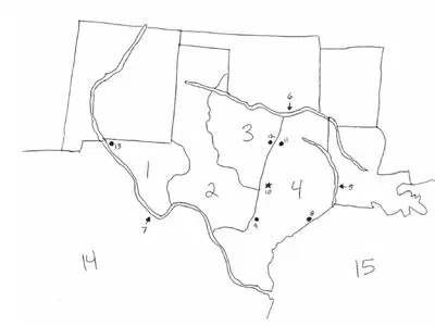
The river creating Texas' western border is ______________.
Rio Grande
Sabine River
Red River
Brazos River
The river creating Texas’ northern border is the ______________________________.
Rio Grande
Sabine River
Red River
Brazos River
All the rivers in Texas flow Southeast, toward the ___________________.
Atlantic Ocean
Pacific Ocean
Gulf of Mexico
Rio Grande
Which region is known for its oil and gas industry?
Mountains and Basins
North Central Plains
Great Plains
Coastal Plains
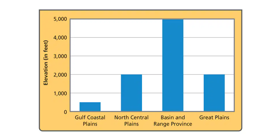
Which region has the highest elevation?
North Central Plains
Great Plains
Mountain and Basins
Coastal Plains
Which region has the most rainfall?
Mountains and Basins
Great Plains
Coastal Plains
North Central Plains
Which element on a map would you look at to determine the meaning of a symbol?
Title
Orientation / Compass Rose
Scale
Legend / Key


Which of the following is TRUE of all Native American groups in early Texas?
They almost destroyed their environment by using it up and moving on.
They adapted to and used their environment to meet their needs.
They ignored their environment, creating ways of meeting their needs without natural resources.
They used up all natural resources.
In which region did the Jumanos live?
Great Plains
Gulf Coastal Plain
Mountains and Basins region
Central Plains

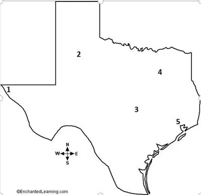
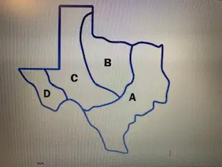
Which city is marked by the letter A?
Houston
Dallas
El Paso
Austin

Which city is marked by the letter B?
Houston
Dallas
Fort Worth
El Paso

In which Texas region is city E located?
Coastal
Mountains and Basins
North Central Plains
Great Plains

In which region will you find the natural landmark Palo Duro Canyon?
Mountains and Basins
Great Plains
North Central Plains
Coastal Plains
In which region is the Big Bend National Park located?
Great Plains
Coastal Plains
North Central Plains
Mountains and Basins
What do we mean when we say, “Native Americans had to adapt to their environment?”
All Native Americans moved to where the land was easy to farm.
Native Americans used resources around where they lived in order to survive
Sedentary Native Americans did not survive as long as Indians that were nomadic.
Which is the BEST example of Native Americans modifying their environment?
Plains culture Indians elected chiefs to lead the tribes
Caddo Indians used irrigation for their crops
Western Gulf Culture Indians traded goods with the Spanish


The dugout canoe helped
the Caddo farm.
the Karankawa fish.
the Comanche hunt.
the Jumano build.

Which of the following Indian groups lived in Region A?
Atakapan
Comanche
Jumano
Kiowa
Which of the following might explain why the first humans in North America shared similarities with early Asian peoples?
North America was once a part of Asia.
The first Americans migrated from Asia by crossing the land bridge Beringia.
The first Americans traded goods and ideas with Muslim traders in Asia.
Asia was easily accessible for North Americans after the ice age.
Akey feature that made Puebloan groups different than the other American Indian groups of Texas was their
nomadic way of life.
refusal to trade with outside groups.
practice of agriculture.
adobe structures.
Which farming group lived in the forests of East Texas and were part of the Mound Builders culture group?
Caddo
Coahuiltecan
Kiowa
Jumano
How many Texas regions did we learn about?
7
20
9
4

Which number on this map is matched with the CORRECT city?
1 - San Antonio
2 - Lubbock
4 - Austin
5 - El Paso

What country is labeled #14?
New Mexico
Brazil
Mexico
United States of America
An image on a map that stands for something else is called a
symbol.
key.
legend.
hemisphere.

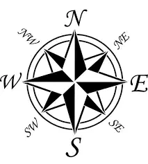
What is shown in the picture?
legend
inset map
compass rose
locator
A compass rose is described as
graphic of a picture that shows direction
key to the symbols used
a picture that represents something else
a type of flower used by Native Americans
Which of the following demonstrates one way the Jumano native peoples group adapted to their environment?
they built igloos for warmth in the winter
they were nomadic following their food source
they built permanent homes made of adobe bricks
they used dugout canoes to fish the Gulf
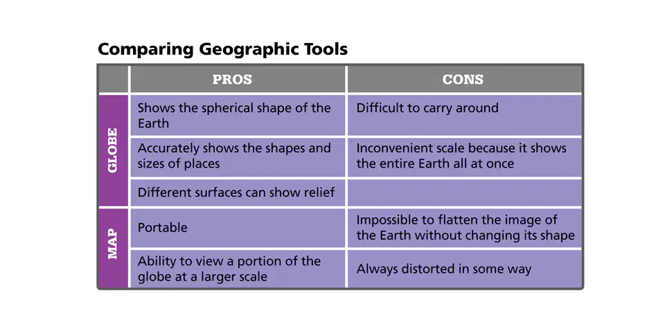
Which geographic tool would be more useful to determine the distance between Texas and Australia?


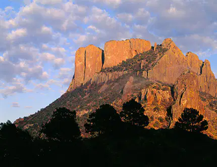
In which region of Texas is this landform most likely located?
the Great Plains
the Coastal Plains
the North Central Plains
the Mountains and Basins