
 Worksheets
7th Grade SS: 1st Semester FINALS Review / Study Guide
Total questions: 122
Worksheet time: 2hrs 47mins
What is the process of removing salt from ocean water
Desalination
Scarcity
Irrigation
Allocation
How much of the worlds fresh water is available in Southwest Asia?
5%
20%
5%
1%
What is the main consumer of water in Southwest Asia?
Agriculture
Pollution
Food
Cooking
Which river is the key water source of Israel and Jordan?
Suez Canal
Jordan River
Tigris River
Euphrates River
Which natural resource has caused many disputes in the Middle East?
Water
Food
Clothing
Bed
What water problems are Southwest Asia facing? (MORE THAN 1)
Pollution
unequal distribution
water shortages
not enough food
no jobs
How do farmers attempt to bring water to their fields?
building dams
stealing it
using irrigation
desalination
Irrigation is......
contamination of water
a supply of water to land or crops
process of taking salt out of seawater
farmers who focus on growing enough food for themselves
What is water pollution?
contamination of bodies of water
a supply of water to land
when soil loses its ability to hold water
when the desert spreads
Which country has built the worlds largest desalination plant?
Saudi Arabi
Turkey
Iraq
Iran
Which country has built over 22 dams with the Anatolia project?
Turkey
Iraq
Saudi Arabia
Syria
What is the process of removing salt from ocean water called?
scarcity
desalination
Irrigation
pollution
What is the main consumer of water in Southwest Asia?
People
Industries
Livestock
Agriculture
Less than _____ of the world's fresh water supply is available to Southwest Asia's population.
20%
10%
1%
50%
Which river is the key water source for Israel and Jordan?
Tigris River
Euphrates River
Nile River
Jordan River
Which natural resource has caused many disputes in the Middle East?
Water
Wood
Food
Uranium
What water problems is Southwest Asia facing? (Check all that apply.)
Pollution
Flooding
Unequal Distribution
Monsoons
Water shortages
The Tigris and Euphrates rivers flow through which countries? (Check all that apply.)
Syria
Turkey
Israel
Iraq
Jordan
Which country has built the world's largest desalination plant?
Saudi Arabia
Israel
Iraq
Syria
Which countries have fought military battles over water rights to the Jordan River? (Check all that apply.)
Turkey
Israel
Jordan
Iraq
What is Desalination?
An underground water pool
A process of removing salt from water
A process for adding salt to water
A process that pollutes water
Which is the Largest country in East Asia?
Taiwan
Japan
China
Mongolia
Which Country is an archipelago?
China
Mongolia
Taiwan
Japan
North or South Korea
an ENORMOUS mountain range north of India, that stretches across West China.
The Himalayan Mountains
The Appalachian Mountains
The Ural Mountains
The Andes Mountains
Which East Asia river has yellow-colored silt and is known as the muddiest river in the world?
Yangtze
Xiang
Huang He
Yellow Sea
The ____ is the longest river in Asia.
Yangtze
Huang He
Yalu
Mekong

Which river involves religious practices that involve human ashes to be dumped in the river in India?
Huang He River
Yangtze River
Ganges River
Yellow River

Which marks the Ganges River?
2
3
9
11

Physical feature "F" (Covering Nepal and forms the border between China and India)
Mt. Everest
Himalaya Mountains
Gobi Desert
Ganges River

What country is this? (yellow)
Pakistan
India
Bangladesh
Sri Lanka
Nepal
Which marks the Ganges River?
2
3
9
11

What physical features is #4?
Bay of Bengal
Deccan Plateau
Ganges Delta
Indian Ocean

What physical feature is #2?
Bay of Bengal
Indian Ocean
Indus River
Ganges Delta

What physical feature is #6?
Indian Ocean
Bay of Bengal
Indus River
Deccan Plateau

Asia's largest desert. It stretches across southern Mongolia & northern China.
Plateau of Tibet
Gobi Desert
Korean Peninsula
Himalayas

This peninsula juts from northeast China between the Yellow Sea and the Sea of Japan.
Plateau of Tibet
Gobi Desert
Korean Peninsula
Himalayas

This country lies south of Mongolia. The East China Sea and South China Seas border it.
China
Japan
Mongolia
Korea

This country consists of a long string of islands off the coast of East Asia.
China
Japan
Korea
Mongolia

This large body of water separates the continents of Europe and Africa.
Black Sea
Caspian Sea
Mediterranean Sea
Arabian Sea

This body of water lies southeast of the China.
Arabian Sea
Bay of Bengal
South China Sea
East China Sea

This body of water lies east of China.
Sea of Japan
Yellow Sea
East China Sea
South China Sea

This body of water lies between China and the Korean Peninsula.
Sea of Japan
Yellow Sea
East China Sea
South China Sea

This body of water lies between the Korean Peninsula and Japan.
Sea of Japan
Yellow Sea
East China Sea
South China Sea

This LARGE body of water is the deepest and largest in the world and lies east of the Asian continent.
Indian Ocean
Pacific Ocean

North Korea
Mongolia
Japan
South Korea

What country is shown by the number "5" on the map?
North Korea
South Korea
China
Japan

Match the description with the region
Sahel
seven major lakes
narrow band of semi-arid land
area with endemic plants and lots of wildlife
Kaapvall craton and wildlife reserves
Which description matches this region:
Savanna
birds, butterflies, and tons of endemic plants
grasslands, Serengeti, large mammal species
ergs, regs, hamadas, and oases
narrow band of semi-arid land, desertification
Which description matches this region:
Rainforest
birds, butterflies, driver ants, 1,100 endemic plant species
coral reefs, barrier islands, mangroves, elephant shrew
seven major lakes, Nile perch, cichlid, hippos
transition zone, desertification
What divides Africa in half?
prime meridian
tropic of cancer
equator
tropic of capricorn
During the Scramble for Africa, Africa was divided between...?
Europeans
Asians
Americans
Africans
What is Africa's largest river?
The Mississippi River
The Nile River
The Yellow River
The Congo River
What is the name of the large desert that covers most of northern Africa?
The Sahara Desert
The Mojave Desert
The Nile Desert
I don't know

Feature #4
Sahara Desert
Kalahari Desert
Sahel
Congo Basin

What is the highest peak in Africa?
Mt. Kilimanjaro
Mt. Everest
Himalayan Mountains
Rocky Mountains
Why is the population of the Sahara so low?
Too much water
Too much oil
Limited access to oil
Limited access to water

What number marks South Africa?
11
13
14
15
Why is there less farmable land in the Sahel region of Africa?
People moving into the area
Air pollution
Too much clean water
Desertification
Which statement about Deforestation is true?
Deforestation is good for the soil.
Deforestation is beneficial for the environment.
Deforestation is helpful to native animal species.
Deforestation can cause soil erosion.
What do members of a religious group have in common?
Share a belief in the same food
Share a belief in the same god
Live in the same state
Must speak the same language
What is a community of people who share a common culture, ancestry, customs, and language called?
Ethnic Group
Religious Group
Most Africans are either Christian or Muslim, but _______ religions still play a role in African culture.
Sacred
Shinto
Traditional
Holy
Which BEST describes how rivers are used in Africa?
Rivers are rarely used
Crocodile farming and hunting
Transportation, Agriculture, & Hydroelectric Power
Irrigation projects in the Rainforest
Why are most rain forests gone today?
Unchecked forest fires
Harsh drought and high winds
Diseases that attack the trees
Logging for industry, farming, and fuel
What is Africa's transition zone between desert and savanna called?
Sahel
Kalahari
Sahara
Tropical Rainforest
How does desertification impact the people living in the Sahel region?
Income from tourism
More people work in factories
Increased starvation and poverty
Decreased support from the United Nations
What are the two main religious groups in Africa?
Christians and Jews
Jews and Muslims
Jews and Hindus
Muslims and Christians
The majority of the Swahili people practice which religion?
Christianity
Islam

Which number correctly identifies the Sahara Desert?
18
17
19
16

Which number correctly identifies the Congo River/Rain Forest?
18
17
19
16

Which number correctly identifies the Savanna?
18
17
19
16

Which number correctly identifies the Sahel?
18
17
19
16
Water Pollution is caused by
Drought
Fertilizers and industrial waste
Farming
Water Pollution isn't an issue in Africa
Desertification is often a result of this other environmental issue
Acid Rain
Water Pollution
Deforestation
Air Pollution
Which is the Largest country in East Asia?
Taiwan
Japan
China
Mongolia
Which Country is an archipelago?
China
Mongolia
Taiwan
Japan
North or South Korea
an ENORMOUS mountain range north of India, that stretches across West China.
The Himalayan Mountains
The Appalachian Mountains
The Ural Mountains
The Andes Mountains
Which East Asia river has yellow-colored silt and is known as the muddiest river in the world?
Yangtze
Xiang
Huang He
Yellow Sea
The ____ is the longest river in Asia.
Yangtze
Huang He
Yalu
Mekong
Which river involves religious practices that involve human ashes to be dumped in the river in India?
Huang He River
Yangtze River
Ganges River
Yellow River
Which marks the Ganges River?
2
3
9
11
Physical feature "F" (Covering Nepal and forms the border between China and India)
Mt. Everest
Himalaya Mountains
Gobi Desert
Ganges River
What country is this? (yellow)
Pakistan
India
Bangladesh
Sri Lanka
Nepal
Which marks the Ganges River?
2
3
9
11
What physical features is #4?
Bay of Bengal
Deccan Plateau
Ganges Delta
Indian Ocean
What physical feature is #2?
Bay of Bengal
Indian Ocean
Indus River
Ganges Delta
What physical feature is #6?
Indian Ocean
Bay of Bengal
Indus River
Deccan Plateau
Asia's largest desert. It stretches across southern Mongolia & northern China.
Plateau of Tibet
Gobi Desert
Korean Peninsula
Himalayas
This peninsula juts from northeast China between the Yellow Sea and the Sea of Japan.
Plateau of Tibet
Gobi Desert
Korean Peninsula
Himalayas
This country lies south of Mongolia. The East China Sea and South China Seas border it.
China
Japan
Mongolia
Korea
This country consists of a long string of islands off the coast of East Asia.
China
Japan
Korea
Mongolia
This large body of water separates the continents of Europe and Africa.
Black Sea
Caspian Sea
Mediterranean Sea
Arabian Sea
This body of water lies southeast of the China.
Arabian Sea
Bay of Bengal
South China Sea
East China Sea
This body of water lies east of China.
Sea of Japan
Yellow Sea
East China Sea
South China Sea
This body of water lies between China and the Korean Peninsula.
Sea of Japan
Yellow Sea
East China Sea
South China Sea
This body of water lies between the Korean Peninsula and Japan.
Sea of Japan
Yellow Sea
East China Sea
South China Sea
This LARGE body of water is the deepest and largest in the world and lies east of the Asian continent.
Indian Ocean
Pacific Ocean
North Korea
Mongolia
Japan
South Korea
What country is shown by the number "5" on the map?
North Korea
South Korea
China
Japan
What is Africa's largest river?
The Mississippi River
The Nile River
The Yellow River
The Congo River
What is the name of the large desert that covers most of northern Africa?
The Sahara Desert
The Mojave Desert
The Nile Desert
I don't know
Feature #4
Sahara Desert
Kalahari Desert
Sahel
Congo Basin

Feature #1
Niger River
Nile River
Congo River
Danube River
What is the highest peak in Africa?
Mt. Kilimanjaro
Mt. Everest
Himalayan Mountains
Rocky Mountains
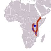
Why is the population of the Sahara so low?
Too much water
Too much oil
Limited access to oil
Limited access to water
What number marks South Africa?
11
13
14
15
What landform has rolling grassland and scattered trees?
Savanna
Nile River
Tropical Rain Forest
Niger River
What landform lies along the Atlantic Coast near the equator?
Sahel
Savanah
Niger River
Tropical Rain Forest
What mountain range is located in North Africa?
Mt. Kilimanjaro
Atlas Mountains
Sahel Mountains
The Alps

