
 Worksheets
7th Grade Winter Final Exam
Total questions: 42
Worksheet time: 27mins
I am a Shi'a Muslim who is part of an ethnic group who is very proud because our ancestors once ruled a large and grand empire. Our land is now called Iran but we still speak our ancient langauge of Farsi.
Arabs
Persians
Kurds
Sunnis
In the 2010s, the population of South Sudan suffered due to a famine in eastern Africa. Corruption and a civil war made it difficult for aid workers to help the people. What was the MOST LIKELY outcome of this situation?
The country maintained a high gross domestic product despite the famine.
Government investment in industrial development helped people find work.
Many people suffered because the government was too unstable to help them.
The population was able to maintain a high standard of living despite the famine.
Abdo is 12 years old and in 5th grade. The other boys in 5th grade are as young as 10 and as old as 16. His school has dirt floors and no doors. Abdo and the other students in his class must learn their lessons without the internet or textbooks. In Abdo's country the government spends most of its money (revenue) fighting the rebels instead of education, medicine, and food. The lack of educational resources in Abdo's country is an impact of...
famine and drought
HIV/AIDS
an unstable government
ethnic conflict
Having characteristics of two types of economic systems.
Command
Market
Mixed
Traditional
Which key figure's birth inspired the creation of the Christian religion?
Jesus
Siddhartha Gautama
Moses
In Kenya's cities, the literacy rate is roughly 90%. In rural Kenya, the literacy rate drops to under 50%. What does this say about the standard of living in Kenya's rural areas?
The standard of living is much lower in rural Kenya than in the urban areas.
Rural areas have a much simpler, carefree quality of life.
Access to education and healthcare in rural areas is easier because there are less people.
The standard of living is much higher in rural Kenya than in the urban areas.
Which of the following could help to prevent the sread of AIDS?
Migrating to big cities
Education and prevention
Having less children
Investing in capital goods
Every year more than one million Africans die of what?
Cancer
Zika Virus
AIDS
Ebola
When a country's government is unstable, it
provides access to education
finds solution to poverty and famine
cannot meet the needs of its people
offers adequate food, clothing, and shelter to citizens
The two predominate forms of democratic governments are parliamentary and
(a)

Which numeral marks the location the Kalahari Desert, which covers parts of Botswana and Namibia?
I
II
III
IV
The Atlas Mountains border the Sahara and separate it from the coastline. Based on this information, which numeral marks the location of the Atlas Mountains?
I
II
III
IV

Based on the map, which statement is most likely correct?
Turkey and Saudi Arabia often have disputes over the use of freshwater in the Persian Gulf.
Iraq and Oman often have disputes over the use of freshwater from the Tigris and Euphrates Rivers.
Turkey, Syria, and Iraq often have disputes over the use of freshwater from the Tigris and Euphrates Rivers.
Saudi Arabia, Iran, and the United Arab Emirates often have disputes over the use of freshwater in the Persian Gulf.
What is the term for a system of acquiring colonies to provide raw materials for a stronger colony?
Nationalism
Imperialism
Socialism
Patriotism
Which statement best describes the "Scramble for Africa"?
Asian nations took control of almost all African territory
European nations took control of almost all African territory
European nations gave back control of almost all African territory
African nations gave back control of almost all European territory
Why was the end of the 19th century know as the "Age of Imperialism"?
African countries aggressively expanded their empires in United States
European countries aggressively expanded their empires in Asia and Europe
African countries aggressively expanded their empires in Asia and Africa
European countries aggressively expanded their empires in Asia and Africa

Which African region's environment has been damaged the MOST by the logging industry and commercial farming?
region 1
region 2
region 3
region 4

This map shows a river that flows through eleven African countries and is the longest river in the world. Which river is shown in the map?
the Zambezi River
the Congo River
the Niger River
the Nile River

The map shows the location of the largest desert in the world, which covers about a third of the continent of Africa. Which desert is highlighted in this map?
the Kalahari
the Arabian
the Sinai
the Sahara

What rivers are shown on this map?
the Amazon and Jordan Rivers
the Danube and Rhine Rivers
the Nile and Congo Rivers
the Tigris and Euphrates River
Which two countries had the GREATEST number of colonies in Africa in the late 1800s?
China and Japan
Spain and Portugal
Great Britain and France
Great Britain and the United States
What region of the world became the MAIN focus of imperialistic powers during the Age of Imperialism?
Africa
Asia
the Caribbean
the South Pacific
After Mandela became president of South Africa, former President F. W. de Klerk
Organized a political opposition party.
Became the nation's deputy president.
Became an ambassador for racial equality.
Attempted to seize power in a military takeover.
During the 1990s, international pressure for a regime change in South Africa took the form of
military invasion
trade embargoes
targeted air strikes
peacekeeping missions
Which of these African nations produces the MOST crude oil on an annual basis?
South Sudan
Congo
Sudan
Nigeria
Emphasizing which economic practice MOST helps African economies benefit from international trade?
specialization
lowering inflation rates
raising interest rates
generalization
From 2010 to 2015, private sector growth in Nigeria was hindered by which of the following?
structural adjustment policies
low fiscal expenditures
government corruption
International Monetary Fund loans

Look at the southern part of Southwest Asia on the maps. The southern interior is called the Rub' al-Khali, or "Empty Quarter" because it is
a mountainous, sparsely inhabited area.
a hot, arid, largely uninhabited desert.
an uninhabited area where rivers meet.
a largely uninhabited forested area.
The Torah is a sacred text of which religion?
Islam
Shintoism
Buddhism
Judaism
The Quran is a sacred text of which religion?
Christianity
Islam
Buddhism
Judaism
Which of the following individuals is considered to be the founder of Islam?
Jesus
Muhammad
Abraham
Siddharta

Which of the following countries is located in Central Africa?
Democratic Republic of the Congo
Egypt
Kenya
Nigeria
Which of the following countries is located in Western Africa?
Democratic Republic of the Congo
Egypt
Kenya
Nigeria
Which of the following countries is located in Eastern Africa?
Democratic Republic of the Congo
Egypt
Kenya
Nigeria
Which of the following countries is located in Northern Africa?
Democratic Republic of the Congo
Egypt
Kenya
Nigeria

Which two countries are highlighted on this map?
Niger and Nigeria
Kenya and Uganda
Congo and DR Congo
Sudan and South Sudan

Which of the following is the largest mountain in Africa?
Kilimanjaro
Victoria
Nile
Atlas
Which African region has been negatively affected by commercial logging, excessive fuel wood consumption, and slash and burn farming techniques?
Savanna
Sahel
Sahara
Tropical Rainforest

The area indicated with the red arrow has a very low population density because it
is dominated by desert.
floods annually.
is prone to outbreaks of disease.
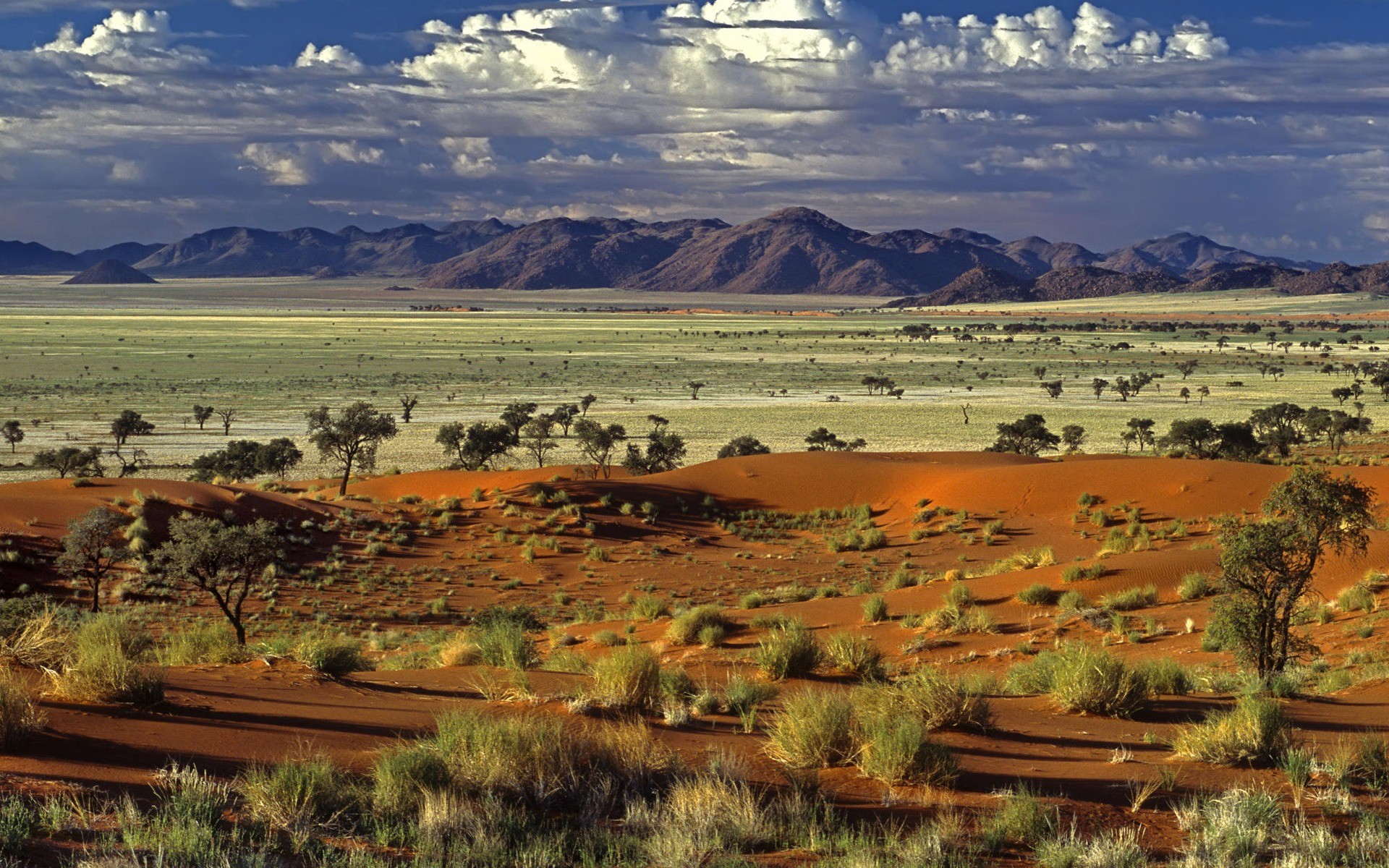
What exactly are savannas?
area of high mostly flatland
tropical grasslands dotted with small trees and shrubs
forest that grow along the equator with dense tress and plants

