
 Worksheets
Geography Test Review
Total questions: 68
Worksheet time: 38mins
There are __basic elements of a map.
Two
Five
Six
Help in calculating the distance between two places on the map.
Title
North line
Scale
Explains signs ,symbols and colours used In the map.
Legend or key
Title
Grid
Network of latitudes and longitudes on a map.
Scale
Equator
Grid system.
The 0 degree longitude is known as ___.
Tropics
Heat zone
Prime Meridian.
A ___________ tells the reader what the map is illustrating.
title
symbols
labels
colors
On a compass rose, N, S, E, W are called the _____________
cardinal directions
intermediate directions
latitude
longitude

What type of map is this?
Physical
Political
Thematic

This map is showing the major cities in the United States. What type of map is this?
Political
Physical
Thematic

What map element is circled here?
Title
Compass
Scale
Key/legend

What map element is circled here?
Scale
Title
Key/legend
Compass rose

What is this symbol?
scale
key
compass rose
map

What are the 4 cardinal direction ?
North- East - South - West
Up - Right - Down - Left
sun - fire - wind - Sea
big - small - fat - thin
the Intermediate Directions?
Southwest
Piper football field is located north of Piper Middle School. This is an example of which type of location
relative location
absolute location

A natural elevation of land higher than a hill
hill
mountain
plateau
plain
An elevated flatland
plateau
mountain
hill
valley

A fairly large natural stream of water
River
Gulf
Ocean
Sea

An area of land almost completely surrounded by water (usually surrounded on 3 sides)
island
isthmus
peninsula
city
What is another name for a city?
rural area
urban area
suburban area
Sparsely populated areas such as the country side
Urban areas
Rural areas
Suburbs
Urbanization
Why would an area be sparsely populated?
lack of natural resources
land is covered with ice
land cannot be developed
all of the above
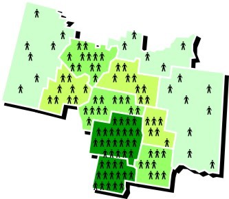
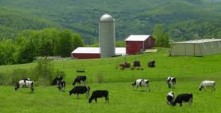

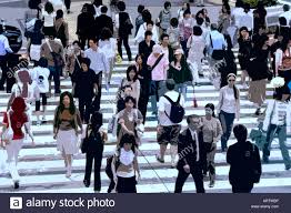
Which community would have the most people?
Suburban
Rural
Urban
What is the main characteristic of a desert?
Sand
Lack of rain
Large amounts of plants
Cactus

an area that receives less than 25cm of rain per year
tundra
taiga
alpine
desert

extremely cold and dry ecosystem
desert
tundra
forest
ocean

Explains how people, ideas & animals move from one place to another.
Place
Location
Movement
Human-Environment Interaction
Describes the CHARACTERISTICS of a location.
Place
H. E. I.
Movement
Region
A famous place is the Grand Canyon, known for its steep rock walls that were carved by the Colorado River.
Region
H. E. I.
Movement
Place
Provides a way of locating places. Absolute location is the exact point where a place is located, such as GPS (Global Positioning System) coordinates.
Location
Movement
Place
Region
Explains how people affect the environment & how the environment affects people.
Movement
Human-Environment Interaction
Place
Region

This photo best represents...
Movement
Region
Human Environment Interaction
People build dams to change the flow of rivers.
H. E. I.
Location
Region
Place

This photo best represents...
Human-Environment Interaction
Movement
Region
Location
The "P" in PEGS stand for ...
Practice
Political
Primary
Perfect
The "E" in PEGS stand for ...
Ethernet
Environment
Equator
Economic
The "G" in PEGS stands for ...
Geography
Global
Gravity
Grades
The "S" in PEGS stands for ...
Slavery
Social
San Antonio
Splendid

The Supreme Court of the United States is located in Washington, DC. Courts are a part of
Political Systems
Economic Systems
Geographic Systems
Social Systems

The Rio Grande River separates Texas from Mexico.
Political
Geographic
Economic
Social


Political
Economic
Geographic
Social

Political
Economic
Geographic
Social

Political
Economic
Geographic
Social

Governor of Texas Greg Abbott
Political
Economic
Geographic
Social
This category includes money and jobs.
Political
Economic
Geographic
Social

