
 Worksheets
Mr. Neff's Geography Review
Total questions: 60
Worksheet time: 45mins
The study of Earth's land and water; its physical features, processes and its people.
lines of longitud
equator
geography
prime meridian

The 7 continents are:
Asia, Africa, Antarctica, Australia, Europe, North America, and Canada
Asia, Africa, Antarctica, Aruba, Europe, North America and South America
Asia, Africa, Antarctica, Australia, Europe, Netherlands and South America
Asia, Africa, Antarctica, Australia, Europe, North America and South America

Which of these are not one of the world's five oceans?
Atlantic
Mediterranean
Indian
Pacific
What is the largest and deepest oceans in the world?
Atlantic
Pacific
Artic
Southern

The countries of Canada, the United States and Mexico can be found on which continent?
Asia
Africa
North America
Europe

What is the name of this line at 0 degrees latitude?
Prime Meridian
Equator
North Pole
South Pole
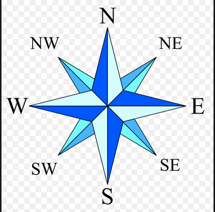


Relative location is where a place is in relation to other places. For example...
1234 Oak Street, 92108
The Great Wall is located near Beijing in northern China.
1600 Pennsylvania Avenue NW, Washington, D.C., DC 20500
90° N Latitude and 20° W Longitude
Explains how people, ideas & animals move from one place to another.
Place
Location
Movement
Human-Environment Interaction
Explains how people affect the environment & how the environment affects people.
Movement
Human-Environment Interaction
Place
Region

This photo best represents...
Movement
Location
Region

Type of map that shows countries, cities, states
Physical
Political
Climate
Atlas

The name of the imaginary line at 0 degrees latitude is the ___________
Prime Meridian
Tropic of Cancer
Equator
Main Meridian

The globe can be divided into __________ hemispheres.
2
4
6
8

Which of the following would be most likely shown on a political map?
Deserts
Mountains
Countries and capitals
Vegetation

What continent do you live on?
South America
North America
Europe
Asia
It's a large body of saltwater that covers the Earth's surface.
Continent
Ocean
Compass Rose
Equator
It's a large landmass that covers the Earth's surface. (there are seven)
Continent
Ocean
Compass Rose
Equator
It shows the symbols on a map.
Continent
legend
Compass Rose
cartography
It provies the actual distances of a map.
map scale
legend
Compass Rose
cartography
A map that shows LANDMARKS such as mountains, rivers, lakes and other geographic features is called...
physical map
political map
weather map
grid map
How many continents are there?
9
6
5
7

This is a large area of flat land.
Island
Plain
Valley
This is a large body of salt water and covers 3/4 of the earth's surface.
Island
River
Ocean
Pond

a long piece of land surrounded by water on three sides
strait
island
peninsula
archipelago
a body of land completely surrounded by water
peninsula
island
bay
gulf
a natural stream of water larger than a brook or creek that flows into an ocean or lake
gulf
river
bay
archipelago


Which part of our planet receives the most direct sunlight?
near the poles.
near the equator
the bottom half
the core
Describe the climate for the polar zone.
Very cold
Very hot
Different seasons (hot, cold, warm, cool)

What continent is this?
Eurasia
North America
South America
Australia

What continent is this?
Eurasia
North America
South America
Australia

What continent is this?
Eurasia
North America
South America
Australia

What continent is this?
Africa
South America
Australia
Antarctica

What continent is this?
Africa
South America
Australia
Eurasia
Where do people speak Spanish and Portuguese?
In South America
In Africa
In Oceania
In North America
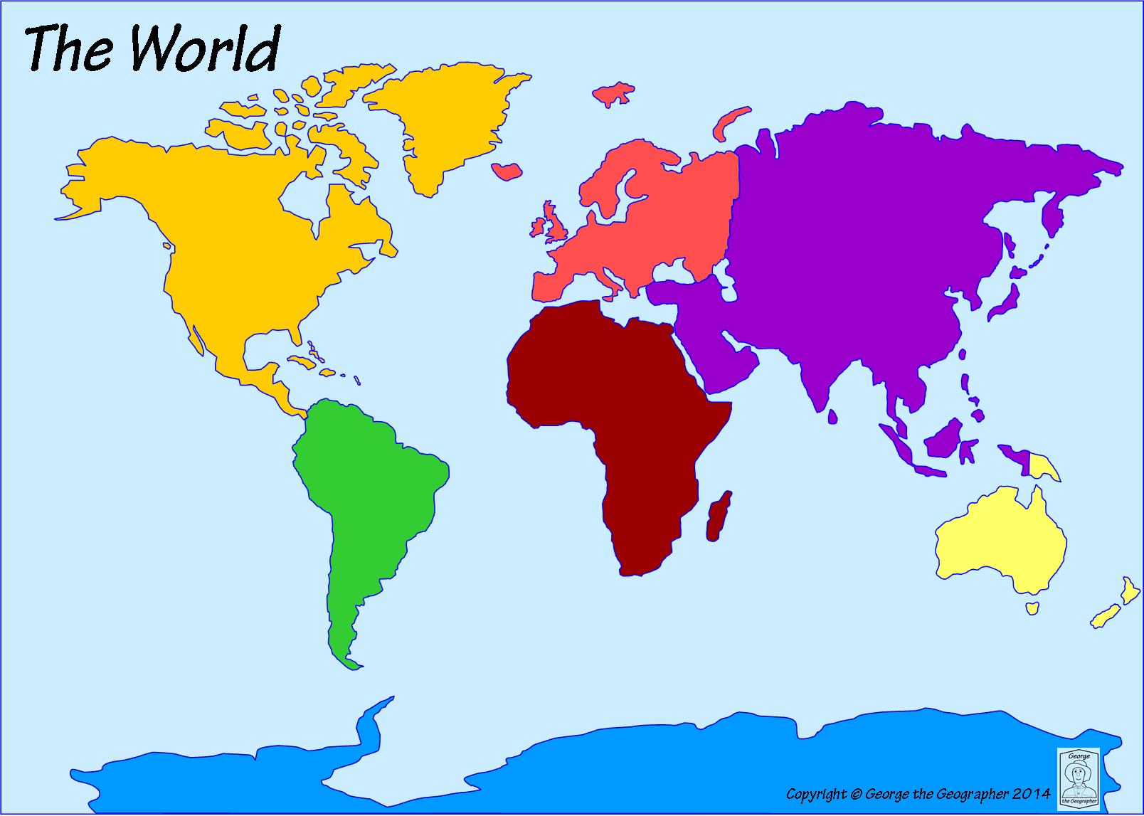
What continent is directly south of North America?
Australia
Europe
Africa
South America

This continent includes countries such as France, Germany, and Italy
Europe
Asia
South America

What continent is this that includes Brazil, Colombia, and Argentia?
Europe
South America
Australia

On this continent you might find a lot of penguins and it's very cold!
North America
Asia
Antarctica

This continent is an island, country, and continent where you might find kangaroos!
Botswana
Australia
The planet Mars

This large continent includes Egypt, The Congo, and the Great Sahara Desert!
Africa
Sweden
Canada

This is the largest ocean in the world!
Hudson Bay
The Mediterranean Sea
The Pacific Ocean

This ocean is between North America and Europe (also between South America and Africa)!
The Atlantic Ocean
The Indian Ocean
The Mississippi River

This Ocean is at the bottom of the world!
The Western Ocean
The Southern Ocean
The Eastern Ocean

This ocean is south of Asia and east of Africa
The Saturn Ocean
The Gulf of Mexico
The Indian Ocean

This ocean is at the top of the world!
The Antarctic Ocean
The Arctic Ocean
The Colorado River

