
 Worksheets
Unit 3 South America Physical Features Test Review (50 ?s)
Total questions: 50
Worksheet time: 28mins

Which feature is shaded in dark here?
Sierra Madre Mountains
Andes Mountains
Amazon Rain Forest
Amazon River

Which feature is seen here?
Andes Mountains
Gulf of Mexico
Panama Canal
Atacama Desert

What area is seen in green here?
Andes Mountains
Gulf of Mexico
Amazon Rain Forest
Panama Canal

Which feature is in the darker shading here?
Caribbean Sea
Amazon River
Panama Canal
Pacific Ocean

River A:
Orinoco River
Amazon River
Parana River
Missouri River
Feature B:
Andes Mountains
Sierra Madre Mountains
Patagonia
Atacama
Feature C:
Andes Mountains
Sierra Madre Mountains
Patagonia
Atacama
Feature D:
Llanos
Pampas
Patagonia
Atacama
Feature E:
Llanos
Pampas
Patagonia
Atacama
Feature F:
Llanos
Atacama
Patagonia
Amazon Basin / Rainforest
River G:
Rio Bravo
Orinoco River
Parana River
Amazon River
Feature H:
Brazilian Highlands
Guiana Highlands
Andes Mountains
Patagonia
Feature I:
LLanos
Guiana Highlands
Pampas
Patagonia
Body of Water- X:
Pacific Ocean
Atlantic Ocean
Arctic Ocean
Caribbean Sea
Body of Water- Y:
Pacific Ocean
Atlantic Ocean
Arctic Ocean
Caribbean Sea
Body of Water- Z:
Pacific Ocean
Atlantic Ocean
Arctic Ocean
Caribbean Sea
Between 2000 and 2020, the size of the Amazon Rainforest has....
Doubled
Tripled
Decreased
Stabilized
What is the longest mountain range on the planet?
Andes
Himalayas
Apennines
Rocky Mountains
The driest desert is the..
Sahara
Mojave
Gobi
Atacama

What is the following Latin America Physical Feature?
Caribbean Sea
Pampas
Sierra Madre Mountains
Andes Mountains

Where are Galapagos Islands?
Ecuador
USA
UK
Vietnam
The Galapagos are very rich in:
Flora and fauna
salt and sea
people and culture
Fruits and cocoa
An area of land that is higher than the rest of the ground but flat on top is called a ______________
mountain
hill
canyon
plateau

What lake is marked below? (the blue speck to the left of the red mark)
Lake Maracaibo
Lake Michigan
Lake Superior
Lake Titicaca
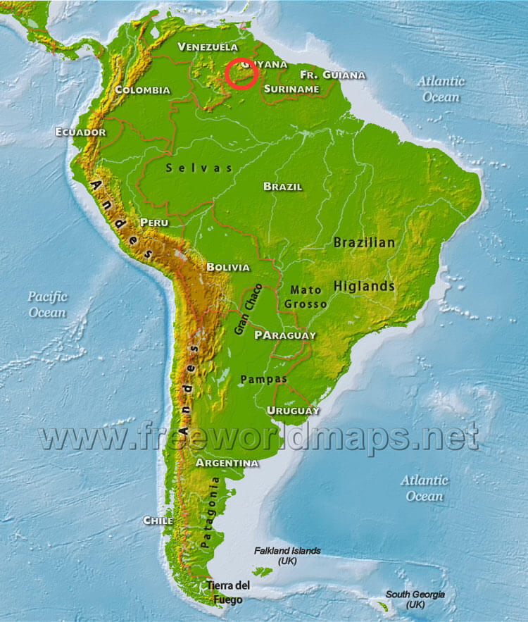
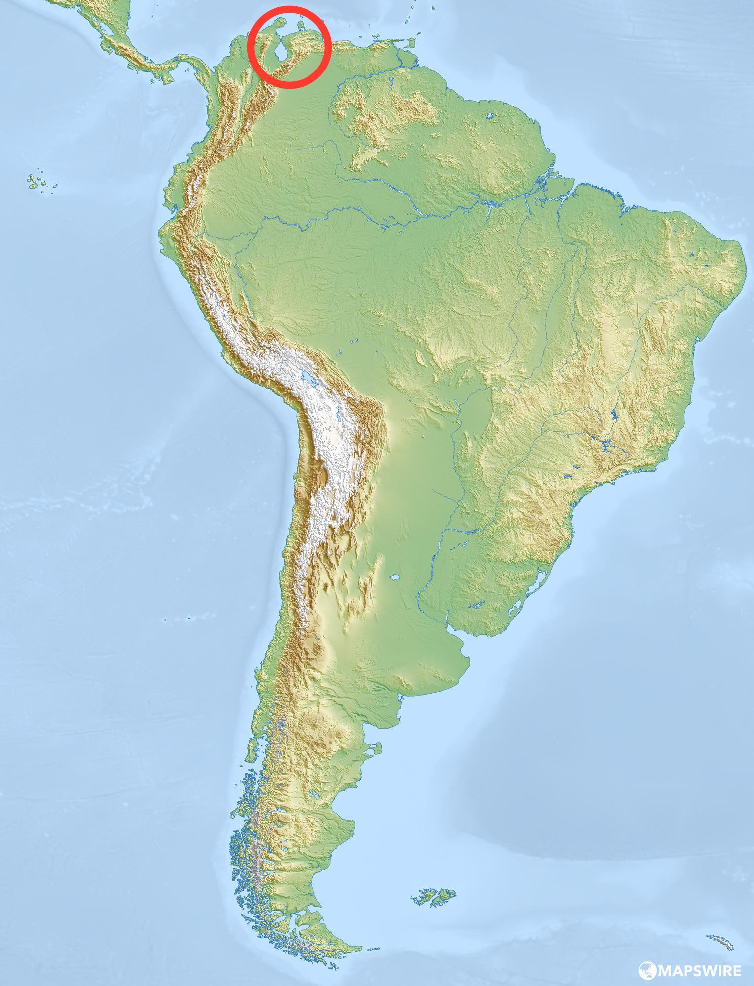

What river is located along the blue line?
Mississippi River
Cauca river
Magdalena River
Orinoco River

According to the compass rose what physical feature is located south of the Orinoco River?
Lake Maracaibo
Caribbean Sea
Pacific Ocean
Guiana Highlands

According to the compass rose what major physical feature is located west of the Guiana Highlands?
Llanos
Andes
Rocky Mountians
Lake Maracaibo

According to the compass rose, what physical feature is located directly east from the Pacific Ocean?
Caribbean Sea
Atlantic Ocean
Lake Maracaibo
Andes Mountains

According to the compass rose what body of water is located north of Llanos
Atlantic Ocean
Pacific Ocean
Caribbean Sea
Indian Ocean
The tropical winds running that blow from east to west near the Equator are called the
subtropical westerlies
polar westerlies
trade winds
polar winds
Crop sold for money at market
Columbian Exchange
Cash
Crop
Colony
Triangle Trade
The Eastern Highlands plunge to the Atlantic Ocean, forming a steep slope called an ___________
Escarpment
Isthmus
Escargo
Plateau
In Patagonia the climates are cooler, the __________soil is good for agriculture, and natural resources are concentrated here.
Barren
Plentiful
Moist
Volcanic
The Andes consist of ____________, groups of several mountain ranges that run parallel to one another
Plateaus
Caudillos
Cordilleras
Escarpments
What are South Americas two largest lakes?
Chapala,Texcoco
Maracaibo,Titicaca
Chapala,Huron
Nicaragua, Chapala
Mines in Colombia have been producing the world’s finest ________ for more than 1,000 years
Emeralds
Diamonds
Jade
Amber
The Andes encircle the _______, which means “high plain.” The altiplano is an area that includes southeastern Peru and western Bolivia.
Mesa Central
Altiplano
Escarpment
Mesa del Norte
Most people live on or near the _______ and along major rivers of the continent. These coastal regions offer favorable climates, fertile land, and access to transportation.
Mountains
Plains
Coasts
Volcanoes
Rainforests harbor at least _______ of all animal and plant species on Earth.
One Third
Three Quarters
One Fourth
Half
A semi-enclosed area where fresh water from a river meets salty water from the sea.
Watershed
Groundwater
Estuary
Ocean


Which of the following is an INCORRECT statement about El Niño and La Niña?
Both occur every 2-7 years
Both occur in the Atlantic Ocean
El Nino is a warming and La Nina is a cooling of the Pacific Ocean
Neither are considered "storms"
Which best describes El Nino?
The water in the Pacific Ocean gets warmer than normal and causes fewer hurricanes to form
The water in the Pacific Ocean gets colder than normal and causes more hurricanes to form.
The water in the Pacific Ocean gets colder than normal, and the flow of the jet stream is disrupted
The water in the Pacific Ocean gets warmer than normal, and the flow of the jet stream is disrupted.
What causes La Nina?
cooling of water in the Atlantic Ocean off the coast of South America
cooling water off the Atlantic coast of the US
cooling water in the Pacific Ocean off the coast of South America
warm water in the Pacific Ocean off the coast of South America

