
 Worksheets
AP Human Geo Unit 4 Review
Total questions: 62
Worksheet time: 1hrs 2mins

What Is a Nation?
A group of people with a common identity through shared cultural traits such as language, religion, and or ethnicity.
The boarders of a nation that match the borders of the state
Nations of people without a state to occupy
A nation of people that live in more than one state

What Is a Nation-State?
A group of people with a common identity through shared cultural traits such as language, religion, and or ethnicity
The boarders of a nation match the borders of the state
Nations of people without a state to occupy
A nation of people that live in more than one state

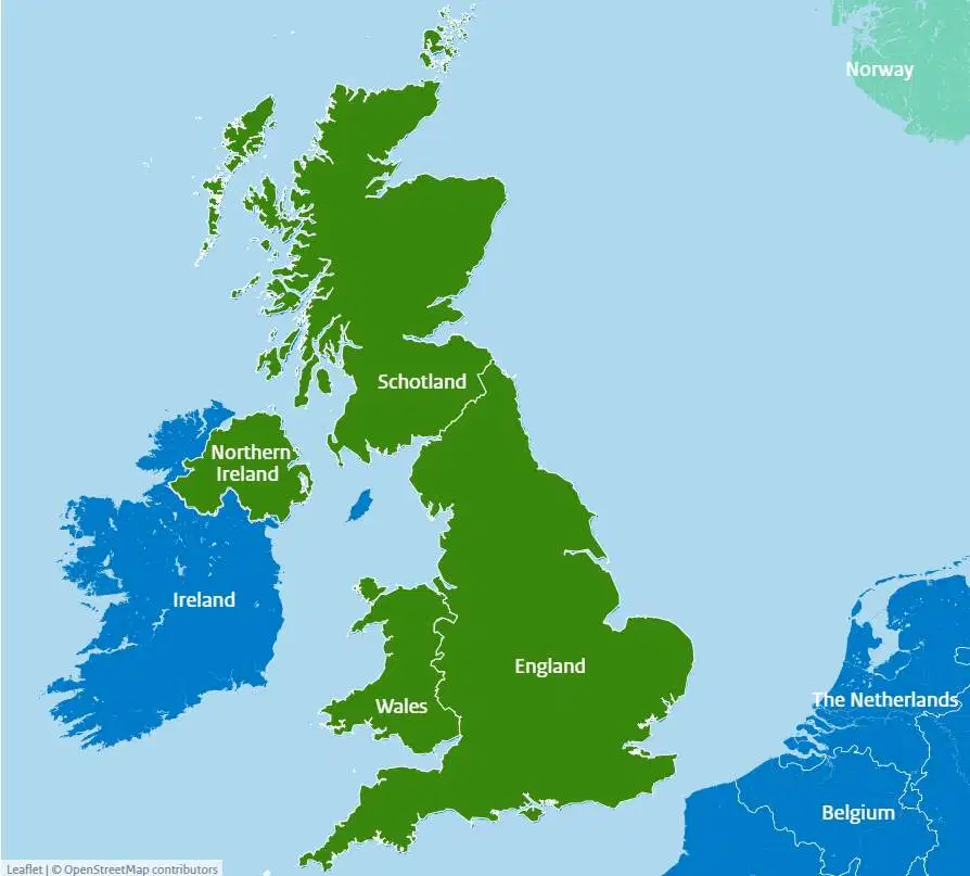
Based on the map, which of the following can be identified as a true statement about Northern Ireland?
It is united with the rest of the island to form a sovereign nation-state.
It forms its own sovereign nation-state predominately made up of the Irish ethnic group.
It is a frontier that is not formally part of a state, but the United Kingdom claims the area.
It is physically separate from the rest of the United Kingdom, a multinational state.

What Is a Stateless Nation?
A group of people with a common identity through shared cultural traits such as language, religion, and or ethnicity
The boarders of a nation match the borders of the state
Nations of people without a state to occupy
A nation of people that live in more than one state

Which of the following terms identifies the type of regions shown in the dark gray-shaded areas on the map?
Functional regions
Urban regions
Semiautonomous regions
Vernacular regions

What Is a Multistate Nation?
A group of people with a common identity through shared cultural traits such as language, religion, and or ethnicity
The boarders of a nation match the borders of the state
Nations of people without a state to occupy
A nation of people that live in more than one state

Owing to their localized geography or their locations on islands or peninsulas, many small political entities such as those labeled on the political map of the world can be identified as
federal states
autonomous republics
multistate nations
nation-states
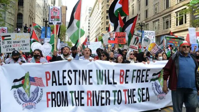
What are some examples of Stateless Nations?
The Kurds in South Asia
The Basaque in Spain
Palestinians in Israel
Germans in Germany

What is a Multinational State?
A country with various ethnicities and cultures within its borders.
Nation of people without a state to occupy
A Nation of people that live in more than one state
A group of people with a common identity through shared cultural traits such as language, religion, ethnicity, and heritage
Some territories within the Russian Federation are characterized by concentrated populations of ethnic groups and these areas function as autonomous republics. Which of the following best explains the political relationship between the autonomous republics and the central government of Russia?
The central government of Russia exerts complete control over the autonomous republics to counteract devolutionary pressures.
The autonomous republics are able to function independently from the central government because of an abundance of natural resources.
Russia is a multistate nation characterized by contested regional boundaries.
The autonomous republics provide ethnic groups with some political control over their homelands while preserving Russia’s territorial integrity.
What are some examples of Multinational States?
The United States
Russia
Iraq
Japan
Which of the following best explains the effect of French language and culture on the federal state of Canada’s political power?
French language and culture act as a centripetal force throughout Canada as the majority of Canadians have English as a first language and the government uses both languages in official communications.
As an expression of political power, the Canadian federal government restricts French language and culture from media and government proceedings.
French language and culture act as centripetal forces and unify all of Canada’s people and government into a single nation.
French language and culture act as a centrifugal force in Canada because independence movements in Quebec have attempted to secede the province from Canada.
Which of the following explains why Korea and Vietnam were viewed as shatterbelts during the Cold War?
Korea and Vietnam were politically controlled by regional powers.
Korea and Vietnam kept two political adversaries geographically separated.
Korea and Vietnam fragmented into new states due to internal tensions.
Korea and Vietnam experienced conflict due to a dispute between global powers.

What's a Autonomous Region?
A location within a state that is given authority to govern interpedently from the nation government.
The control and influence over a specific geographer space
A location within a sate that is given SOME authority to govern interpedently from the nation government,
What are some examples of Autonomous Region?
Texas In the United States
Madrid In Spain
Berlin In Germany
Sydney in Australia
What's a Semi-Autonomous Region?
A location within a state that is given authority to govern interpedently from the nation government.
The control and influence over a specific geographer space
A location within a sate that is given SOME authority to govern interpedently from the nation government,
Which of the following describes an example of a consequent boundary?
The Berlin Wall between East and West Germany no longer exists, but the location is still evident.
European powers divided Africa at the Berlin Conference and drew boundaries across the continent.
The United States–Canadian boundary was set at the 49th parallel by a treaty before the area was settled.
Canada created the province of Nunavut to provide greater autonomy for the First Nations.

What is Territorially?
A location within a state that is given authority to govern interpedently from the nation government.
The control and influence over a specific geographer space
A location within a sate that is given SOME authority to govern interpedently from the nation government,

What is Political Power?
Control over people, land and resources
When people control land and resources
The former international border between East Germany and West Germany is best described as
an open border
a demilitarized zone
a relict boundary
an antecedent boundary
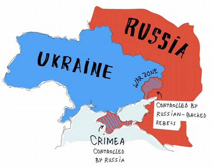
What are Shatterbelts?
A region that is geographically located between states with overlapping territoriality and political power
A strategic strait of canal which is narrow, hard to pass through and has competition for use
Borders that are established before there has been major settlement by people in a territory
Borders that are drawn in areas that have been settled by people, typically due to changes that have occurred over time
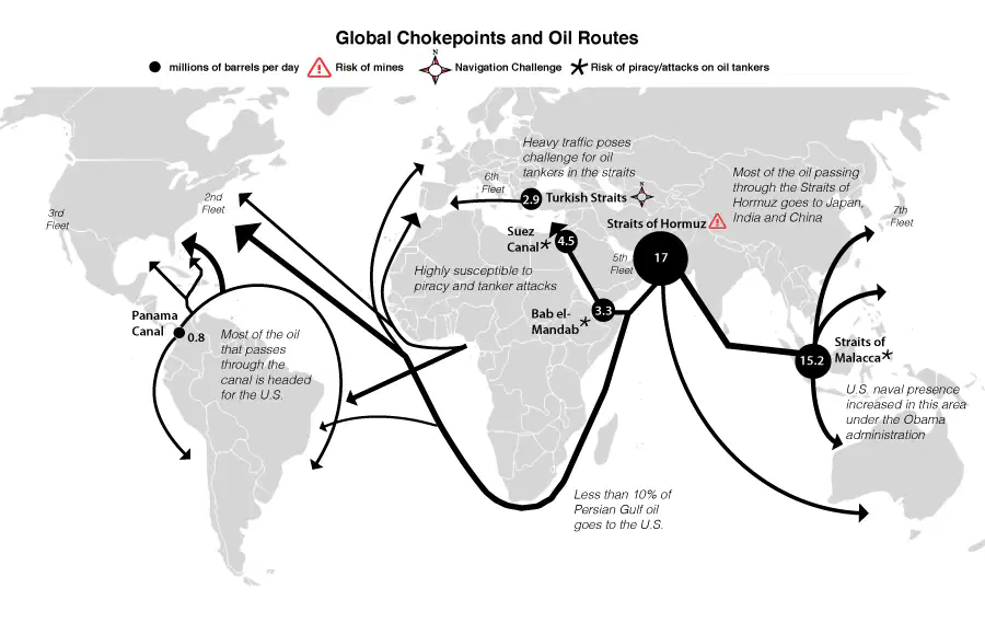
True or False: A choke point is a strategic strait or canal which is narrow, hard to pass through and has competition for use
True
False
Which of the following is an example of a superimposed boundary?
The geometric boundary between the United States and Canada
The border of the European Union
The Pyrenees Mountains between France and Spain
The geometric boundary between Iraq and Saudi Arabia

Based on the information in the map, what is the most likely outcome of the possible establishment of an independent Kurdistan for the Kurdish people?
The state of Turkey, seeking to connect areas with a substantial Kurdish population into an independent state, might take action against neighboring states.
The Kurdish people, seeking a state of their own with a majority Kurdish population, might secede from or rebel against the states labeled on the map.
The Kurdish people would have to migrate into a single country to gain a population majority and would struggle for control of the government.
In areas with a Kurdish majority population, Kurdish people are politically active among Turks, Iranians, Iraqis, and Syrians and would be able to win an election on a national vote to secede.
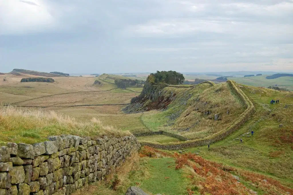
What is a Antecedent Boundary?
Borders that are established before there has been major settlement by people in a territory
Borders that are drawn in areas that have been settled by people, typically due to changes that have occurred over time
Type of Subsequent boundary that takes into account the existing cultural distribution of the people in the territory and redevelops boundary lines to align with cultural boundaries
Border that is drawn over existing and accepted borders by a outside force
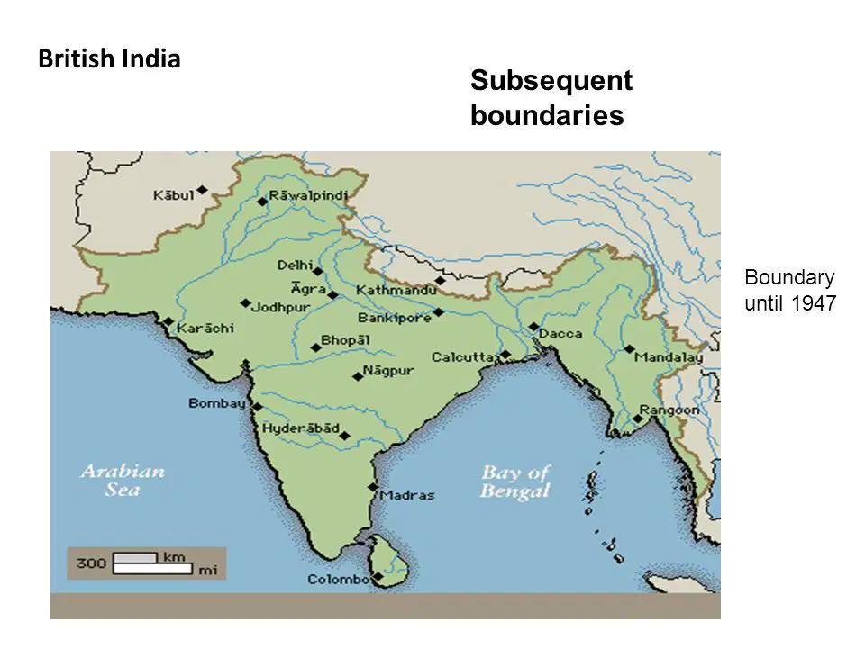
What is a Subsequent Boundary?
Borders that are established before there has been major settlement by people in a territory
Borders that are drawn in areas that have been settled by people, typically due to changes that have occurred over time
Type of Subsequent boundary that takes into account the existing cultural distribution of the people in the territory and redevelops boundary lines to align with cultural boundaries
Border that is drawn over existing and accepted borders by a outside force
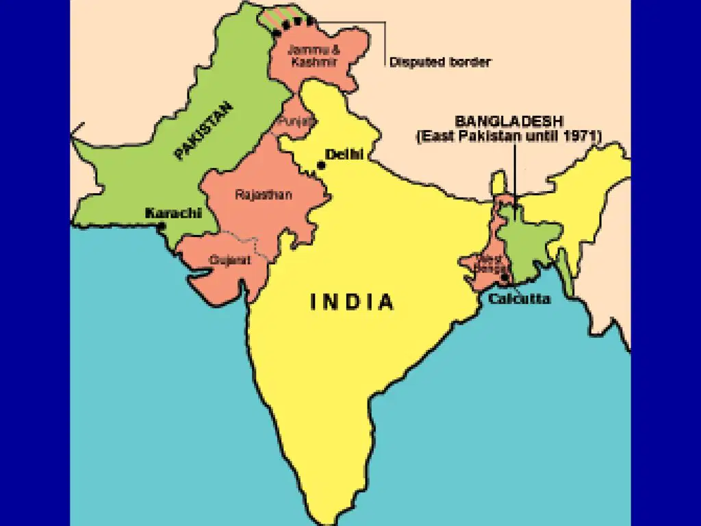
What is a Consequent Boundary?
Borders that are established before there has been major settlement by people in a territory
Borders that are drawn in areas that have been settled by people, typically due to changes that have occurred over time
Type of Subsequent boundary that takes into account the existing cultural distribution of the people in the territory and redevelops boundary lines to align with cultural boundaries
Border that is drawn over existing and accepted borders by a outside force
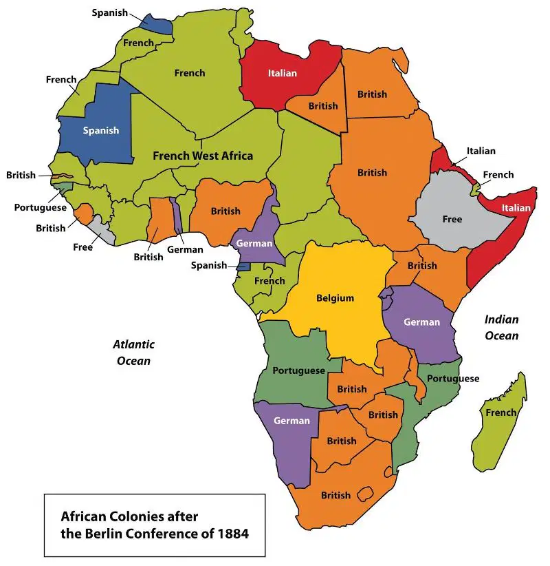
What is a Superimposed Boundary?
Borders that are established before there has been major settlement by people in a territory
Borders that are drawn in areas that have been settled by people, typically due to changes that have occurred over time
Type of Subsequent boundary that takes into account the existing cultural distribution of the people in the territory and redevelops boundary lines to align with cultural boundaries
Border that is drawn over existing and accepted borders by a outside force
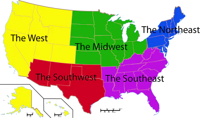
What is a Geometric Boundary?
Borders that are established on straight lines of latitude and longitude instead of physical or cultural boundaries
Borders that are drawn in areas that have been settled by people, typically due to changes that have occurred over time
Type of Subsequent boundary that takes into account the existing cultural distribution of the people in the territory and redevelops boundary lines to align with cultural boundaries
Border that is drawn over existing and accepted borders by a outside force

What is a Relic Boundary?
Borders that are established on straight lines of latitude and longitude instead of physical or cultural boundaries
Established borders which do not exist anymore
Type of Subsequent boundary that takes into account the existing cultural distribution of the people in the territory and redevelops boundary lines to align with cultural boundaries
Border that is drawn over existing and accepted borders by a outside force
The Berlin Conference established the borders of North African countries including Egypt, Libya, and Sudan. The landscape of these countries influenced the types of boundaries imposed by the European colonial powers. Which of the following boundary types best explains the influence of landscape on the political borders of the North African region?
Antecedent, based on tribal cultural boundaries that existed before European colonization
Geometric, with straight lines, disregarding physical features or tribal cultural differences of the areas
Natural, with irregular lines, accounting for regional physical features such as mountains or water bodies
Consequent, accounting for local differences in language and religion during European colonization

What's are Defined Boundaries?
Countries legally define and agree to where borders are located through an agreement or treaty
Identifying the location of the defined boundaries on a map through the drawling of boundaries, particularly of electoral precincts, states or countries
Visible marking of the landscape with objects, such as fences or signs
Legal management of the border through, laws immigration regulation, documentation, and prosecution
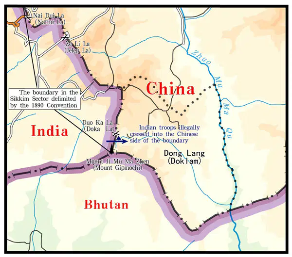
What's are Delimited Boundaries?
Countries legally define and agree to where borders are located through an agreement or treaty
Identifying the location of the defined boundaries on a map through the drawling of boundaries, particularly of electoral precincts, states or countries
Visible marking of the landscape with objects, such as fences or signs
Legal management of the border through, laws immigration regulation, documentation, and prosecution

The Philippines and Malaysia lay claim to resources under and around the Spratly Islands. Which of the following best explains how the United Nations Convention on the Law of the Sea (UNCLOS) influences claims to the islands by both countries?
The claims to the Spratly Islands by both the Philippines and Malaysia overlap due to exclusive economic zones up to 200 nautical miles from their coasts.
The Philippines and Malaysia both claim the islands lie within their territorial seas up to 12 nautical miles from their coasts.
The claims to the islands by the Philippines and Malaysia overlap due to the median line principle.
The Philippines and Malaysia both claim ownership to the resources based on a historic possession of the islands.
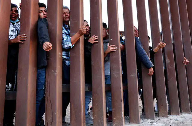
What's are Demarked Boundaries?
Countries legally define and agree to where borders are located through an agreement or treaty
Identifying the location of the defined boundaries on a map through the drawling of boundaries, particularly of electoral precincts, states or countries
Visible marking of the landscape with objects, such as fences or signs
Legal management of the border through, laws immigration regulation, documentation, and prosecution

What's are Administered Boundaries?
Countries legally define and agree to where borders are located through an agreement or treaty
Identifying the location of the defined boundaries on a map through the drawling of boundaries, particularly of electoral precincts, states or countries
Visible marking of the landscape with objects, such as fences or signs
Legal management of the border through, laws immigration regulation, documentation, and prosecution

Which of the following best explains the governance of the shaded areas shown on the map?
These areas are established as nation-states for indigenous peoples at the local scale.
These areas show territory occupied by indigenous peoples as stateless nations at a local scale.
These areas show territory controlled by indigenous peoples as a single multistate nation.
These areas show where indigenous peoples have a limited amount of self-government at a national scale.

What is Considered Territorial sea?
12 nautical miles from the coastline
200 nautical miles from the coastline
200+ nautical miles from the coastline
What is Considered Exclusive Economic zone (EEZ) ?
12 nautical miles from the coastline
200 nautical miles from the coastline
200+ nautical miles from the coastline
What is Considered International Waters?
12 nautical miles from the coastline
200 nautical miles from the coastline
200+ nautical miles from the coastline
True or False: A state has special rights over EEZ's which allow them to explore and use marine resources such as fishing, wailing, as well as natural resources like natural gas, oil, energy.
True
False
True or False: A Median Line Principle is when drawing a boundary that is midway, between two or more state's coasts
True
False

What is a Federal Government?
A style of government in which power is shared between central, regional, and local government
A style of government in which the power is located centrally and the purpose of regional or local units is to carry out policy
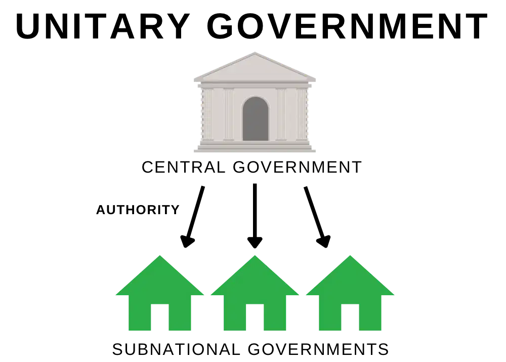
What is a Unitary Government?
A style of government in which power is shared between central, regional, and local government
A style of government in which the power is located centrally and the purpose of regional or local units is to carry out policy
True or False: In Federal power is diffused to state and local government on multiple levels.
True
False
What are some Positives for Federal Government?
Reduction of conflict around specific issues because each substate can legislate differently
Local issues resolved more quickly by regional/local governments
Efficiency in the creation and implementation of laws
Change happens quickly-only has to go through the central government
What are some Positives for Unitary Government?
Reduction of conflict around specific issues because each substate can legislate differently
Local issues resolved more quickly by regional/local governments
Efficiency in the creation and implementation of laws
Change happens quickly-only has to go through the central government
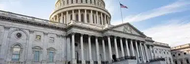
What are some negatives for Federal Government?
Slow to enact change
Conflicts between national, state, and local level governmental units can cause confusion and stall progress
More vulnerable to corruption or authoritarianism
Central government may not be in touch with local issues
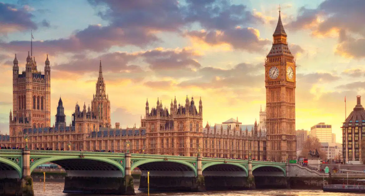
What are some negatives for Unitary Government?
Slow to enact change
Conflicts between national, state, and local level governmental units can cause confusion and stall progress
More vulnerable to corruption or authoritarianism
Central government may not be in touch with local issues
What are some examples of Federal Governments?
The United States
Australia
Germany
The United Kingdom
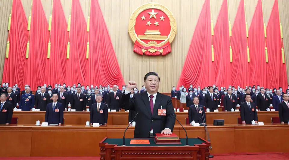
What are some examples of Unity Governments?
The United States
China
Ireland
The United Kingdom
True or False: Population distribution ratio changes every ten years.
True
False

What is Reapportionment?
Process in which U.S house of representatives seats, are re-allocated to different states, based off population change
Organization that utilizes the popular vote to then vote for president.
State's internal political boundaries that determine voting districts for the U.S house of reps and the state legislature. Redrawn to accurately reflect the new census
A geographic term used by state and local governments to organize elections
Which of the following describes typical characteristics of federal states?
A centralized government and strong centripetal forces
A fragmented land area and a single ethnic group
A small land area and high population density
A large land area and multiple ethnic groups
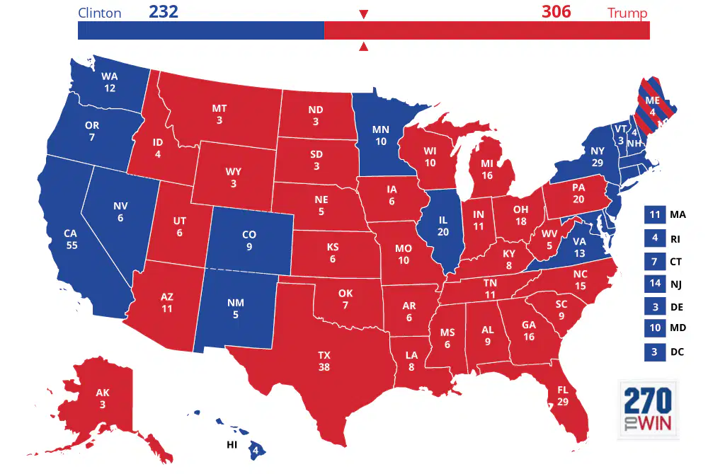
What is the Electoral College?
Process in which U.S house of representatives seats, are re-allocated to different states, based off population change
Organization that utilizes the popular vote to then vote for president.
State's internal political boundaries that determine voting districts for the U.S house of reps and the state legislature. Redrawn to accurately reflect the new census
A geographic term used by state and local governments to organize elections

What is Redistricting?
Process in which U.S house of representatives seats, are re-allocated to different states, based off population change
Organization that utilizes the popular vote to then vote for president.
State's internal political boundaries that determine voting districts for the U.S house of reps and the state legislature. Redrawn to accurately reflect the new census
A geographic term used by state and local governments to organize elections
Which of the following describes a unitary form of governance?
Stronger states and transnational corporations indirectly control weaker states.
A state has a strong central government with no power given to regions.
A collection of independent communities shares government services.
A state’s more powerful central government shares power with its regions.

What is a Voting District?
Process in which U.S house of representatives seats, are re-allocated to different states, based off population change
Organization that utilizes the popular vote to then vote for president.
State's internal political boundaries that determine voting districts for the U.S house of reps and the state legislature. Redrawn to accurately reflect the new census
A geographic term used by state and local governments to organize elections
Which of the following describes a federal form of governance?
A centralized government creates a barrier to local participation in the political process.
Autonomous regions act outside the authority of a central government.
Federal states encourage devolutionary movements and break apart quickly.
Multiple substates have local control and are unified to pursue common goals at the national level.
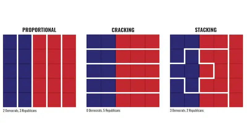
What is Gerrymandering?
Process in which U.S house of representatives seats, are re-allocated to different states, based off population change
Organization that utilizes the popular vote to then vote for president.
State's internal political boundaries that determine voting districts for the U.S house of reps and the state legislature. Redrawn to accurately reflect the new census
Redistricting for a political advantage, when the political party that controls a majority of seats in the state legislature draws political district boundaries to maintain or extend their political power
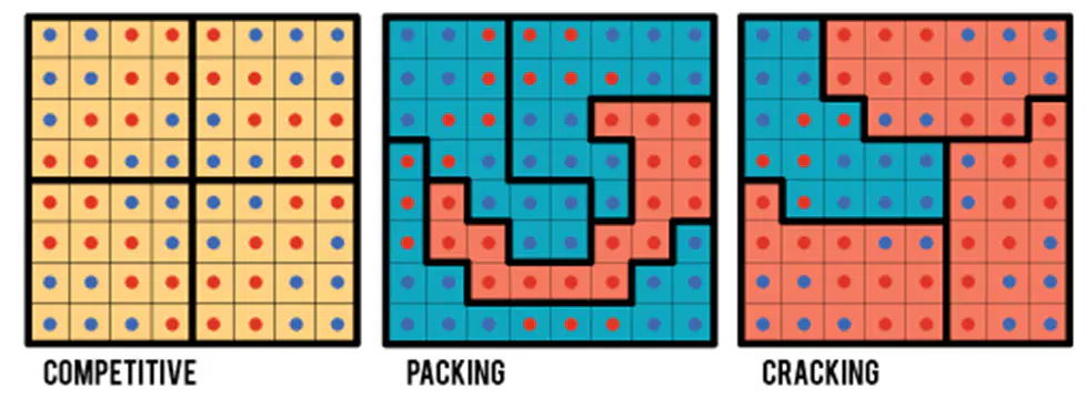
What is Packing?
Clustering like minded voters in a single district, thereby allowing the other party to win the remaining districts
Dispersing like minded voters among multiple districts in order to minimize their impact and prevent them from gaining a majority
What is Cracking?
Clustering like minded voters in a single district, thereby allowing the other party to win the remaining districts
Dispersing like minded voters among multiple districts in order to minimize their impact and prevent them from gaining a majority

