wayground logo

Free Printable Worksheets

Font size

S
M
L
XL
Worksheets

World Geography

Total questions: 66

Worksheet time: 49mins
Name
Class
Date
1.

How many continents are there in the world?

a)

6

b)

7

c)

10

d)

1 Giant Continent

2.

How many oceans are there on the Earth?

a)

4

b)

2

c)

7

d)

5

3.

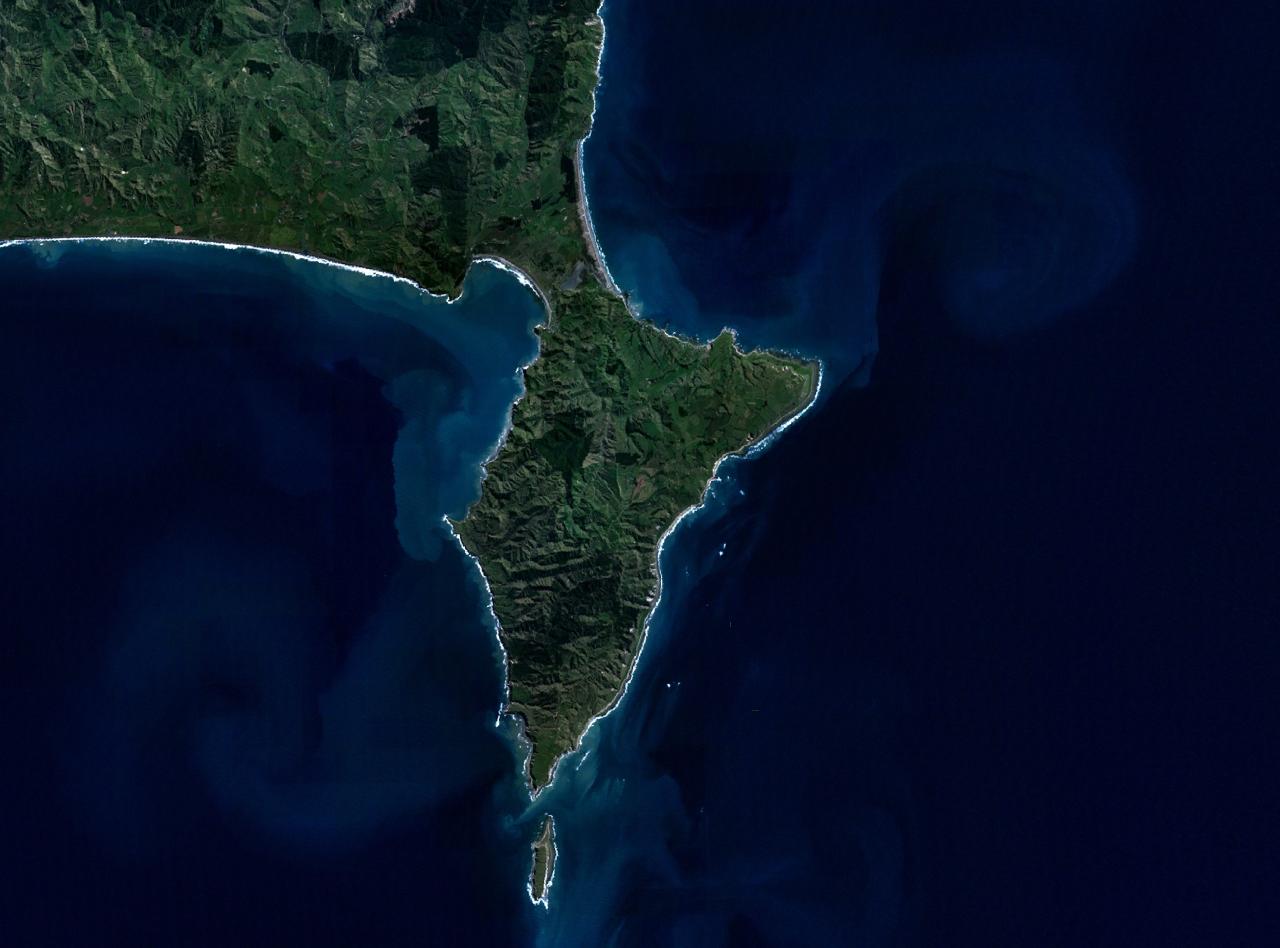
What do you call land surrounded by water on 3 sides?

a)

island

b)

continent

c)

tributary

d)

peninsula

4.

How many hemispheres are there in the world?

a)

4

b)

1

c)

14

d)

100

5.

The directions North, South, East, and West are called the

a)

Reverse directions

b)

Intermediate directions

c)

Cardinal directions

d)

Compass directions

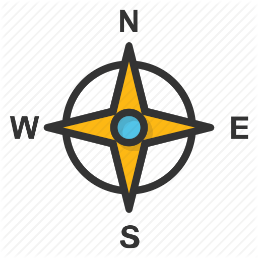
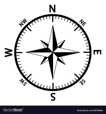
6.

What is this direction finder called?

a)

Briar Rose

b)

Yellow Rose

c)

Compass Rose

d)

Rose Bowl

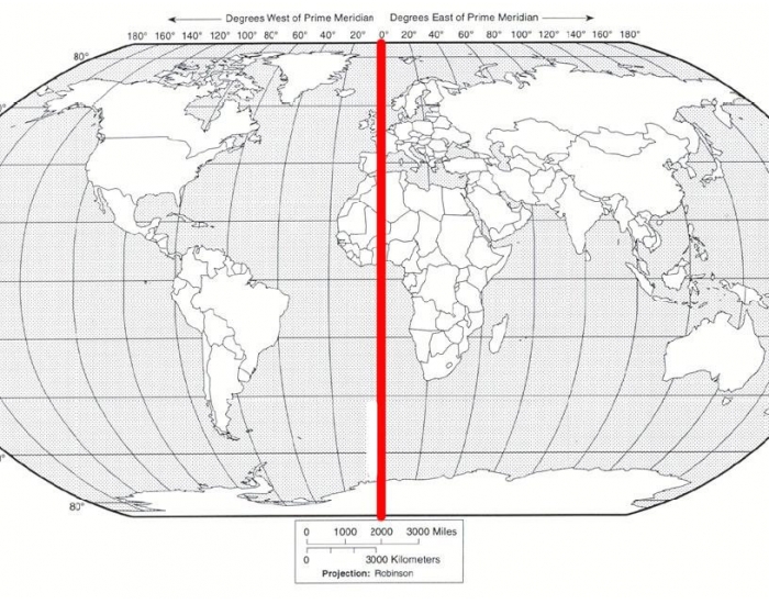
7.

What is the imaginary line that divides the Earth East and West?

a)

Equator

b)

Dividing Line

c)

Prime Meridian

d)

Axis

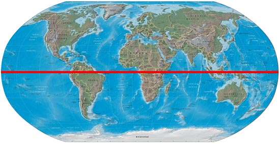
8.

What imaginary line divides the Earth North to South?

a)

Axis

b)

Prime Meridian

c)

Equator

d)

Compass Rose

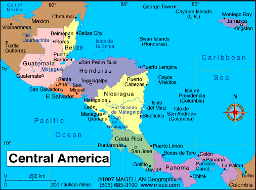
9.

How many countries are in Central America?

a)

7

b)

1

c)

3

d)

50

10.

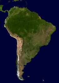
How many countries are in South America?

a)

1

b)

13

c)

50

d)

7

11.

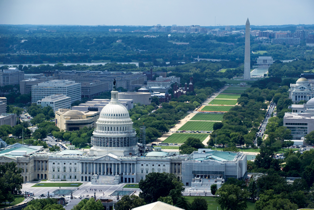
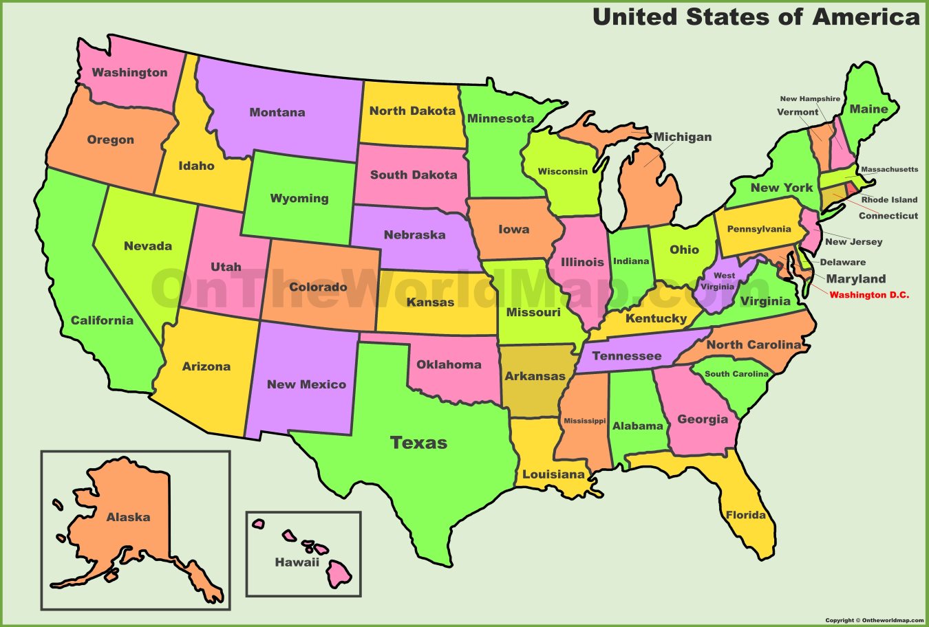
What is the capital of the USA?

a)

Washington

b)

Trenton

c)

Washington, D.C.

d)

America

12.

What does D.C. stand for?

a)

District of Colonies

b)

Domingo Capital

c)

District Capital

d)

District of Columbia

13.

What were the last 2 states admitted to the USA?

a)

Alaska and Montana

b)

Alaska and Hawaii

c)

Hawaii and Montana

d)

Hawaii and Idaho

14.

What 2 oceans border the USA?

a)

Atlantic and Arctic

b)

Arctic and Pacific

c)

Atlantic and Pacific

d)

Atlantic and Southern

15.

On what continent would you find the country of Egypt?

a)

Asia

b)

Africa

c)

North America

d)

South America

16.

What is the largest ocean?

a)

Pacific

b)

Atlantic

c)

Indian

d)

Arctic

17.

Which continent is the largest?

a)

Africa

b)

Asia

c)

Antarctica

d)

Russia

18.

What continent would you find the United States on?

a)

Asia

b)

North America

c)

South America

d)

Africa

19.

Who is America's neighbor to the North?

a)

Mexico

b)

Canada

c)

Vietnam

d)

England

20.

Who is America's neighbor to the South?

a)

America

b)

Canada

c)

England

d)

Mexico

21.

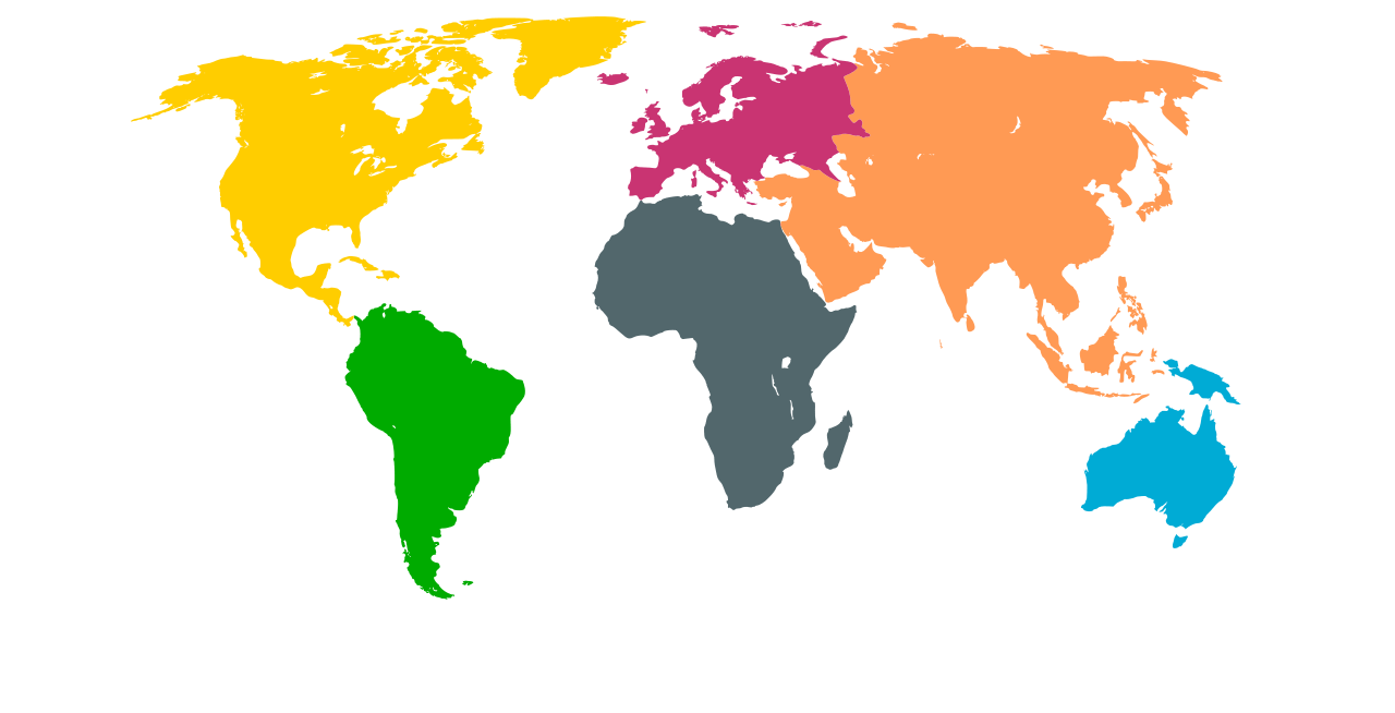
What is the name of the yellow continent?

a)

Australia

b)

North America

c)

The United States

d)

Australia

22.

What is the name of the grey continent?

a)

North America

b)

South America

c)

Africa

d)

Asia

23.

What is the name of the green continent?

a)

North America

b)

Brazil

c)

South America

d)

Africa

24.

What is the name of the blue continent?

a)

Africa

b)

Asia

c)

Australia

d)

Orange

25.

What is the name of the orange continent?

a)

Europe

b)

Asia

c)

Russia

d)

China

26.

What is the name of the pink/red continent?

a)

Europe

b)

Asia

c)

North America

d)

Australia

27.

Which continent is South of North America?

a)

Mexico

b)

South America

c)

Africa

d)

Brazil

28.

Which continent is East of Europe?

a)

Asia

b)

Africa

c)

North America

d)

Australia

29.

Which continent is directly North of Australia?

a)

Asia

b)

Africa

c)

North America

d)

Europe

30.

Which of the following countries is in Asia?

a)

China

b)

Brazil

c)

Ireland

d)

Australia

31.

Which of the following countries is in North America?

a)

Canada

b)

Chile

c)

Greece

d)

Japan

32.

Click on all of the countries that are on the continent of Africa

a)

Nigeria

b)

South Africa

c)

France

d)

Thailand

33.

True or False: Spain is a country in Europe.

a)

True

b)

False

34.

True or False: Senegal is a country in Asia.

a)

True

b)

False

35.

True or False: The U.S. is a country in North America.

a)

True

b)

False

36.

True or False: Mexico is a country in South America

a)

True

b)

False

37.
Which continent is labeled in Red 
a)
Africa 
b)
North America 
c)
Antarctica 
d)
Europe 
38.
Name the highlighted country
a)
Saudi Arabia
b)
Iraq
c)
Iran
d)
Turkey
39.
What is this object known as?
a)
map symbol
b)
map key
c)
map scale
d)
compass rose
40.
Which continent is home of the Sahara Desert and is considered the hottest?
a)
South America
b)
Europe
c)
Africa
d)
Australia
41.

Warmest ocean on the planet?

a)

Atlantic Ocean

b)

Coral Sea

c)

Pacific Ocean

d)

Indian Ocean

42.
Name the highlighted state.
a)
Missouri
b)
Illinois
c)
Iowa
d)
Ohio
43.
The African country of ___ is highlighted.
a)
Egypt
b)
Kenya
c)
Morocco
d)
South Africa
44.
The European country in red is ___?
a)
Russia
b)
Italy
c)
France
d)
Greece
45.
The European country in red is ___?
a)
Sweden
b)
Britain
c)
Germany
d)
Noraway
46.
The European country in red is ___?
a)
Italy
b)
Germany
c)
Noraway
d)
Poland
47.
Which body of water is in the red rectangle?
a)
Persian Gulf
b)
Gulf of Oman
c)
Gulf of Aden
d)
Arabian Sea
48.
What is the moon’s effect on the Earth?                     
a)
The moon influences the seasons by bombarding the Earth with lunar radiation.
b)
The moon reacts with the sun to block harmful radiation from reaching the Earth.
c)
The moon has no measurable effect on the Earth at all.
d)
The gravitational pull of the moon and sun cause the ocean tides to fluctuate.
49.
Atlantic Ocean
a)
A
b)
D
c)
C
d)
E
50.
Pacific Ocean
a)
D
b)
E
c)
B
d)
C
51.
Indian Ocean
a)
D
b)
E
c)
A
d)
C
52.
Arctic Ocean
a)
C
b)
A
c)
D
d)
B
53.
Southern Ocean
a)
C
b)
A
c)
E
d)
B
54.
North America
a)
A
b)
F
c)
C
d)
B
55.
South America
a)
D
b)
F
c)
E
d)
G
56.
Europe
a)
D
b)
B
c)
E
d)
C
57.
Africa
a)
D
b)
C
c)
E
d)
B
58.
Asia
a)
D
b)
C
c)
B
d)
A
59.
Antarctica
a)
G
b)
F
c)
E
d)
B
60.
Australia
a)
C
b)
D
c)
E
d)
F
61.

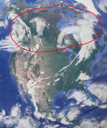
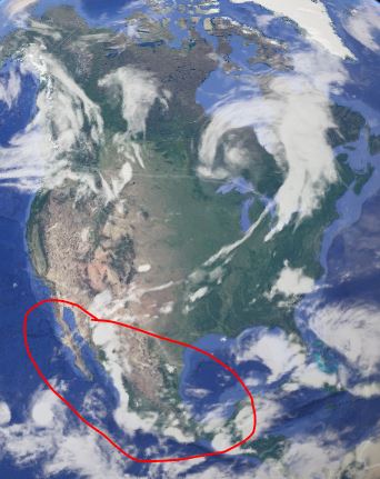
What continent is circled?

a)

Brazil

b)

Africa

c)

South America

d)

Iceland

62.

Where is Asia

a)
b)
c)
d)
63.
What is the disadvantage of a map compared to a globe?
a)
a map distorts properties like distance 
b)
a map shows little detail
c)
a map indicates actual distances
d)
a map is very large
64.
What happens to the Poles on a Robinson projection?
a)
Their shape appears to be perfectly maintained
b)
They appear to be significantly larger areas
c)
they appear to be slightly flattened
d)
Their distance from the Equator appears longer than it actually is
65.
Which of the following collects visual information about earth?
a)
Transmitters
b)
GPS
c)
GIS
d)
Satellites
66.
To be labeled a geographer, one must
a)
actively explore geography
b)
serve as a geography teacer
c)
always use maps
d)
be consulted before construction projects