
 Worksheets
9 weeks review topo and satellite view
Total questions: 35
Worksheet time: 1hrs 10mins
What is the driving force behind the movement of the plates?
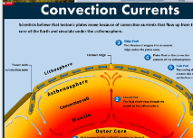
Convection currents in the Earth's mantle are caused by:
Less dense hot magma moving downward
Less dense hot magma moving upward
Tectonic plate movement
More dense cooler magma moving upward
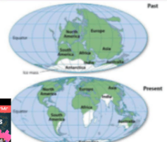
What types of evidence did Wegener use to support the theory of Continental Drift? (Select ALL answer that are correct)
evidence from land features
evidence from animal fossils
evidence from ancient climates
evidence from plant fossils
evidence from human remains
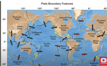
Which is an example of a transform boundary:
The Himalayas
The Andes
Iceland
The Caribbean
San Andreas

Identify the type of plate boundary:
oceanic-continental convergent
oceanic-oceanic convergent
continental-continental convergent
transform
divergent
Match the plate boundary to its definition.
Plates spread apart
Divergent
Plates come together
Convergent
Plates rub against each other
Transform

Name the type of heat transfer shown in the picture.
convection
conduction
radiation

Match the plate boundary to its diagram.

Divergent

Convergent

Transform

The image above shows sand dunes in a desert. What process is responsible for changing sand dunes in a desert?
Glaciers
Rain
River
Wind

If the lines are close together on the map, it means that the rise/drop is ________________
Steep
Gradual

If the lines are far apart, it means it is a slow or ________________ rise/drop
Gradual
Steep

Which one is the steepest?
2
1
4

The satellite image below shows a portion of the Namib Desert in Africa. This is an ancient, sandy desert with dunes that can be up to 305 m tall. The Namib Desert extends inland from the Atlantic Ocean between 80 km and 200 km and receives only 5 mm to 76 mm of rain each year.
A satellite picture of this same area taken weeks before shows that the shape and location of some sand dunes have changed. Which of these most likely caused the changes in the dunes?
Ocean waves
Flowing rivers
Blowing wind
Crustal uplift

Which of the following best describes how mountains change over time?
The elevation of the peaks will decrease due to erosion.
The elevation of the peaks will increase due to weathering.
The elevation of the peaks will increase due to deposition.
Mountains stay the same, they never change.
Drag your hotspot to the hillside with a STEEPER incline.

Reorder the following from LOWEST to HIGHEST elevation.
D
A
B
C
E

A river area is shown on the topographic map. Four riverbank areas are labeled on the map. Which two riverbanks are the steepest?
W and X
Y and Z
X and Y
W and Z

The satellite photograph shows a large meteorite crater that is 1200 m in diameter and 170 m deep. This crater is located in a flat, arid part of northeastern Arizona How will this crater most likely change over time?
It will get deeper as it fills with water
It will rise up like a volcanic crater
It will become less deep as the rain erodes.
It will widen as it fills with lava


What heats the Earth's oceans?
People
Boats
a heater
sun

Which two species most likely compete for water?
X
Y
Z
What is an invasive species?
An organism that is new to an environment that has positive effects on the environment.
An organism that is native to an environment that has negative effects on the environment.
An organism that is new to an environment that has negative effects on the environment.
An organism that is native to an environment that has positive effects on the environment.

Which of the following factors carves out canyons through the processes of weathering and erosion?
Water
Wind
Roots
Gravity
Which of the following best describes how mountains change over time?
The elevation of the peaks will decrease due to erosion.
The elevation of the peaks will increase due to weathering.
The elevation of the peaks will increase due to deposition.
Mountains stay the same, they never change.

