
 Worksheets
Maps and landforms
Total questions: 71
Worksheet time: 3590secs
A map showing the climate zones of North America is which type of map?
Thematic Map
Political Map
Physical Map
Geological Map
What is an area of flat land that is often covered in grass and trees?
landform
valley
peninsula
plains
What is a natural feature of the earth, such as mountains and peninsulas?
plain
relief
landform
lake
What is the distance above or below sea level?
relief
a beach
plain
elevation
What is an area defined by its common features?
a country
a state
a region
a city

Which type of map is this?
physical
political
elevation
topographical

What is shown on this map?
resources
climate
regions
capitals
What can you conclude from the fact that political maps often change, but physical maps rarely do?
Political borders change more often than natural landmarks
Physical maps are updated far more frequently than political maps
Political mapmakers are constantly seeking out new information about geography
Every time there is an election, a political map must be updated
If you're having trouble figuring out what the symbols on a map represent, where would you look?
The back of the map.
The title of the map
The map legend
The compass rose

On the following map, what do the grey triangles represent?
Sources of fuel
Gold mines
Areas where precious gems can be found
Areas where nonmetals can be found
If you were looking at a map, and wanted to learn where the area it represents is located on the planet, what would you look for?
The map legend
Lines of latitude and longitude
Symbols
The map key

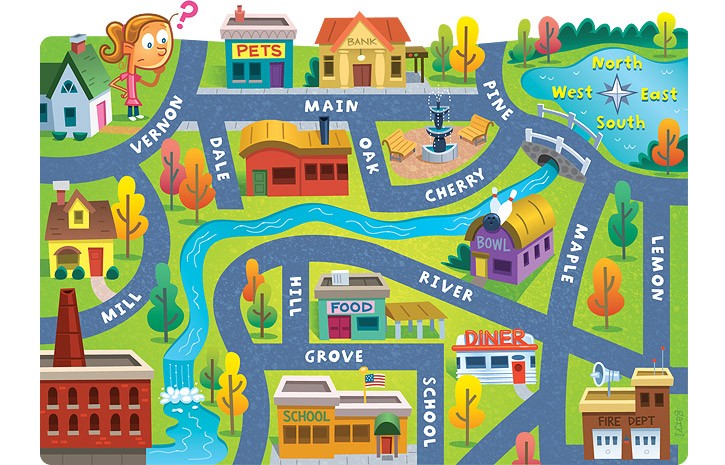
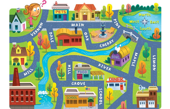
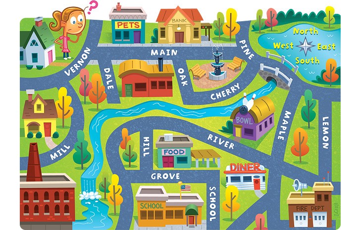
Circle the SCALE on this map:

Physical feature on Earth's surface is a(n) __________
plains
plateau
valley
mountain
landform
The highest of Earth's physical features are____________.
plains
plateau
valley
mountains
landform
A low area between mountains or hills is a(n)__________.
plains
plateau
valley
mountains
landform
A large, flat area higher than the land around it is a(n) __________.
plains
plateau
valley
mountains
landform
Wide, flat areas of land are called ___________.
plains
plateau
valley
mountains
landform
Natural streams of flowing water that empty into lakes, oceans,or other bodies of water are____________.
Oceans
lake
rivers
basin
A body of water with land all around it is a(n) ___________.
Oceans
lake
rivers
basin
The largest landform under the ocean is an ocean __________.
Oceans
lake
rivers
basin
Lines are used to show elevation and steepness of slopes on a(n) ______________ map.
surveyor
relief
topographical
What is a map?
A book of places
A drawing that represents a portion of Earth on a flat surface that can be transported.
A piece of paper that shows rivers.
A symbol that shows cities.
What map feature tells us about what the symbols on the map represent?
Key or Legend
Scale of Miles
Title
Compass Rose

Using the map that you see, answer the following question: Which direction would I take to get from Buffalo to Glen Falls?
South
North
East
North East

Using the map scale, about how far is the school from City Hall?
Almost 2 miles
1 mile
3 miles
17 miles
Which map can I use to see how much rain falls in that area?
Climate Map
Topographical Map
Political Map
Globe
A person that makes maps is called?
Cartographer
Mapographer
Geographer
Choreographer

How many continents are in the world?
7
5
6
4

How many oceans are in the world?
6
4
5
7

Name the continent.
North America
South America
Asia
United States

Name the continent
South America
North America
Africa
Asia

Name the continent.
Asia
Africa
South America
North America

Name the continent.
Asia
Australia
Europe
Antartica

Name the continent.
Europe
Australia
Antartica
Asia

Name the continent.
Europe
Asia
Austraila
Africa

Name the continent in blue.
Africa
Antarctica
South Pole
Australia

Which ocean is between North America and Asia?
Pacific Ocean
Atlantic Ocean
Arctic Ocean
Indian Ocean

Which ocean is found down near Antarctica?
Arctic Ocean
Southern Ocean
Atlantic Ocean
Indian Ocean

Which ocean is found between Africa, India, and Australia?
Pacific Ocean
Indian Ocean
Atlantic Ocean
Southern Ocean

Which ocean is found in the north of Europe and Asia?
Arctic Ocean
Atlantic Ocean
Pacific Ocean
Indian Ocean

river

lake

cliff
An (a) is land surrounded by water.
Match the following.

waterfall

ocean

stream

What is this picture of?
lake
valley
plains

What is this?
plains
mountain
hills


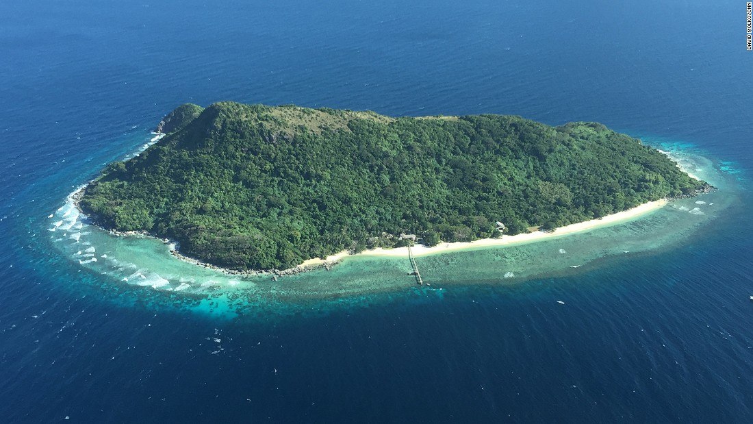


What Landfrom is this?
Hills
Mountains
Volcano
River

What landform is this?
mountain
strait
cataract
mesa

the land
bay
gulf
sea
isthmus

plateau
What are these examples of?
· Earthquakes
· Volcanoes
· Hurricanes
Landforms
Processes that help create landforms
Maps
Mountains
A plain is ___________________________________.
A place with very dry climate
A flat piece of land
The highest type of landform
A hurricane

Galveston Bay
This landform is important because it protects and improves water quality, provides fish and wild life habitats, stores flood waters and maintains surface water flow during dry periods. What landform is this?
Mountains
Valley
Plain
Wetland
a giant sheet of ice
navigable
tributary
glacier
wetland
a low wet area such as a swamp or marsh
navigable
tributary
glacier
wetland

