
 Worksheets
SS 7th Grade: January
Total questions: 82
Worksheet time: 1hrs 17mins





The number "5" represents which ocean?
Atlantic Ocean
Pacific Ocean
Southern Ocean
Arctic Ocean
Indian Ocean
The number "4" represents which ocean?
Atlantic Ocean
Pacific Ocean
Southern Ocean
Arctic Ocean
Indian Ocean
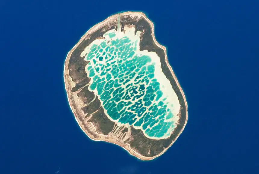
atoll
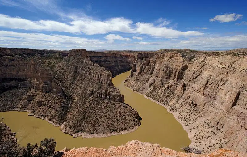

peninsula
Large area of flat grasslands
Plain
River
Ocean
Valley


A landform with water all around it is an:
Longitude lines measure time zones as well as distance ____________ and _______________ of the ___________________.
East, West, Prime Meridian
North, South, Prime Meridian
East, West, Equator
North, South, Equator
900 North is the__________________
North Pole
South Pole
Prime Meridian
Equator

What is the RED line called? Check all that apply.
The halfway mark
The Equator
The Prime Meridian
0 degrees latitude

Which Continents are completely in the Southern Hemisphere? Check all that apply.
South America
Africa
Antarctica
Australia

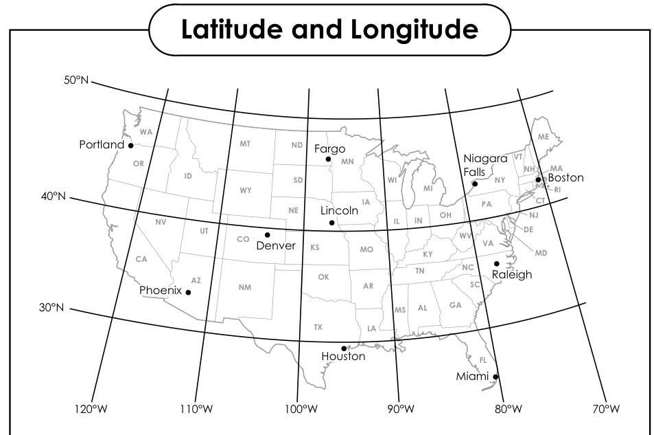
What is the Absolute Location of Denver?
west of St. Louis
105 degrees S, by 39 degrees E
Southeast of Seattle
39 degrees N, 105 degrees W
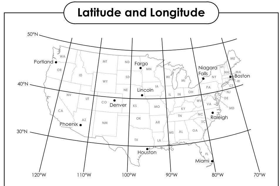
What is the Absolute Location of Portland?
45°N, 122°W
122°W, 45°N
North of Denver.
East of Boston.


Which hemispheres does the United States belong to?
Northern and Western
Southern and Eastern
Northern and Eastern
Southern and Western

Which line measures at 0 degrees longitude?
Equator
Prime Meridian
Northern Hemisphere
Latitude

What major city is the red arrow pointing to?
El Paso
Dallas
Lubbock
San Antonio
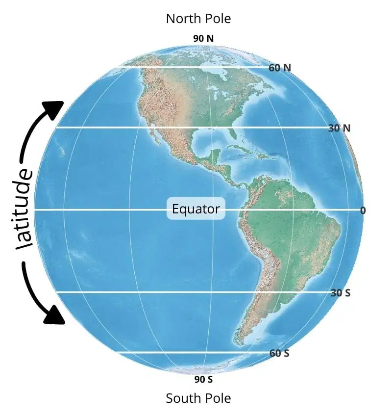
Latitude lines tell us how far a location is from the Equator and ___.
time
years
temperature
Earth's rotation on its axis
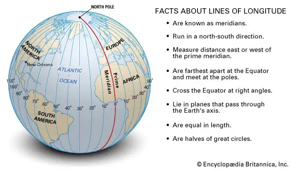
Longitude lines tell us about time zones and ___.
temperature and climate
area
a location's distance from the Prime Meridian
seasons and Earth's rotation

Using relative location, what direction is the Indian Ocean from Asia?
North
South
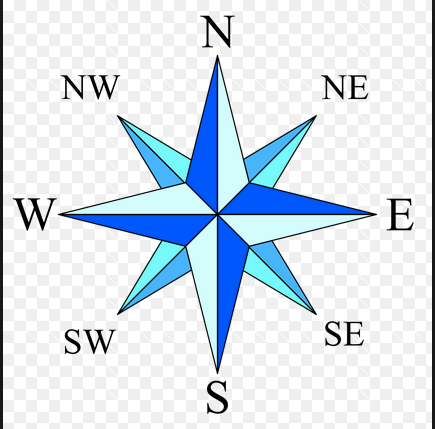
North, South, East, & West are
intermediate directions
cardinal directions
North, South, East, & West are
intermediate directions
cardinal directions
Northeast, Southeast, Northwest, & Southwest are
intermediate directions
cardinal directions
The United States is ________ of Canada.
North
South
East
West


Which ocean is west of Africa?
Indian Ocean
Atlantic Ocean

Africa is located _____________of the Indian Ocean.
North
South
East
West


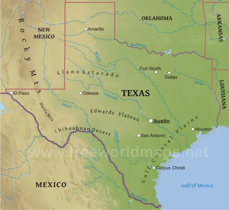
The Rocky Mountains are ___ from Amarillo, TX.
North
East
South
West
Fort Worth is ____ from the Gulf of Mexico.
North
East
South
West
Fort Worth is ____ from the Gulf of Mexico.
North
East
South
West
Oklahoma is ____ from Texas.
North
East
South
West
San Antonio is ____ from Dallas.
Northwest
Southeast
Southwest
Northeast

Which group relied heavily on buffalo for food, clothing, shelter, etc?
Southeastern Culture Groups
Puebloan Culture Groups
Gulf Culture Groups
Plains Culture Groups

Which group lived in adobe houses called pueblos?
Gulf Culture Group
Puebloan Culture Group
Plains Culture Group
Southeastern Culture Group

A region named after the French King Louis XIV:
Oklahoma
Texas
Louisiana
Nebraska

A portable home made of tanned buffalo hides:
condominium
igloo
tepee
pueblo

A religious settlement often used by Spanish colonists in North America:
mission
fort
stockade
garrison
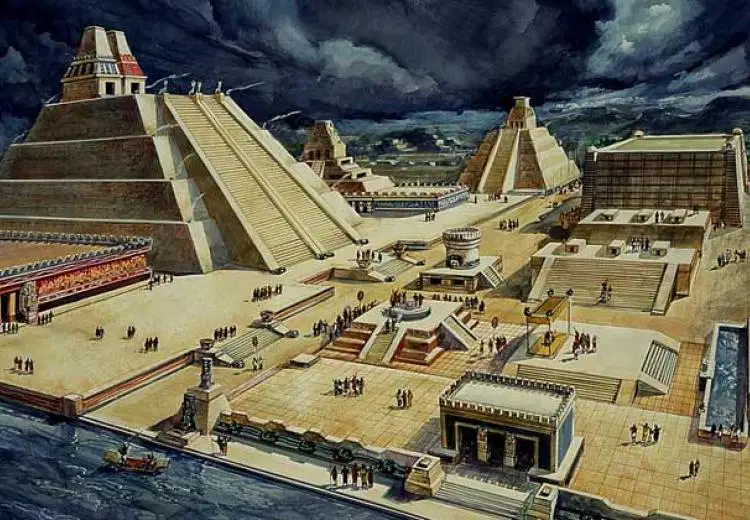
Native American culture who ruled central Mexico before the Spanish conquered it. They had an empire around Tenochtitlan.

A Spanish soldier and conqueror of Mexico and Peru in the 16th century:

Last Aztec emperor who was overthrown by the Spanish conquistadors:
Moctezuma

Italian explorer sent from Spain aboard three ships in 1492:
Amerigo Vespucci
San Salvador
Christopher Columbus
King Ferdinand

A settlement far away from the country that rules it:
voyage
expedition
colony
log

The movement of people, germs, plats and animals across the Atlantic Ocean following the journeys of Columbus
Columbus Traveling
Columbian Expeditioners
Columbian Exchange
Columbus Colony

Spanish soldier who led a small army in conquering the Aztec Empire:
Francisco Pizarro
Francisco Coronado
Cabeza de Vaca
Hernan Cortes
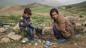
A person who travels from place to place without a permanent home:
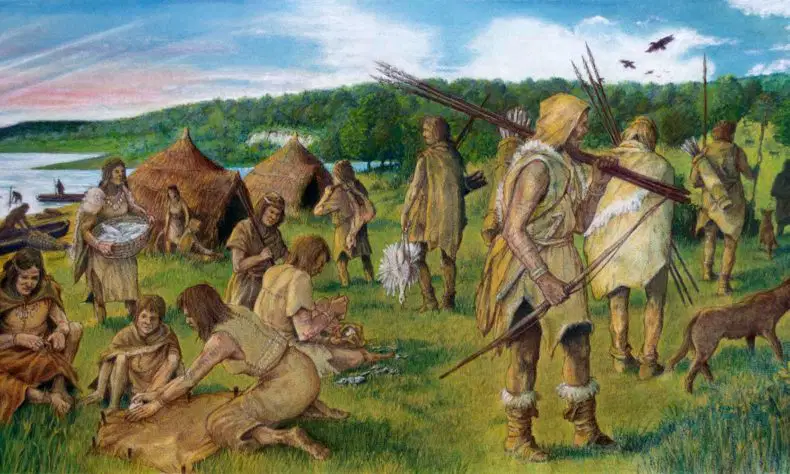
Why did hunter gatherers often migrate?
An official who rules in the king or queen's name:
viceroy
friar
conquistador
shaman
Union of different groups:
village
confederacy
navigation
transportation

Dealer or agent acting as a go-between for producers of goods and consumers who buy them:
shaman
middleman
priest
chief

Puebloan people of Arizona and New Mexico often lived in houses made from this material:
adobe
titanium
copper
gold

A very dangerous disease which European explorers brought to North America:
smallpox
covid 19
avion flu
chickenpox

To find a way to pass over a long body of water:
retrograde
conquer
overland
navigate
A district of a colony or country similar to a state:
continent
province
plateau
tributary
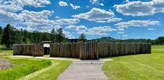
A crude fort or settlement usually made of logs:
skyscraper
mission
stockade
palace

How long did Cabeza de Vaca need to survive in North America before he could return to Spain?
8 years
65 days
4 months
24 years
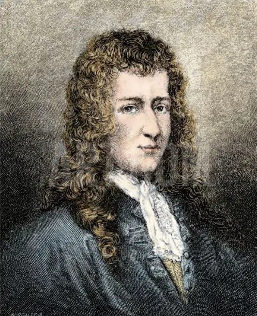
A French explorer who explored the entire length of the Mississippi River:
Cortes
Atahualpa
Pizarro
La Salle
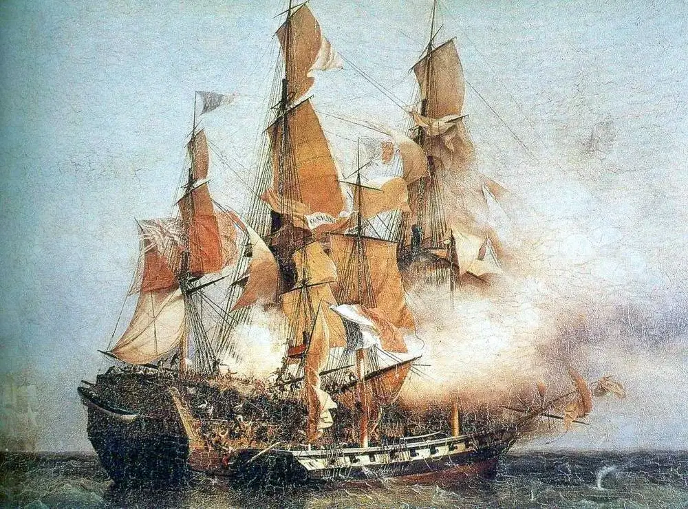
Government-sponsored pirate ships which are outfitted with weapons:
privateer
mission
viceroy
merchant


What did La Salle do when Fort Saint Louis was in trouble?
He signed a peace treaty with the Spanish soldiers
He joined the Caddo tribe
He tried walking north toward Quebec
He sailed back to France in La Belle

Who started a movement of 300 Anglo American into Texas in 1825?
General Lopez de Santa Anna
Stephen F Austin
Cabeza de Vaca
Hernan Cortez
Who is often referred to as the "Father of Texas"?
Antonio Lopez de Santa Anna
Stephen F Austin
John Denver
Sam Houston
Which of these are known as "pull factors" for human migration?
more available food
war and political violence
high paying jobs
lack of rights for citizens
an epidemic or plague
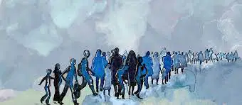
The movement of a large number of people to a new location with the intention of settling there:
cultural diffusion
population density
human migration
political

