Wayground logo

Free Printable Worksheets

Font size

S
M
L
XL
Worksheets

Weather

Total questions: 48

Worksheet time: 27mins

Name
Class
Date
1.
a)
Warm Front
b)
High Air Pressure
c)
Cold Front
d)
High Temperatures
2.
a)
Low Clouds
b)
Low Temperatures
c)
Light Wind
d)
Low Air Pressure
3.
a)
High Air Pressure
b)
High Temperatures
c)
Heavy Rain
d)
Hail
4.
a)
High Pressure
b)
Warm Front
c)
Cold Front
d)
Mountains
5.
High Pressure is associated with this type of weather...
a)
Cloudy/Overcast Weather
b)
Cold Weather
c)
Warm Weather
d)
Fair Weather
6.
Low Pressure is associated with this type of weather...
a)
Cloudy/Overcast Weather
b)
Cold Weather
c)
Warm Weather
d)
Fair Weather
7.
A cold front moving into an area can bring this type of weather...
a)
Warmer Temperatures, Clear Skies
b)
Colder Temperatures, Clear Skies
c)
Warmer Temperatures, Clouds
d)
Colder Temperatures, Clouds, and Precipitation
8.
A warm front moving into an area can bring this type of weather...
a)
Warmer Temperatures, Clear Skies
b)
Colder Temperatures, Clear Skies
c)
Warmer Temperatures, Clouds, and steady precipitation
d)
Colder Temperatures, Clouds, and Precipitation
9.
____________ air sinks/falls because it is ____________dense.
a)
Cold, More
b)
Warm, Less
c)
Cold, Less
d)
Warm, More
10.
Choose the best forecast for Los Angeles on Saturday.
a)
cooler temperatures
b)
warmer temperatures 
c)
low pressure
d)
snow
11.
Choose the best forecast for Dallas on Saturday.
a)
thunderstorms
b)
snow
c)
warmer temperatures
d)
clear skies
12.
Choose the best forecast for New York on Saturday. 
a)
sunny skies
b)
warmer temperatures
c)
snow
d)
sleet
13.
Which city is experiencing cloudy skies and rain?
a)
New York 
b)
Seattle
c)
Dallas
d)
Boise
14.
Which city is close to a warm front?
a)
Chicago
b)
New York
c)
Boise
d)
Denver
15.
When warm and cool water mix, winds will...
a)
Stay the same
b)
Get slower
c)
Intensify and cause storms
d)
Change directions
16.
Models that show heat rising up and cold moving down are models of:
a)
Conduction
b)
Complexion
c)
Radiation
d)
Convection
17.
The heat source for covection in the atmosphere is the:
a)
Core
b)
Water
c)
Land
d)
Sun
18.
The heat source for convection in the ocean is-
a)
The sun
b)
The moon
c)
The core
d)
Volcanoes
19.
Convection in the Ocean is caused by volcanoes
a)
True
b)
False
20.
Convection in the atmosphere is caused by the rotation of the Earth on its axis
a)
True
b)
False
21.
Convection in the oceans and in the atmosphere is caused by the sun
a)
True
b)
False
22.
How can you tell which direction a front will move in?
a)
The direction of the symbols will point in the opposite  direction that the front moves
b)
The direction of the symbols will point in the same direction as the front moves
23.

Where is the original source of the energy that occurs in convection currents?

a)

Point F

b)

Point G

c)

Point H

d)

Point A

24.

The sun's energy is transferred to Earth through ______________________.

a)

convection

b)

radiation

c)

conduction

d)

none of the above

25.

What is occurring at point E on the diagram?

a)

The Earth is absorbing the sun's radiation.

b)

The air has risen because it picked up heat, becoming more dense.

c)

The air has risen because it picked up heat, becoming less dense.

d)

The air is sinking because it has cooled becoming less dense.

26.

What is created at Point G on the diagram?

a)

wind

b)

water

c)

fire

d)

hail

27.

Wind always flows from higher pressure to lower pressure.

a)

True

b)

False

28.

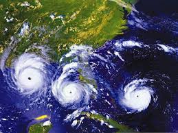
Hurricanes are a very strong type of __________.

a)

tornado

b)

blizzard

c)

tropical storm

d)

tsunami

29.

Select 2 other names for a hurricane.

a)

typhoon

b)

cyclone

c)

blizzard

d)

earthquake

30.

Hurricanes usually occur between the months of __________.

a)

January and March

b)

April and June

c)

November and January

d)

June and November

31.

The sea water that starts a hurricane gets warm from ________________.

a)

volcanoes

b)

the moon

c)

lightning

d)

the sun

32.

Where do hurricanes form?

a)

In the warm waters of the Atlantic Ocean near the equator

b)

In the cool waters of the North Sea

33.

What does this symbol represent?

a)

Tornado

b)

Hurricane

c)

Cold Front

34.

Which is necessary for a Hurricane to get stronger?

a)

Warm ocean water

b)

Wind

c)

water at 80 degrees F

d)

ALL of the above

35.

What can cause a Hurricane to get weak?

a)

Cooler Air/Water

b)

Reaching land

c)

Both

36.

Where do Hurricanes form?

a)

NEAR the Equator

b)

Away from the Equator

c)

NEAR the North/South Poles

37.

Hurricanes develop in ________ regions.

a)

Arctic/Polar

b)

Tropical

38.

Where do hurricanes form?

a)

In the warm waters of the Atlantic Ocean near the equator

b)

In the cool waters of the North Sea

39.
What is a watershed?
a)
Water in an area
b)
Water that flows into a river or stream
c)
Land that water flows over and through
d)
Water that is salty
40.
What is all the water that runs off the surface of the land and washes into rivers, streams, and other waterways called?
a)
Runoff
b)
Storm Drain
c)
Surface Water
d)
Tributary
41.
The following computer model was created to illustrate how a watershed can be affected by human activities. What is the most likely reason for placing the farm land upstream from the factories?
a)
The water at the highest point of the river will have been impacted the least by human activities, so it should be the cleanest.
b)
Farms do not have a negative impact on watersheds, so they should be placed upstream.
c)
The factory puts pollution into the air, so it does not matter where the farm is located.
d)
The farm should be placed upstream because pesticides from the farm will end up in the river, which is beneficial for the factories downstream.
42.
As the map shows, there are multiple drainage basins in Texas. Ft. Worth and Dallas are in the same drainage basin. What is the most likely reason that the water in the Trinity River is dirtier in Houston than it is in Dallas?
a)
Ocean pollutants are entering the river.
b)
Pollutants are entering from other drainage basins.
c)
The river basin picks up more human pollutants.
d)
The water goes through a salt dome and get more polluted.
43.

Farmers can best reduce negative effects on the water quality of nearby streams and lakes by planting crops that

a)

produce less oxygen

b)

produce less carbon dioxide

c)

need less fertilizer

d)

need less solar energy

44.
A company known as Arten Industries is wanting to build a factory in the watershed that is pictured. The company wants to limit the ecological impact it has on surrounding areas. Where should the company build its factory?
a)
top of the river so the rain can dilute the pollution
b)
away from the river so the pollution can not reach the river
c)
the middle of the river so the pollution can have time to settle.
d)
the bottom of the river so it effects a smaller amount of land
45.
Which of these human activities is most likely to cause the excessive growth of phytoplankton in the world's oceans?
a)
The use of chemical fertilzers that are carried by runoff into rivers
b)
The logging of old-growth forests, which results in erosion
c)
The spraying of chemical herbicides that reduce carbon dioxide in the air
d)
The mining of fossil fuels, which requires digging underground tunnels
46.
A student sets up the investigation show below. The movement of colored water through the gravel best models-
a)
condensation of water vapor
b)
surface runoff of precipitation
c)
conservation of water
d)
pollution of groundwater
47.
A student drew the model to represent a part of a watershed and some human activities that affect the watershed. How do the industrial, agricultural, and residential activities of humans most likely affect the groundwater in the area?
a)
The activities prevent most of the water from evaporating into the atmosphere
b)
Pollutants from the activities percolate through the soil and enter the water table
c)
The activities replace the groundwater used.
d)
All of the above
48.
A student's model of an area new a city depicts many activities that affect the quality of the water in the area. How does the agricultural activity most likely affect the surface water of the area?
a)
Excess crop fertilizer is carried by runoff into the river, causing excess growth of water plants.
b)
Excess crop material accumulates on the riverbanks, slowing the movement of the river water
c)
Crops reduce erosion, increasing the amount of soil entering the river
d)
Crops absorb pure water from soil, causing the remaining water to contain more salt.