Worksheets
Unit 1 Test Remediation
Total questions: 21
Worksheet time: 47mins
1-15.
Answer the questions below after watching the video
What do topographic maps use to show the elevation and shape of the land?
Colors
Shadows
Textures
Contours
Which of the following is NOT a real-world application of topographic maps?
Emergency management
Resource management
Recreation
Cooking recipes
Why are topographic maps essential for planning a hike?
They offer discounts on hiking gear.
They show the best restaurants along the route.
They help in choosing camping locations and finding water sources.
They provide weather forecasts.
What is a key feature of Hadrian's Wall according to topographic maps?
It has many rivers.
It is heavily wooded.
It is very hilly.
It is a short walk.
How do topographic maps assist in resource management?
By predicting stock market trends.
By revealing coal and uranium deposits.
By showing the best shopping centers.
By displaying popular tourist spots.
What is a key feature of topographic maps in resource management?
They reveal flat and sunny places for solar panels.
They offer travel discounts.
They show the best fishing spots.
They predict the weather.
What is a consideration when placing mines according to topographic maps?
Proximity to shopping malls
Proximity to beaches
Proximity to roads for transportation
Proximity to schools
Why was the Carmichael Coal Mine project controversial?
It was located in a desert.
It threatened endangered species and the Great Barrier Reef.
It was too expensive.
It was too close to a city.
What is a requirement for wind farms according to topographic maps?
They must be near the ocean.
They should be in a forest.
They need a landscape on a plateau.
They must be underground.
What should be considered when building wind farms according to topographic maps?
Proximity to beaches
Altitude to maximize wind speed
Proximity to schools
Proximity to shopping centers
How do topographic maps help in emergency management?
By predicting the weather.
By showing safe places to build housing.
By providing entertainment options.
By offering travel discounts.
What can topographic maps predict in flood-prone areas?
The best picnic areas
The location of treasure
The best fishing spots
Water movement direction
Which of the following is a natural disaster that topographic maps can help manage?
Earthquakes
Forest fires
Tornadoes
Volcanic eruptions
What is a benefit of using topographic maps in disaster management?
They provide free internet access.
They help in planning evacuation routes.
They offer discounts on insurance.
They predict the stock market.
What is a key consideration for emergency managers using topographic maps?
Locating safe high ground during floods
Choosing vacation spots
Predicting the stock market
Finding the best restaurants
16-25.
Answer the questions below after watching the video
What is the main topic of today's episode?
The history of maps
Climate zones
Latitude and Longitude
The geography of Spain
What is the equator?
A line that measures time zones
A line that divides the Earth into eastern and western hemispheres
A line that divides the Earth into northern and southern hemispheres
A line that runs from the North Pole to the South Pole
Which latitude is marked at 0 degrees?
The Arctic Circle
The Equator
The Tropic of Capricorn
The Tropic of Cancer
Which climate zone is generally warm and humid?
Tropical zone
Polar zone
Temperate zone
Arctic zone
What is the prime meridian?
A line that runs parallel to the equator
A line that divides the Earth into northern and southern hemispheres
A line that divides the Earth into eastern and western hemispheres
A line that measures the distance from the equator
How is the time difference between two places calculated?
By counting the number of longitude degrees between them
By counting the number of latitude degrees between them
By measuring the distance from the prime meridian
By measuring the distance from the equator
What are the coordinates of a location?
The latitude and longitude position of the location
The distance from the equator
The distance from the prime meridian
The climate zone of the location
How are coordinates written?
Latitude first, followed by longitude
Prime meridian first, followed by equator
Equator first, followed by prime meridian
Longitude first, followed by latitude
What is the total number of latitudes around the Earth?
180
118
360
90
What is the total number of longitudes around the Earth?
90
180
360
118
Which of the following is found in the earths Geosphere
Soil
Rocks
Minerals
All of the Above
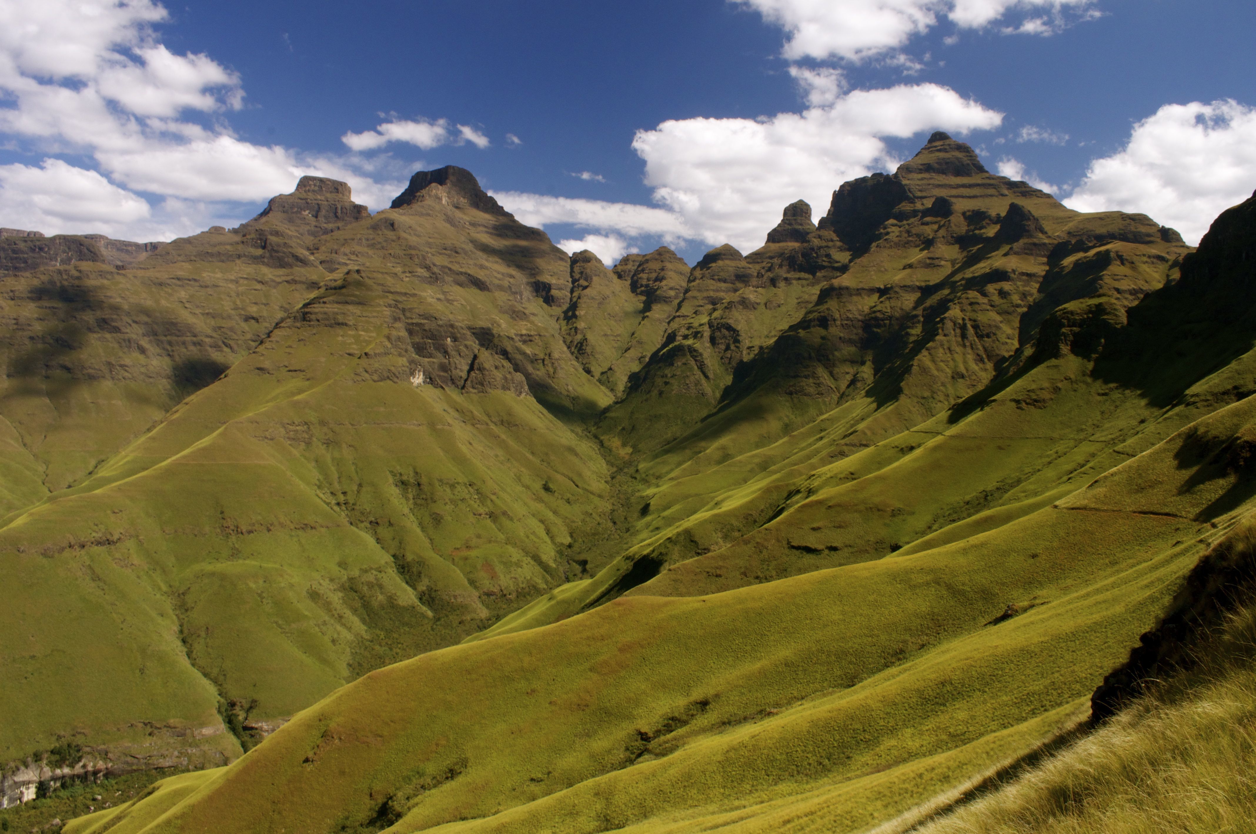




This is part of the....
Geosphere
Atmosphere
Hydrosphere
Biosphere