Worksheets
Exploring Georgia's Geography and Climate
Total questions: 75
Worksheet time: 57mins
Which river forms part of the border between Georgia and Alabama?
Savannah River
Chattahoochee River
Ocmulgee River
Flint River
What is the largest geographic region in Georgia by area?
Coastal Plain
Piedmont
Blue Ridge
Ridge and Valley
Which climate zone covers most of Georgia?
Humid Continental
Tropical Rainforest
Humid Subtropical
Desert
Which river flows into the Atlantic Ocean and forms part of the border between Georgia and South Carolina?
Flint River
Savannah River
Oconee River
Altamaha River
Which region of Georgia is known for its mountainous terrain?
Piedmont
Blue Ridge
Coastal Plain
Ridge and Valley
Which of the following is a major agricultural product of Georgia that benefits from the state's climate?
Oranges
Peaches
Bananas
Coffee
Which river is NOT considered one of Georgia’s major rivers?
Ocmulgee River
Mississippi River
Flint River
Altamaha River
Which geographic region of Georgia is located between the Blue Ridge and the Appalachian Plateau?
Piedmont
Ridge and Valley
Coastal Plain
Fall Line
Which mineral resource is mined in the Blue Ridge region of Georgia?
Coal
Marble
Oil
Salt
Why is the Piedmont region important for Georgia’s population and economy?
It is mostly uninhabited
It contains major cities and industries
It is covered by forests only
It is used only for mining
How does Georgia’s humid subtropical climate affect its agriculture?
It limits the growing season
It allows for a long growing season and diverse crops
It causes frequent droughts
It prevents any farming
Which natural resource is most important for Georgia’s paper industry?
Timber
Gold
Granite
Oil
What is the main reason the Coastal Plain region is suitable for farming?
High elevation
Fertile soil and flat land
Rocky terrain
Cold temperatures
How does the presence of major rivers benefit Georgia’s economy?
They provide drinking water only
They support transportation, agriculture, and industry
They are used only for recreation
They have no economic impact
Which region of Georgia is most likely to experience cooler temperatures and more rainfall?
Coastal Plain
Blue Ridge
Piedmont
Ridge and Valley
How does the Fall Line affect the development of cities in Georgia?
It has no effect
It provides a natural boundary for city growth
It led to the development of cities due to water power for mills
It is a tourist attraction only
Which of the following best explains why peanuts are a major crop in Georgia?
The state has a cold climate
The soil and climate are ideal for peanut growth
Peanuts require high elevation
Peanuts grow only in forests
How does Georgia’s location near the Atlantic Ocean influence its climate?
It causes extremely cold winters
It moderates temperatures and increases humidity
It leads to desert conditions
It prevents rainfall
A farmer in the Coastal Plain region wants to grow a crop that requires a long, warm growing season and plenty of rainfall. Which crop should they choose and why?
Wheat, because it grows best in cold climates
Peanuts, because the region’s climate and soil are ideal for them
Apples, because they need high elevation
Grapes, because they require dry conditions
Suppose a drought occurs in Georgia’s Piedmont region. What impact might this have on the region’s agriculture and water supply, and what could farmers do to address these challenges?
No impact; farmers do not need water
Reduced crop yields and water shortages; farmers could use irrigation and water conservation methods
Increased crop yields; farmers could plant more crops
No change; the region is always dry
A company wants to build a granite quarry in Georgia. Which region should they consider and why?
Blue Ridge, because it has large granite deposits
Piedmont, because it is known for granite resources
Coastal Plain, because it is flat
Ridge and Valley, because it has coal
If the climate in Georgia became significantly drier, what would be the likely impact on the state’s agriculture and natural resources?
Increased crop production and more forests
Decreased crop yields and stressed water resources
No change in agriculture
More rainfall and flooding
A city planner is deciding where to build a new city in Georgia. Which geographic factors should they consider, and why?
Only the color of the soil
Access to water, transportation routes, and natural resources for economic growth
The number of trees only
The region’s distance from the ocean only
A severe hurricane hits Georgia’s Coastal Plain. What are some possible effects on the region’s agriculture and infrastructure?
No effect; hurricanes do not impact land
Flooding, crop damage, and destruction of roads and buildings
Increased crop yields
More mountains form
A student is comparing the Ridge and Valley region to the Piedmont region. What differences in land use and economic activity might they find, and why?
Both regions are used only for mining
Ridge and Valley focuses on farming and forestry, while Piedmont has more industry and urban areas due to its location and resources
Both regions are deserts
Piedmont is only used for recreation
If a new dam is built on the Chattahoochee River, what are some potential positive and negative impacts on Georgia’s environment and economy?
Only positive impacts; no negatives
Positive: more electricity and water supply; Negative: possible habitat loss and changes to river flow
Only negative impacts; no positives
No impact at all
A group of farmers in the Blue Ridge region wants to increase their crop production. What challenges might they face due to the region’s geography and climate, and what solutions could they try?
No challenges; the region is perfect for all crops
Steep slopes and heavy rainfall can cause soil erosion; they could use terracing and cover crops to prevent erosion
Too much flat land; they could build hills
Lack of water; they could dig wells

Which central region is shown in this picture?
Coastal Plains
Piedmont
Blue Ridge Mountains
Valley & Ridge
Appalachian Plateau

What color is the Piedmont on this map?
blue
green
yellow
orange

What color is the Appalachian Plateau on this map?
red
orange
yellow
green

What color is the Ridge and Valley on this map?
red
orange
yellow
blue

What color is the Blue Ridge region on this map?
blue
green
orange
yellow

Which region is directly north of the Coastal Plain?
Appalachian Plateau
Valley and Ridge
Blue Ridge Mountains
Piedmont
What continent is Georgia located on?
United States
North America
U.S.A
South America
This region is located in north-central Georgia, west of the Blue Ridge region & is known for its narrow peaks and open flat land in between.
Appalachian Plateau
Blue Ridge
Valley and Ridge
Piedmont
Coastal Plain
This region is located in the middle/central area of the state, the name of this region means foot of the mountains, it is the most populous region in the state.
Piedmont
Valley and Ridge
Coastal Plain
Appalachian Plateau
Blue Ridge
Which of the following is located in the northwest corner of the state also known as the "Tag" corner, it is also the smallest region & only producer of coal in the state.
Blue Ridge
Coastal Plain
Appalachian Plateau
Ridge and Valley
Which region is the largest in Georgia?
Appalachian Plateau
Blue Ridge Mountains
Coastal Plains
Piedmont
The Piedmont region is made of type of land?
low rolling hills and flat areas with trees
sandy beaches and the ocean
mountains and rivers
swamps and wetlands

What is the largest geographic region that takes up to 60% of the state?
Appalachian Plateau
Valley and Ridge
Blue Ridge
Piedmont
Coastal Plain
What boundary that separates the Piedmont and the Coastal Plain?
Mississippi River
Barrier Islands
Fall Line
Appalachian Mountains

3. What physical feature of Georgia is located at #8 on the map?
Barrier Islands
Okefenokee Swamp
Fall Line
Savannah River
What is a major river in Georgia that serves as the GA-SC border, is important to shipping, and is along which the first English settlements in Georgia were established?
Oconee River
Savannah River
Mississippi River
Chattahoochee River

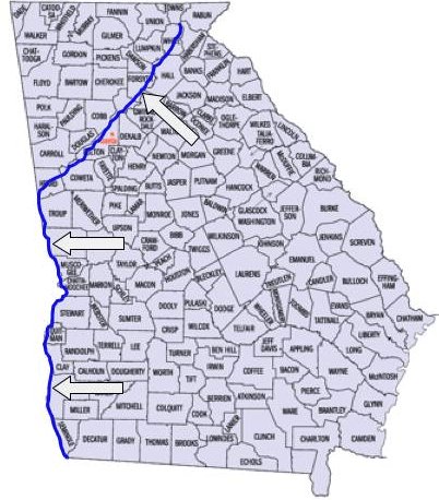
Which physical feature is an important source of water for the state that forms part of the border between Georgia and Alabama?
Chattahoochee
Coosa
Flint
Savannah
Forts were built here to defend the early settlement of Georgia:
Savannah River
Barrier Islands
Appalachian Mountains
Chattahoochee River
What region produces the most agriculture (farming) in the state?
Coastal Plains
Piedmont
Appalachian Plateau
Ridge and Valley
Blue Ridge
What region is the business/industry center of Georgia located in?
Coastal Plains
Piedmont
Appalachian Plateau
Ridge and Valley
Blue Ridge

What is relative location?
Where a place is compared to another place.
Where a place is as defined by latitude and longitude.
The location of a star on a map.
The location of oceans and continents.
The mountain chain that reaches into northern Georgia is the
Ozarks.
Rockies.
Shenandoah.
Appalachians.
Which of the following is true regarding Georgia's barrier islands?
They protect the mainland from erosion.
They feature most of the state's waterfalls.
The public is not allowed to visit any of the islands.
They receive more snowfall than any other region.
Which region of Georgia has the highest population? (Hint: Think about where Georgia's capital city is located.)
Blue Ridge
Valley and Ridge
Piedmont
Coastal Plain
Which industry would be MOST affected by Georgia's mild climate?
agriculture
chemical
mining
transportation
How is Georgia's overall climate best described?
wet and hot
dry and hot
dry and cold
humid and mild
Georgia is located in the following hemispheres
Southern and Western
Northern and Western
Southern and Eastern
Northern and Eastern
Which of the following is the best description of the geography of the state of Georgia?
Elevation tends to be higher in the southern regions of the state and lower in the northern regions.
The highest elevation is located at the Fall Line in the middle of the state.
Georgia’s terrain is almost flat and the elevation does not change much at all.
Elevation tends to be higher in the northern regions of the state and lower in the southern regions.
Which region of Georgia produces the most agriculture in the state, including peanuts, peaches, and cotton?
Appalachian Plateau
Blue Ridge
Coastal Plain
Valley and Ridge
Which of the following best defines Brasstown Bald?
Georgia's highest mountain, at 4,784-foot-high. located in the Blue Ridge region
The point at which hilly or mountainous lands meet the coastal plain. This was once the shoreline of an ancient ocean.
The third largest physiographic region located in northeast Georgia has Georgia's highest point and the start of the Appalachian Trail.
How does Georgia’s relatively mild climate contribute to the state’s economy?
The economy benefits because of good rainfall and poor farming.
The economy suffers because the temperature varies too much.
The economy suffers because of the lack of good growing soils
The economy benefits because of good farming areas and good year long tourist spots
Textile and carpet industries dominate which region?
Piedmont
Blue Ridge
Ridge & Valley
Appalachian Plateau
Coastal Plains

Based on the map, answer the following question.
What region of the United States is Georgia located?
Northeastern
Northwestern
Southeastern
Southwestern
This river is known for its shipping ability to Augusta. It also creates the border with South Carolina.
Chattahoochee
Fall Line
Okefenokee Swamp
Savannah
This physical feature is a natural boundary between the Coastal Plain and Piedmont. It has many waterfalls and early settlers created many modern day cities on it.
Okefenokee Swamp
Chattahoochee
Fall Line
Savannah
Do our transportation systems have to work together in order to bring goods and services to our states?
True
False
Which ocean borders Georgia's coast?
Pacific
Indian
Artic
Atlantic
Which industry would most likely suffer from a drought in Georgia?
Farming
The hospitality industry
Trade
Airline
Why is the Fall Line important?
It was the first boundary in GA
It was an important source of power due to change in elevation
It was once home to major cities that have been abandoned
It was a dividing line between the north and the south during the Civil War
Georgia is located which direction from the equator?
North
South
East
West

Where is the state of Georgia located?
in the Southern and Western Hemispheres
in the Northern and Western Hemispheres
. in the Southern and Eastern Hemispheres
in the Northern and Eastern Hemispheres

Based on your knowledge of Georgia, where are these cities located?
the Piedmont region
the Valley and Ridge region
the Blue Ridge region
the Coastal Plain region

In which region of Georgia did one of the first gold rushes in the United States takes place?
region I
region II
region III
region Iv