
Font size
 Worksheets
Map Skills Reference Guide: Compass Rose – Finding Direction
Total questions: 82
Worksheet time: 46mins
According to the Map Skills Reference Guide, which of the following are the cardinal directions?
North, East, South, West
Up, Down, Left, Right
North, South, Up, Down
East, West, Left, Right
According to the Map Skills Reference Guide, what does the compass rose help you do?
Helps you describe where things are located
Shows the population of a city
Measures the distance between two points
Identifies the types of landforms
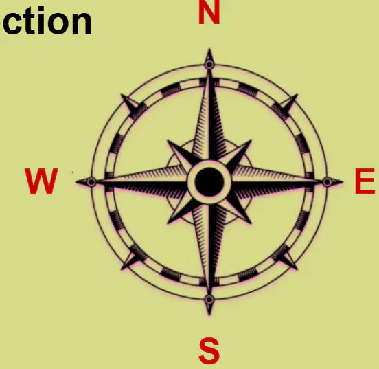
Look at the compass rose diagram. Which direction is labeled with the letter 'N'?
North
South
East
West
According to the Map Skills Reference Guide, fill in the blank: The four cardinal directions are North, East, South, and _____
West
Up
Left
Forward
What is the intermediate direction represented by NE?
Northeast
Northwest
Southeast
Southwest
What is the intermediate direction represented by SE?
Southeast
Southwest
Northeast
Northwest
What is the intermediate direction represented by SW?
Southwest
Southeast
Northwest
Northeast
What is the intermediate direction represented by NW?
Northwest
Northeast
Southwest
Southeast
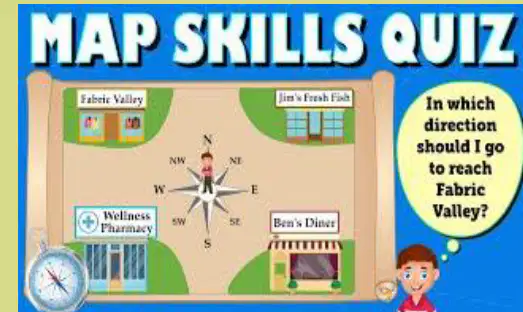
Map Skills Quiz: In which direction should I go to reach Fabric Valley?
Northeast
Southeast
Southwest
Northwest

Look at the town map. Which building is labeled as 'HOSPITAL'?
School
Hospital
Store
Police Station
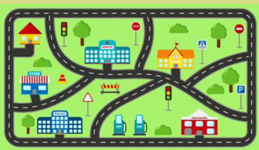
What is the function of the building labeled 'FIRE STATION'?
The function of the Fire Station is to respond to fires and emergencies.
The function of the Fire Station is to sell groceries to the public.
The function of the Fire Station is to provide education to students.
The function of the Fire Station is to treat sick animals.
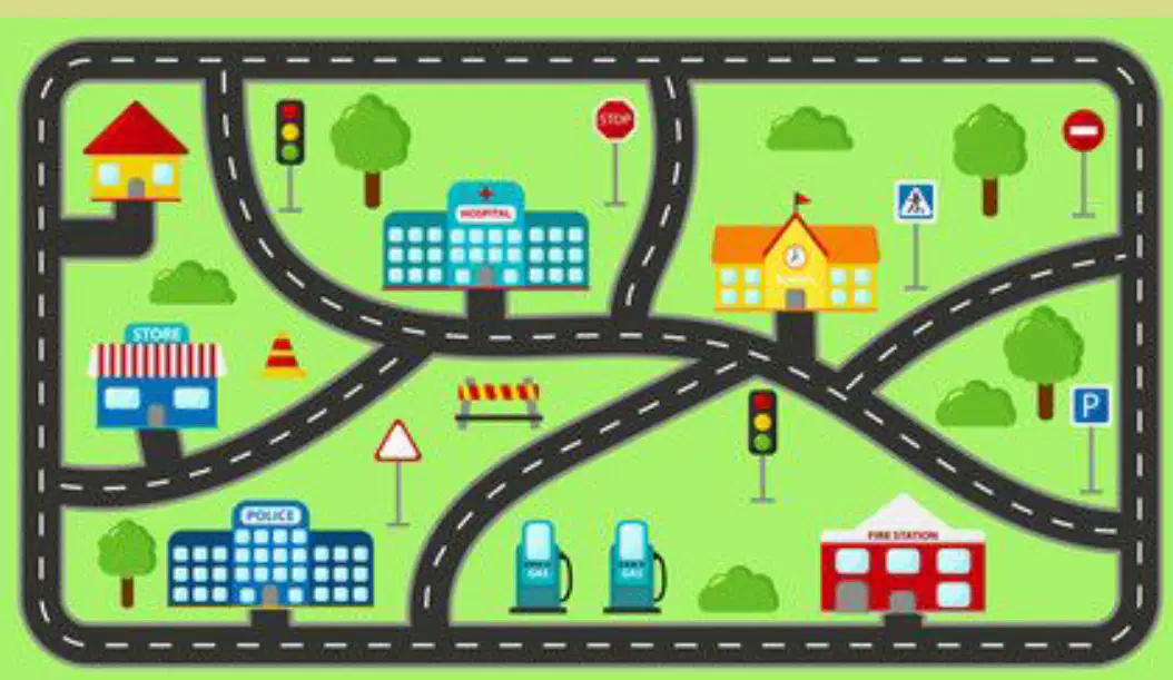
Look at the town map. Which sign means 'STOP'?
Red circle with a white line
Red octagon with 'STOP' written on it
Blue square with 'P'
Yellow triangle

Look at the town map. Fill in the blank: The building where you go to learn is called the _______.
School
Hospital
Library
Post Office
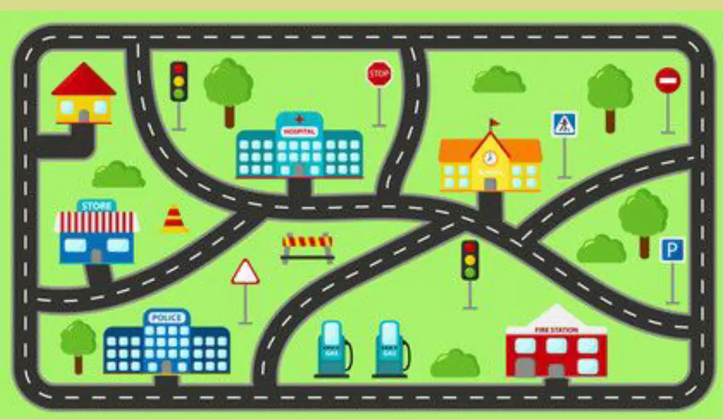
Look at the town map. Which building is next to the gas station?
Fire Station
Store
Police Station
Hospital
What do the letters and numbers in a map grid represent?
A) Letters represent rows and numbers represent columns
B) Letters represent columns and numbers represent rows
C) Both letters and numbers represent columns
D) Both letters and numbers represent rows
How are locations found on a map with a grid?
By using colors
By using coordinates like B2 or C3
By using shapes
By using directions only
Fill in the blank: The lake is at ___; the town is at B3.
C1
A2
D4
B1
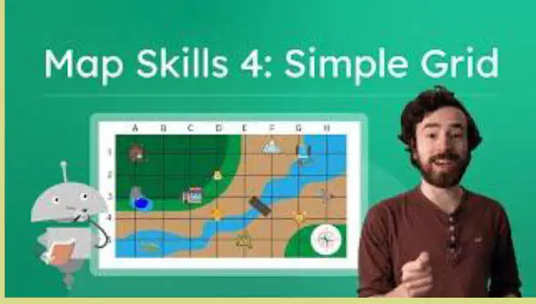
On a map grid, the location B2 means column B and row 2.
True
False
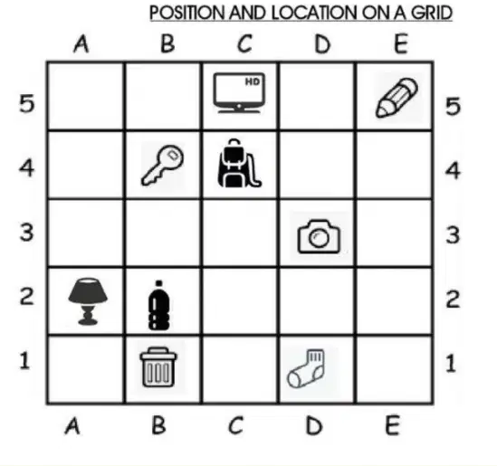
The ______ is at D3.
camera
table
lamp
computer
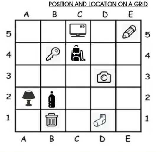
The position of ______ is at A2.
lamp
table
chair
sofa
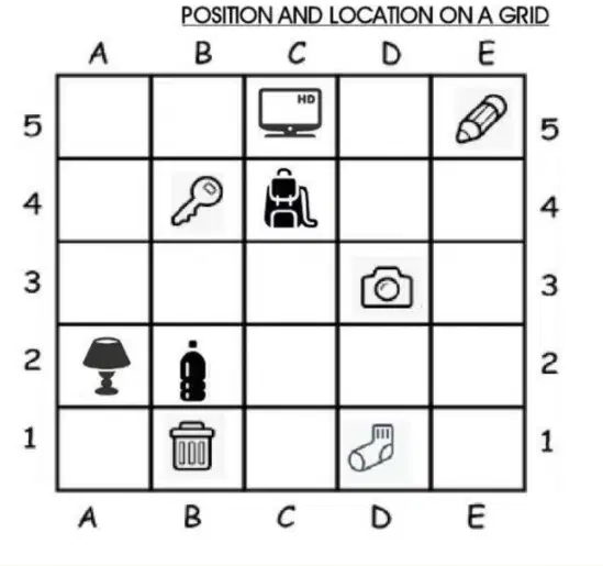
The ______ is at C5.
TV
Sofa
Lamp
Table
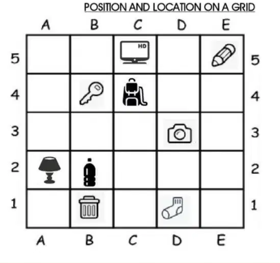
The location of the rubbish bin on the grid is at ______.
B1
A2
C3
D4
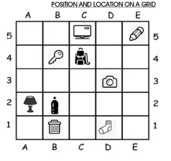
The pencil is located at ______.
E5
B2
C3
D4
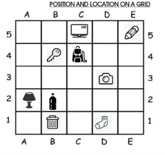
What is the location of the key on the grid? It is located at ______.
B4
A2
C3
D1
What are natural features?
Created by nature (rivers, mountains, forests)
Made by or related to people (languages, religions, customs)
Boundaries or places made by governments (countries, states, cities)
What are cultural features?
Created by nature (rivers, mountains, forests)
Made by or related to people (languages, religions, customs)
Boundaries or places made by governments (countries, states, cities)
What are political features?
Created by nature (rivers, mountains, forests)
Made by or related to people (languages, religions, customs)
Boundaries or places made by governments (countries, states, cities)
The Mississippi River is an example of a ______ feature.
natural
artificial
historical
cultural
The U.S.–Canada border is an example of a ______ feature.
political
physical
climatic
cultural
An English language area is an example of a ______ feature.
cultural
physical
economic
political
Which type of map shows mountains and rivers?
Physical map
Political map
Resource map
Economic map
Which type of map shows cities and borders?
Physical map
Political map
Resource map
Economic map
Which type of map shows natural resources like coal or oil?
Physical map
Political map
Resource map
Economic map
Which type of map shows trade routes and industries?
Physical map
Political map
Resource map
Economic map
A blue wavy line on a map usually means a _______.
river
mountain
road
forest
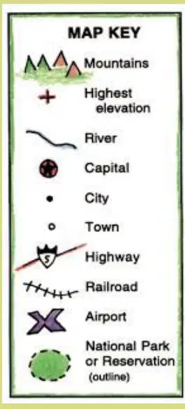
What does a shield symbol on a map key usually represent?
Highway
Hospital
School
Park
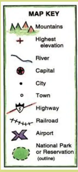
What does a red dot on a map key usually represent?
Capital
River
Mountain
Desert
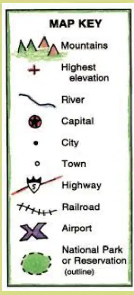
What does a black dot on a map key usually represent?
City
River
Mountain
Forest
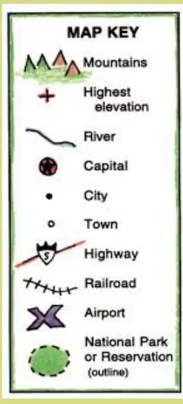
What does a circle symbol on a map key usually represent?
Town
River
Mountain
Forest
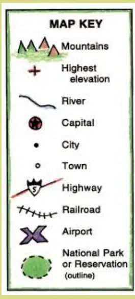
What does an X symbol on a map key usually represent?
Airport
Hospital
School
Library
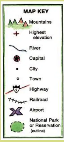
What does a green bush outline on a map key usually represent?
National Park or Reservation (outline)
River
Highway
Mountain Peak
What does a map scale show?
The color of the map
The ratio of distance on the map to real-world distance
The height of mountains
The population of a city
Fill in the blank: 1 inch = 5 miles means 1 inch on the map equals ____ miles in real life.
5
1
10
50
According to the instructions, what should you use to measure distance on a map before multiplying by the scale?
A compass
A ruler
A calculator
A pencil
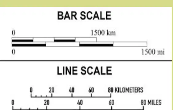
Refer to the diagrams labeled 'BAR SCALE' and 'LINE SCALE'. Which of the following is a type of map scale shown in the image?
Pie chart
Bar scale
Line scale
Both B and C
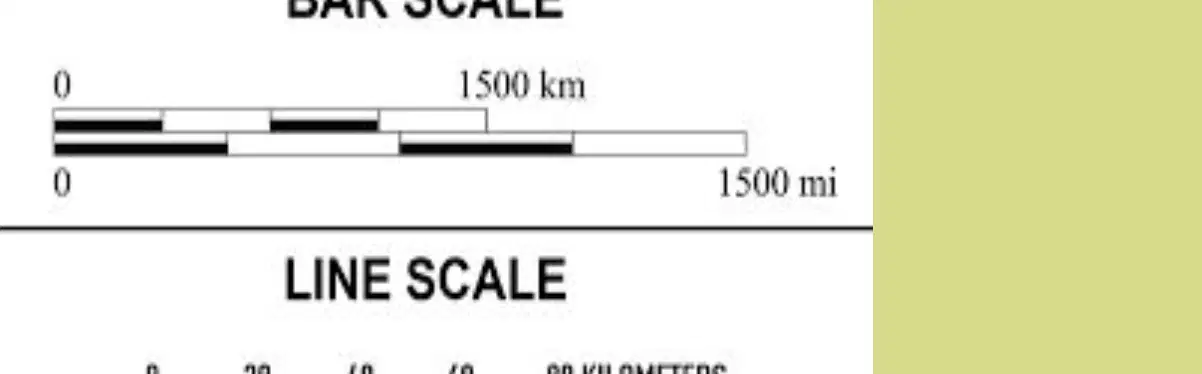
What are the two types of map scales shown in the image?
Bar scale and Pie scale
Bar scale and Line scale
Line scale and Circle scale
Pie scale and Circle scale
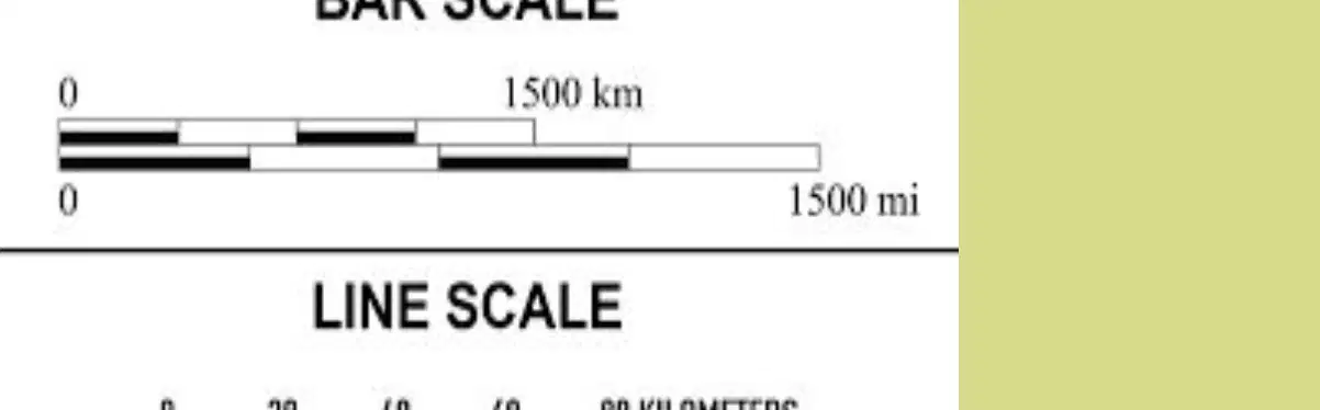
In the bar scale shown in the image, what is the maximum distance represented in kilometers?
1500 kilometers
500 kilometers
1000 kilometers
2000 kilometers

In the line scale shown in the image, what is the maximum distance represented in miles?
80 miles
40 miles
100 miles
60 miles
Using a Map to Explain Impact of Geography on Historical and Current Events Geography influences where people ______ and how they live. (Fill in the blank)
settle
travel
eat
vote
Using a Map to Explain Impact of Geography on Historical and Current Events Rivers provide ______ and trade routes; mountains can protect or isolate.
water
electricity
sand
oil
Using a Map to Explain Impact of Geography on Historical and Current Events Many cities grow near rivers because water supports life and trade.
True
False
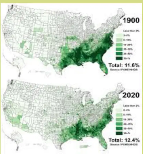
Has the total percentage of the population living in the highlighted areas increased or decreased from 1900 to 2020?
Increased
Decreased
What should you look for on maps to make conclusions?
Patterns and trends
Colors and shapes
Names and dates
Roads and highways
More people live near water or in ______ areas.
flat
mountainous
desert
forest
This helps us understand human ______ and natural features.
behavior
color
height
taste
What does the word 'natural' refer to in the context of maps?
Features created by humans
Features found in nature
Features on a map key
Features with labels
What direction do latitude lines run?
North–South
East–West
Up–Down
Diagonal
Latitude lines measure how far ______ or ______ a place is from the Equator (0°).
north, south
east, west
up, down
left, right
Longitude lines run ______–______ and measure east or west from the Prime Meridian (0°).
north–south
east–west
up–down
diagonal–horizontal
What is the reference line for measuring longitude?
Equator
Prime Meridian
Tropic of Cancer
International Date Line
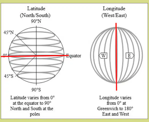
What is the value of latitude at the Equator?
90°
45°
0°
180°
Maps change over time due to which of the following reasons?
City growth
Border changes
Environmental changes
All of the above
Political maps show ______, while physical maps show ______.
borders, landforms.
rivers, capitals.
mountains, cities.
climates, populations.
Comparing old and new maps helps us understand history and trends.
True
False
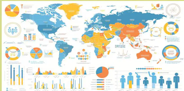
Maps combined with data like rainfall charts or population graphs help explain what?
Historical events
Trends
Languages
Borders
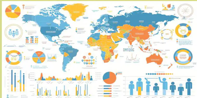
A rainfall chart plus a farmland map shows why certain crops grow in some areas.
True
False
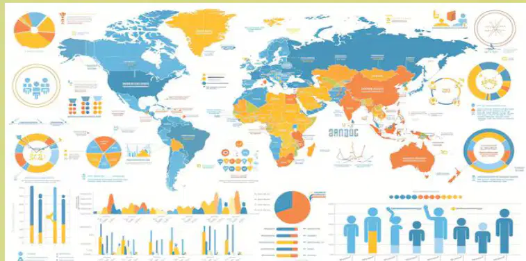
Fill in the blank: Maps combined with data like _______ charts or population graphs help explain trends.
rainfall
temperature
elevation
distance
Which of the following tools help track changes and trends in geography?
Google Maps
Google Earth
GIS (Geographic Information Systems)
All of the above
Fill in the blank: Tools like Google Maps, Google Earth, and GIS (Geographic Information Systems) help track ______ and trends.
changes
locations
distances
directions
Geographic technology tools can show how cities expand, forests shrink, or rivers change.
True
False
What are the five themes of geography?
Location, Place, Human-Environment Interaction, Movement, Region
Latitude, Longitude, Climate, Culture, Economy
Mountains, Rivers, Cities, Countries, Continents
Weather, Population, Language, Technology, Government
Which theme of geography is described as 'Where is it?' and includes absolute and relative location?
Location
Place
Region
Movement
Which theme of geography asks 'What is it like there?' and includes physical and human features?
Place
Region
Movement
Location
Which theme of geography is about how people and environment affect each other?
Human-Environment Interaction
Location
Movement
Region
Which theme of geography is about how people, goods, and ideas move?
Movement
Region
Location
Place
Which theme of geography refers to areas with similar features?
Region
Location
Movement
Place
The difference between absolute and relative location is:
Absolute location is a fixed point using coordinates, while relative location describes a place in relation to other places.
Absolute location is always changing, while relative location is fixed.
Relative location uses coordinates, while absolute location uses landmarks.
Absolute location is based on time zones, while relative location is based on climate.
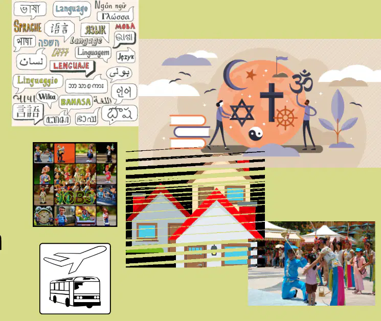
What are examples of characteristics that are part of human geography? Fill in the blank with the correct characteristics.
Language, religion, culture, homes, jobs, transportation.
Mountains, rivers, oceans, valleys, deserts.
Planets, stars, galaxies, black holes, comets.
Atoms, molecules, elements, compounds, reactions.
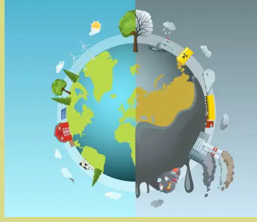
Why is it important to study the relationship between people and their environment? Fill in the blank: It is important to study the relationship between people and their environment to understand how people ______ to and ______ the environment, and ______ problems like pollution.
adapt, change, solve
ignore, avoid, create
destroy, harm, worsen
observe, copy, increase

Look at this map, if Whatville and Whereville are drawn 3 inches apart in the picture, how far apart are they actually in real life?
20 miles
1 inch
3 inches
60 miles

Look at the map. What map element measures the distance between locations?



