wayground logo

Free Printable Worksheets

Font size

S
M
L
XL
Worksheets

U1-Ch2: Checkpoint

Total questions: 30

Worksheet time: 21mins
Name
Class
Date
1.
What is the most accurate way to show the earth?
a)
a globe
b)
a map
c)
a picture
d)
a painting
2.
A Global Positioning System (GPS) helps people locate places based on data from __________.
a)
satellites
b)
sailboats
c)
airplanes
d)
projections
3.
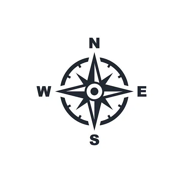
Which part of a map is shown in the graphic?
a)
map title
b)
compass rose
c)
scale bar
d)
map key
4.
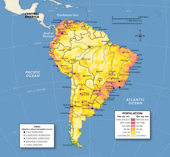
How would a geographer use this map? Select all that apply.
a)
to chart the migration patterns of birds
b)
to look for patterns in population density
c)
to compare the terrain of different regions
d)
to examine how fast a population grows or shrinks over time
5.
Which of the following is NOT a theme of Geography?
a)
Oceans
b)
Movement
c)
Regions, Location, and Place
d)
Human-Environment Interactions
6.
How was entrepreneurship shown in early civilizations?
a)
finding good land and freshwater
b)
trading goods to earn a profit
c)
working for their king on large projects
d)
by not having taxes
7.
What are goods shipped out of the country called?
a)
exports
b)
imports
c)
barter
d)
globalization
8.
What are goods bought from other countries called?
a)
exports
b)
barter
c)
imports
d)
globalization
9.
What is the picture below an example of?
a)
export
b)
import
c)
barter
d)
inflation
10.
Which of the statements below is correct?
a)
Lines of longitude measure distance north and south of the Equator
b)
Lines of latitude measure distance east and west of the Prime Meridian
c)
The Equator cuts the world into a Northern and Southern Hemisphere
d)
The Prime Meridian cuts the world into a Northern and Southern Hemisphere
11.
The following map is an example of a...
a)
Physical Map
b)
Political Map
c)
Special-Purpose Map
12.
The following map is an example of a...
a)
Physical Map
b)
Political Map
c)
Special-Purpose Map
13.
The United States is an example of a...
a)
Market Economy
b)
Mixed Economy
c)
Traditional Economy
d)
Command Economy
14.
Select the 3 branches of the United States Government
a)
Legislative
b)
Federal
c)
Executive
d)
Judicial
e)
Treasury
15.
Each branch of the United States Government has different powers. We call these_______________and they help to make sure no one person of branch gets to much power.
a)
Checks and Balances
b)
Safety measures
c)
Democrats and Republicans
d)
State and Federal
16.
In America we elect people to vote on our behalf (for us) so that we don't have to go to Washington D.C. or Lansing every time the government takes action on something. This is called a
a)
Representative government
b)
Direct Democracy
c)
Government voting
d)
Monarchy
17.
What is the Relative Location of the Gulf of Mexico?
a)
west of Houston
b)
85 degrees W by 27 degrees N
c)
85 degrees N by 27 degrees W
d)
west of Miami
18.
Absolute and relative are two ways of describing the theme of...
a)
regions
b)
movement
c)
location
d)
human environment interaction
19.
The imaginary line that runs through the middle of the earth east and west is called?
a)
Prime Meridian
b)
Equator
c)
Date Line
20.

Which of these IS NOT a theme of Geography?

a)

Movement

b)

Location

c)

Interaction

d)

Region

21.

What are the 5 Themes of Geography?

a)

Movement, Region, Human Environment Interaction, Location, and Place

b)

Movement, climate, Location, Place, and Human Environment Interaction

22.
The statement:  "The Eiffel Tower is located at 48.8584° N, 2.2945° E," is an example of which of the 5 Themes of Geography?
a)
Movement
b)
Region
c)
Place
d)
Location
23.

Eurasia is comprised of which two numbers?

a)

1

b)

2

c)

3

d)

4

e)

5

24.

What type of map is this?

a)

Political

b)

Physical

c)

Road

d)

Thematic

25.

Emma and her family are flying to the United Kingdom for their winter vacation. From there, they will board a plane that will take them to Italy. In which region on this map will Emma and her family be traveling?

a)

I

b)

II

c)

III

d)

IV

26.

What is this an example of?

a)

compass rose

b)

physical map

c)

map grid

d)

map key

27.

What tool would you use to measure the distance between two places on a map?

a)

key

b)

legend

c)

scale

d)

grid

28.

A map key is

a)

a region.

b)

a place used to locate trees.

c)

a box on a map in which all the symbols are explained.

d)

something use to open a treasure box holding maps.

29.
The science of map making is known as...
a)
Geology
b)
Mapology
c)
Cartography
d)
Earth Writing
30.
In the grid system used to map locations on Earth's surface, lines parallel to the Equator are called
a)
latitudinal lines
b)
geometric lines
c)
barometric lines
d)
longitudinal lines