


7th Grade Plate Boundary Quizzes
Test your understanding of plate boundaries with this comprehensive Grade 7 quiz that covers the three main types of tectonic plate interactions and their geological effects. Practice identifying convergent, divergent, and transform boundaries while receiving instant feedback to strengthen your Earth science knowledge.

20 questions
Plate Motion: Plate Boundaries

Quiz
•
7th Grade

20 questions
Tectonic Plates
Quiz
•
7th Grade
14 questions
Plate Tectonics Boundary Quiz
Quiz
•
7th Grade

19 questions
Tectonic Plate Boundaries Makeup
Quiz
•
7th Grade

18 questions
051 EL 2 Exam - Earth's Layers/Plate Tectonics
Quiz
•
7th Grade

20 questions
7.10B Divergent Boundaries CCA Review
Quiz
•
7th Grade
25 questions
Plate Tectonics & Crustal Features
Quiz
•
7th Grade
22 questions
TEST: Plate Tectonics
Quiz
•
7th Grade
10 questions
Plate Boundary (Kesler)
Quiz
•
7th Grade
16 questions
plate boundaries & landfeatures
Quiz
•
6th - 8th Grade
10 questions
Plate Tectonics Review
Quiz
•
6th - 8th Grade
13 questions
ES-2.1-Plate Tectonics Open-Notes Quiz
Quiz
•
6th - 8th Grade
Explore 7th Grade Plate Boundary Quizzes
Plate boundary concepts form a cornerstone of Grade 7 Earth and Space Science education, helping students understand the dynamic processes that shape our planet's surface. These comprehensive quiz collections available through Wayground provide targeted assessment opportunities that allow seventh-grade students to demonstrate their understanding of convergent, divergent, and transform plate boundaries. The practice questions systematically evaluate students' grasp of tectonic processes, including seafloor spreading, subduction zones, and fault systems, while providing immediate feedback that reinforces correct understanding and identifies areas requiring additional study. Through varied question formats and difficulty levels, these quizzes develop critical thinking skills as students analyze geological evidence, predict earthquake and volcanic activity patterns, and connect plate movement to real-world geological phenomena. Wayground's extensive library of millions of teacher-created resources ensures educators have access to high-quality plate boundary quizzes that align with state and national science standards. The platform's robust search and filtering capabilities enable teachers to quickly locate assessments that match specific learning objectives, from basic plate boundary identification to complex analysis of tectonic interactions. Customization tools allow instructors to modify existing quizzes or create personalized assessments that address individual student needs, supporting both remediation for struggling learners and enrichment for advanced students. The flexible digital delivery system accommodates various classroom environments, whether used for formative assessment during instruction, summative evaluation of unit mastery, or independent practice assignments, making it an invaluable resource for reinforcing plate boundary concepts and supporting differentiated Earth and Space Science instruction.
FAQs
How do I teach the three types of plate boundaries to middle school students?
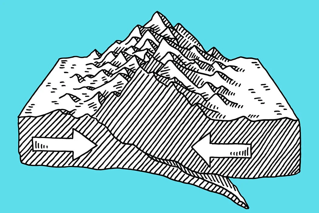
Start by anchoring each boundary type to a concrete real-world example: the Mid-Atlantic Ridge for divergent boundaries, the Himalayas for convergent boundaries, and the San Andreas Fault for transform boundaries. Use cross-section diagrams to show plate movement direction and the resulting landforms or geological events at each boundary. Having students predict outcomes — such as whether a subduction zone or a mountain range will form — before confirming with evidence builds the analytical thinking this topic requires.
What exercises help students practice identifying plate boundary types?
Effective practice asks students to classify boundaries based on geological evidence rather than just memorizing definitions. Exercises that present a set of clues — such as the presence of a deep ocean trench, a rift valley, or lateral fault scarps — and ask students to identify the boundary type mirror the reasoning geologists actually use. Practice problems that require students to connect boundary type to resulting landform or seismic activity deepen understanding beyond surface-level recall.
What mistakes do students commonly make when learning about plate boundaries?
The most common error is confusing convergent boundary subtypes: students frequently mix up ocean-ocean, ocean-continent, and continent-continent collisions, not realizing each produces different outcomes such as island arcs, subduction trenches, or folded mountain ranges. Students also tend to treat transform boundaries as less significant, overlooking that they produce major earthquakes without creating or destroying crust. Targeted practice that explicitly contrasts these scenarios helps students build more precise mental models.
How can I use plate boundary quizzes to support students who struggle with tectonic concepts?
For students who struggle, focus first on movement direction — whether plates are moving apart, together, or past each other — before introducing landform outcomes. Simplified diagrams with labeled arrows reduce cognitive load and give struggling learners a reliable visual anchor. On Wayground, teachers can apply accommodations such as reduced answer choices and read-aloud support to individual students, making the same quiz accessible at different levels without requiring separate materials.
How do I use Wayground's plate boundary quizzes in my classroom?
Wayground's plate boundary quizzes are available as printable PDFs for traditional classroom distribution and in digital formats for technology-integrated or hybrid learning environments. Teachers can also host quizzes as a quiz directly on Wayground, enabling real-time student responses and automatic grading. All quizzes include complete answer keys, so they work equally well for guided practice, independent review, or formative assessment without additional preparation.
How do plate boundary quizzes connect to real-world geological events?
Plate boundary quizzes that incorporate real-world examples — such as mapping the location of recent earthquakes or volcanic eruptions onto a plate boundary diagram — make abstract tectonic theory concrete and memorable. Students who can link the 2011 Tōhoku earthquake to a convergent oceanic boundary, or Icelandic volcanism to a divergent mid-ocean ridge, demonstrate a deeper conceptual understanding than those who only know boundary names. This application-level thinking is also what most standardized assessments in Earth science require.

Accessibility
Features
Wayground Super
School & District
Wayground for Business
Create a quiz
Create a presentation
Wayground AI
Subjects
Mathematics
Social Studies
Science
Physics
Chemistry
Biology
About
Our Story
Wayground Blog
Media Kit
Careers
Support
F.A.Q.
Help & Support
Privacy Policy
Terms of Service
Teacher Resources
2026 Wayground


Get our app

