
Topographic Maps Quizzes
Test your knowledge of topographic maps with this comprehensive geography quiz designed to assess your understanding of contour lines, elevation, and map interpretation. Practice identifying landforms and terrain features through self-paced questions with instant feedback to strengthen your cartographic skills.
31 questions
Topographic Maps
Quiz
•
7th - 12th Grade

16 questions
Topographic Maps
Quiz
•
8th Grade

8 questions
Topographic maps
Quiz
•
6th - 9th Grade

22 questions
Topographic Maps Contour Interval
Quiz
•
8th Grade
20 questions
Understanding Topographic Maps Quiz
Quiz
•
7th Grade

19 questions
Types of Maps
Quiz
•
6th - 8th Grade
10 questions
Maps
Quiz
•
7th Grade
11 questions
Maps and Map Tools
Quiz
•
5th Grade
Explore Topographic Maps Quizzes
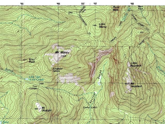
Topographic maps represent a fundamental component of geographic literacy, requiring students to interpret elevation changes, contour lines, and three-dimensional terrain features on two-dimensional surfaces. Wayground's comprehensive collection of topographic map quizzes provides structured assessment opportunities that develop critical spatial reasoning skills and geographic analysis capabilities. These practice questions challenge students to read elevation data, identify landforms, calculate gradient and relief, and understand how human activities interact with physical terrain. Through targeted feedback and systematic understanding checks, students build confidence in interpreting the symbolic language of topographic mapping while strengthening their ability to visualize landscape characteristics from cartographic representations. Wayground supports geography educators with access to millions of teacher-created topographic mapping resources that can be efficiently discovered through robust search and filtering capabilities. Teachers can align quiz content with curriculum standards while utilizing differentiation tools to customize difficulty levels, question types, and assessment formats for diverse learning needs. The platform's flexible digital delivery system enables immediate scoring and data analysis, allowing educators to identify knowledge gaps in contour interpretation, elevation reading, and landform recognition for targeted remediation. These comprehensive quiz collections support both formative assessment during initial instruction and summative evaluation of topographic mapping competencies, while providing enrichment opportunities for advanced students ready to tackle complex terrain analysis challenges.
Accessibility
Features
Wayground Super
School & District
Wayground for Business
Create a quiz
Create a presentation
Wayground AI
Subjects
Mathematics
Social Studies
Science
Physics
Chemistry
Biology
About
Our Story
Wayground Blog
Media Kit
Careers
Support
F.A.Q.
Help & Support
Privacy Policy
Terms of Service
Teacher Resources
2026 Wayground


Get our app

