
Earth Science- Earth's Dimensions
Presentation
•
Science
•
10th Grade
•
Hard

Sarah Sheehan
FREE Resource
10 Slides • 45 Questions
1
Multiple Choice

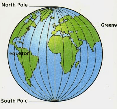
The earth's actual shape is most correctly described as...
2
Open Ended

What do the contour
lines on a
topographic map
show us?
3
Multiple Choice
4
Multiple Choice

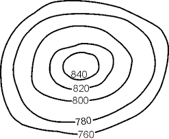
What is the elevation of point A on this map? (The contour interval is 10 ft.)
5
Multiple Choice

6
Multiple Choice

7
8
Multiple Choice
9
Open Ended
10
Fill in the Blanks
11
Multiple Choice
12
13

14
15
Open Ended

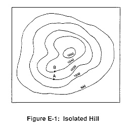
If the distance between A and B is 10 miles, what is the gradient of this slope?
16
Multiple Choice
17
Multiple Choice
18
Multiple Choice
19
Multiple Choice
20
Multiple Choice

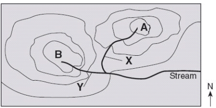
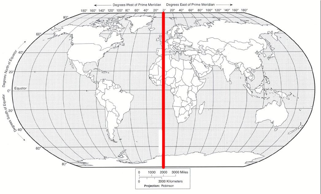
Location D is located at which coordinates?
21
Multiple Choice
22
Multiple Choice
23
Multiple Choice
24
Multiple Choice
25
26

27

28
Multiple Choice

A camera was placed outside at night and pointed directly at Polaris and several other stars. The lens was kept open and a time-exposure photograph was taken. The diagram below represents that photograph of Polaris and star trails, with an angular protractor to measure apparent motion.
How many hours was the lens kept open to create the star trails in this photograph?
29
Multiple Choice

At which latitude were these star trails observed?
30
Multiple Choice
31
Multiple Choice
32
Multiple Choice
33
Multiple Choice
34
Multiple Choice
35

36
Multiple Choice
37

38
Multiple Choice
39
40
Multiple Choice
41
Draw
42
Multiple Choice
43
Multiple Choice

What is the latitude of this person?
44
Multiple Choice
45
Multiple Choice
46
Multiple Choice
47
Multiple Choice
48
Multiple Choice

The graph represents percentage of elements by volume. This graph best represents the elements of the Earth's
49
Multiple Choice
50
Multiple Choice

Base your answer on the map, which shows the latitude and longitude of five observers, A, B, C, D and E, on Earth. What is the altitude of Polaris (the North Star) above the northern horizon for observer A?
51
Multiple Choice
52
Multiple Choice
53
Multiple Choice
54
Multiple Choice
55
Multiple Choice
The earth's actual shape is most correctly described as...
Show answer
Auto Play
Slide 1 / 55
MULTIPLE CHOICE
