Geologic Maps and Their Features
Interactive Video
•
Science, Geography, Other
•
9th - 10th Grade
•
Practice Problem
•
Hard

Patricia Brown
Used 1+ times
FREE Resource
Read more
10 questions
Show all answers
1.
MULTIPLE CHOICE QUESTION
30 sec • 1 pt
Why is map reading considered an important skill despite the prevalence of smartphones?
Smartphones are not reliable.
Map reading helps in understanding the terrain better.
Paper maps are more accurate.
Smartphones can run out of battery.
2.
MULTIPLE CHOICE QUESTION
30 sec • 1 pt
What is a key difference between road maps and scientific maps?
Scientific maps provide data about the world.
Road maps are used only in cities.
Scientific maps are easier to read.
Road maps are more colorful.
3.
MULTIPLE CHOICE QUESTION
30 sec • 1 pt
What type of information is typically shown on a tourist map?
Geological formations.
Weather patterns.
Roads, trails, and points of interest.
Elevation and terrain details.
4.
MULTIPLE CHOICE QUESTION
30 sec • 1 pt
What is the primary focus of a topographic map?
Depicting the landscape's topography.
Highlighting tourist attractions.
Displaying weather conditions.
Showing political boundaries.
5.
MULTIPLE CHOICE QUESTION
30 sec • 1 pt
Where can geologic maps typically be found?
In local bookstores.
At university library collections.
On public transport.
In tourist information centers.
6.
MULTIPLE CHOICE QUESTION
30 sec • 1 pt
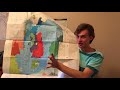
What do the colors on a geologic map represent?
Types of vegetation.
Different rock units.
Various tourist attractions.
Different weather conditions.
7.
MULTIPLE CHOICE QUESTION
30 sec • 1 pt
How are rock units labeled in the keys of geologic maps?
Alphabetically.
By size.
Chronologically.
By color.
Access all questions and much more by creating a free account
Create resources
Host any resource
Get auto-graded reports
Continue with Google

Continue with Email
Continue with Classlink
Continue with Clever
or continue with
Microsoft
%20(1).png)
Apple
Others
Already have an account?
