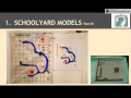
Understanding Schoolyard Models and Resources
Interactive Video
•
Geography
•
5th - 6th Grade
•
Practice Problem
•
Hard

Patricia Brown
FREE Resource
Read more
10 questions
Show all answers
1.
MULTIPLE CHOICE QUESTION
30 sec • 1 pt
What is the primary objective of the schoolyard models investigation?
To design a new school building
To learn about historical maps
To build a 3D model of the school area
To create a digital map of the school
2.
MULTIPLE CHOICE QUESTION
30 sec • 1 pt
Which materials are suggested for creating the 3D model?
Sand and water
Only centimeter cubes and craft sticks
Toothpicks, Lego pieces, and cardboard
Clay and paint
3.
MULTIPLE CHOICE QUESTION
30 sec • 1 pt
Why is it beneficial to take students outside for this activity?
To avoid classroom noise
To have more space
To get fresh air
To make the experience more genuine
4.
MULTIPLE CHOICE QUESTION
30 sec • 1 pt
What is the purpose of placing an overlay transparency on the model?
To protect the model
To trace the model from an aerial view
To add color to the model
To measure the model's dimensions
5.
MULTIPLE CHOICE QUESTION
30 sec • 1 pt
What can students learn by comparing different representations of their model?
The weather patterns in the area
The differences in scale and perspective
The history of the school
The architectural design of the school
6.
MULTIPLE CHOICE QUESTION
30 sec • 1 pt
What should be included in the map grid drawing?
A photo of the model
A timeline of the project
A map key and symbols
A list of materials used
7.
MULTIPLE CHOICE QUESTION
30 sec • 1 pt
How do the word bank and content inquiry sections assist students?
By offering extra credit opportunities
By giving them a break from the activity
By providing additional reading material
By helping them reflect on their learning
Access all questions and much more by creating a free account
Create resources
Host any resource
Get auto-graded reports
Continue with Google

Continue with Email
Continue with Classlink
Continue with Clever
or continue with
Microsoft
%20(1).png)
Apple
Others
Already have an account?
