Explore Year 5 Mexico geography worksheets and printables that help students learn about Mexican states, capitals, landforms, and cultural regions through engaging practice problems with complete answer keys.
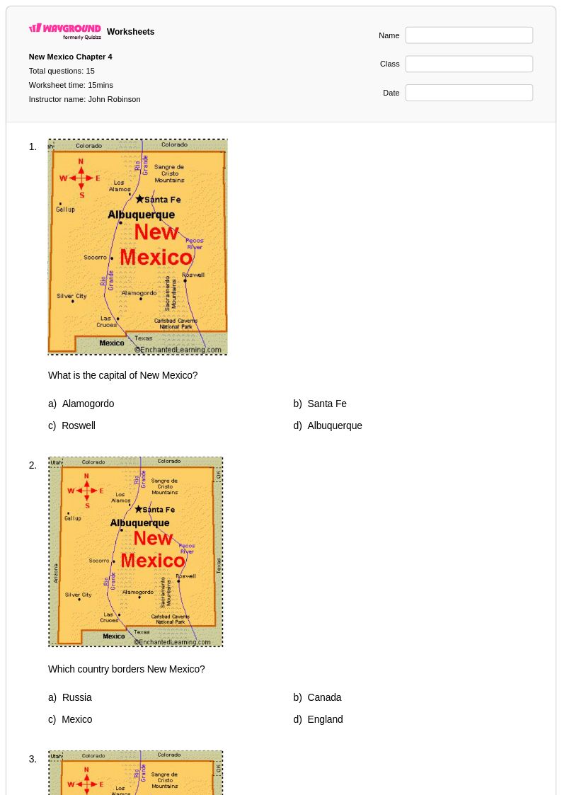
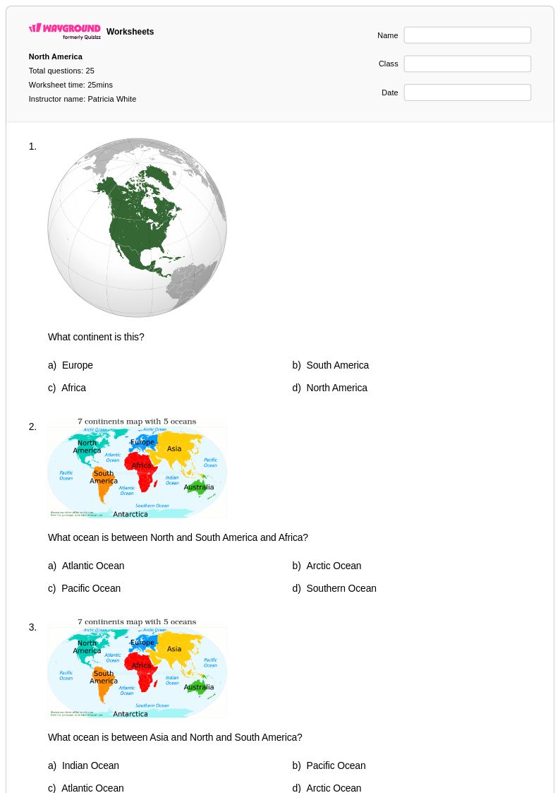
Mexico geography worksheets for Year 5 students available through Wayground (formerly Quizizz) provide comprehensive exploration of Mexico's diverse physical and cultural landscapes. These educational resources strengthen students' map reading skills, geographic vocabulary, and understanding of Mexico's states, capitals, major cities, mountain ranges, rivers, and coastal regions. The worksheet collection includes practice problems covering Mexico's borders with the United States and Central America, climate zones from desert to tropical regions, and significant landmarks such as the Yucatan Peninsula and Baja California. Each worksheet comes with a complete answer key and is available as free printables in pdf format, allowing students to develop their knowledge of Mexican geography through structured activities that reinforce location identification, landform recognition, and cultural geography concepts.
Wayground (formerly Quizizz) supports educators with an extensive collection of teacher-created Mexico geography resources specifically designed for Year 5 learners. The platform's millions of worksheets include robust search and filtering capabilities that allow teachers to quickly locate materials aligned with state geography standards and curriculum requirements. These differentiation tools enable instructors to customize content for varying skill levels, supporting both remediation for struggling students and enrichment opportunities for advanced learners. The flexible format options include both printable pdf worksheets for traditional classroom use and digital versions for interactive learning, making lesson planning more efficient while providing multiple approaches to skill practice that help students master essential geographic knowledge about Mexico's regions, political divisions, and physical features.
FAQs
How do I teach Mexico geography to elementary and middle school students?
Start with Mexico's physical geography — major mountain ranges like the Sierra Madre Occidental and Oriental, the Central Plateau, and coastal plains — before moving into political geography such as states, capitals, and major cities. Using labeled map activities helps students build spatial awareness and connect physical features to cultural and economic patterns. Layering in cultural regions and climate zones after students have a physical foundation gives context to why population and industry are distributed the way they are.
What worksheets help students practice Mexico geography skills?
Map labeling exercises that ask students to identify Mexico's 31 states and their capitals are strong foundational practice. Worksheets focused on physical features — such as locating the Gulf of California, the Yucatán Peninsula, or the Baja California Peninsula — build spatial analysis skills. Adding questions that connect geography to cultural regions or economic activity pushes students toward higher-order geographic thinking.
What common mistakes do students make when learning Mexico geography?
Students frequently confuse Mexico's coastal regions, mixing up Pacific and Gulf Coast states, or misplace the Sierra Madre ranges relative to the Central Plateau. Another common error is conflating Mexico City (a federal entity) with a standard state, which matters when studying Mexico's political divisions. Students also tend to underestimate Mexico's geographic diversity, assuming a uniform desert landscape rather than recognizing its varied climate zones, rainforests, and highland regions.
How can I use Mexico geography worksheets to support diverse learners in my classroom?
Differentiation for Mexico geography can include simplified map outlines with word banks for students who need scaffolding, alongside open-response and analysis tasks for advanced learners. On Wayground, teachers can apply individual accommodations such as read aloud support, reduced answer choices, extended time, and adjustable reading modes — all configurable per student without affecting the rest of the class. These settings are reusable across future sessions, making it practical to maintain consistent support for students with ongoing needs.
How do I use Mexico worksheets from Wayground in my classroom?
Mexico worksheets on Wayground are available as printable PDFs for traditional classroom use and in digital formats for technology-integrated environments, including the option to host them as a live quiz on Wayground. Teachers can download and print map activities, practice problems, and assessment worksheets, or assign them digitally for individual or whole-class completion. Each worksheet includes a complete answer key, which streamlines grading and makes the materials ready to use with minimal preparation.
How do I assess student understanding of Mexico geography?
Effective assessment for Mexico geography includes both identification tasks — correctly labeling states, capitals, and physical features on blank maps — and short-answer or analysis questions that ask students to explain geographic patterns. Checking whether students can connect physical geography to human geography (for example, why major cities cluster on the Central Plateau) reveals deeper conceptual understanding beyond memorization. Common errors on assessments, such as misidentifying border states or reversing the Sierra Madre ranges, can guide targeted review.