Explore Year 4 Oceania geography worksheets from Wayground that help students learn about Australia, New Zealand, and Pacific islands through engaging printables, practice problems, and comprehensive answer keys.
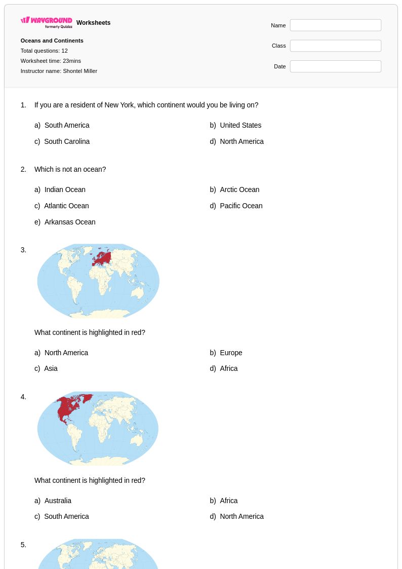
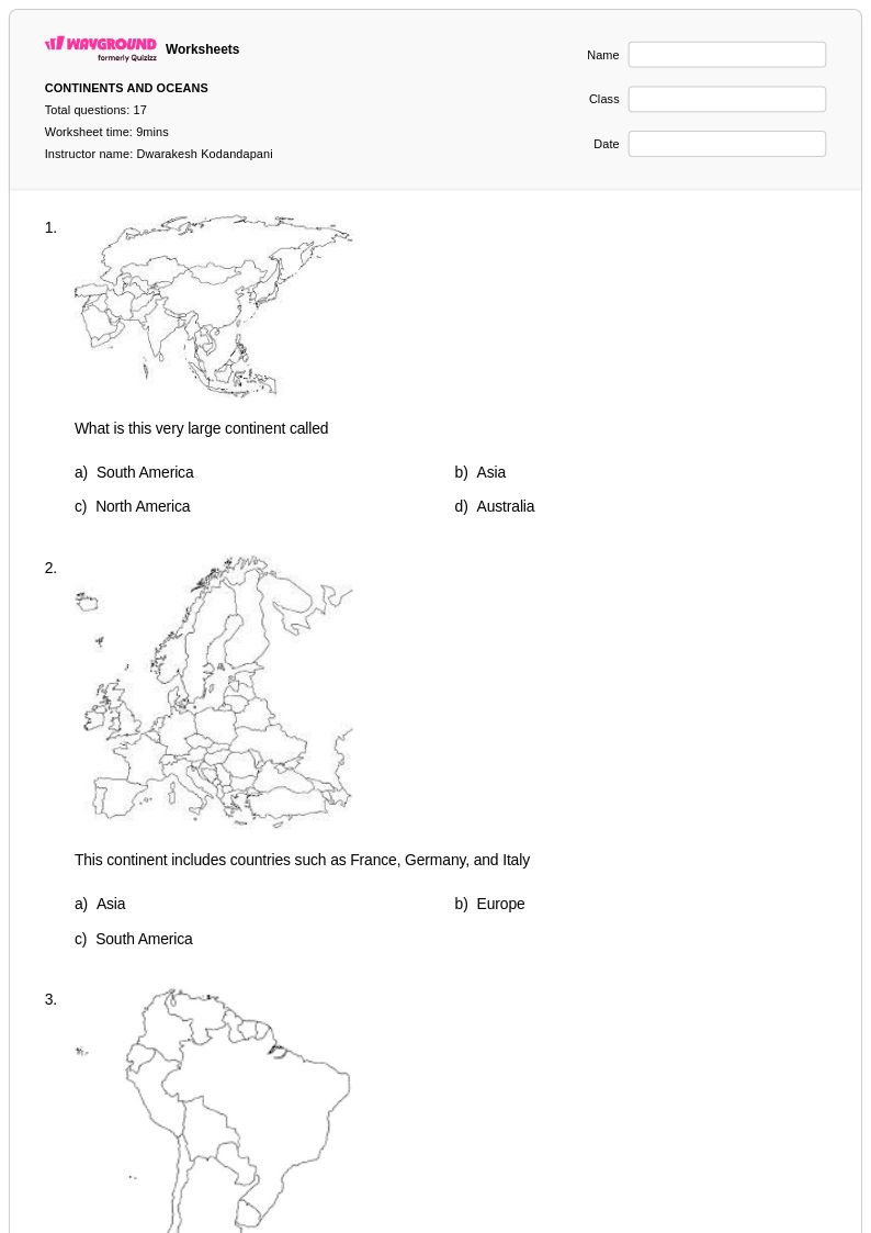
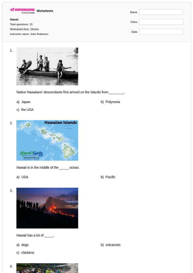
Oceania worksheets for Year 4 students available through Wayground (formerly Quizizz) provide comprehensive exploration of this fascinating Pacific region's geography, cultures, and unique characteristics. These educational resources strengthen students' map skills, spatial awareness, and cultural understanding as they investigate Australia, New Zealand, Papua New Guinea, Fiji, and numerous island nations scattered across the Pacific Ocean. The worksheets include practice problems that challenge fourth graders to identify major landforms, locate capital cities, analyze climate patterns, and compare the diverse ecosystems found throughout Oceania's varied landscapes. Each printable resource comes with a detailed answer key, making assessment and self-directed learning straightforward for both classroom instruction and independent study. These free educational materials cover essential geographic concepts including the formation of coral atolls, volcanic islands, the Great Barrier Reef, and the cultural significance of the Pacific Ring of Fire region.
Wayground (formerly Quizizz) supports educators with an extensive collection of teacher-created Oceania geography worksheets, drawing from millions of high-quality resources developed by classroom professionals worldwide. The platform's robust search and filtering capabilities allow teachers to quickly locate materials aligned with specific grade-level standards and learning objectives, while differentiation tools enable customization for diverse student needs and abilities. These versatile worksheets are available in both printable pdf format and interactive digital versions, providing flexibility for traditional classroom settings, remote learning environments, and hybrid instruction models. Teachers can easily modify content to support remediation for struggling learners or create enrichment activities for advanced students, making lesson planning more efficient while ensuring targeted skill practice in Pacific geography, cultural studies, and spatial reasoning that builds foundational knowledge for future social studies learning.
FAQs
How do I teach Oceania geography to students who have little prior knowledge of the region?
Start by anchoring the region visually — have students locate and label the three subregions (Polynesia, Melanesia, and Micronesia) on a blank map before introducing individual countries or territories. From there, build outward by connecting physical geography concepts like coral atoll formation and volcanic islands to specific locations students have already mapped. This spatial foundation makes abstract concepts like ocean currents and isolation far more concrete.
What are the best exercises to help students practice Oceania geography skills?
Map labeling activities that require students to identify countries, territories, and subregions are foundational for Oceania, given how dispersed the region is across the Pacific. Pairing these with practice problems on physical geography topics such as coral atoll formation, volcanic island structure, and ocean current patterns helps students connect spatial knowledge with geographic processes. Worksheets that ask students to analyze the relationship between isolation and settlement patterns are especially effective for building higher-order geographic thinking.
What mistakes do students commonly make when learning about Oceania?
A common misconception is conflating Oceania with Australia alone, causing students to overlook the Pacific island nations of Polynesia, Melanesia, and Micronesia entirely. Students also frequently confuse the subregions with one another or misplace island groups on maps due to the region's vast geographic spread. Another recurring error is underestimating how physical geography, particularly volcanic activity and coral reef systems, directly shapes human settlement and resource availability across the Pacific.
How can I differentiate Oceania geography instruction for students at different skill levels?
For students who need foundational support, focus on map reading and basic country identification before introducing complex concepts like plate tectonics or ocean current systems. More advanced students can explore how physical geography drives economic and cultural patterns across the Pacific, including the challenges of isolation faced by island communities. On Wayground, teachers can apply individual accommodations such as reduced answer choices to lower cognitive load for struggling students, or assign enrichment-level digital activities to students who are ready for greater challenge, all within the same session.
How do I use Wayground's Oceania geography worksheets in my classroom?
Wayground's Oceania worksheets are available as free printable PDFs for traditional classroom use and in digital formats for technology-integrated environments, including the option to host them as a live quiz on Wayground. Every worksheet includes a complete answer key, so teachers can use them for independent practice, homework, or formative assessment without additional preparation. The platform's search and filtering tools allow teachers to quickly find materials aligned to specific curriculum standards or geographic skill areas, making it straightforward to slot these resources into an existing unit on world geography or the Pacific region.
How does Oceania geography fit into a broader world geography curriculum?
Oceania serves as an effective case study for several cross-cutting geographic concepts, including island biogeography, the impact of tectonic activity along the Ring of Fire, and how physical isolation shapes cultural and economic development. Its inclusion in a world geography curriculum gives students practice with map reading across a non-contiguous region, which builds spatial reasoning skills that transfer to other units. Covering Oceania also rounds out students' understanding of all major world regions, ensuring they can situate Australia, New Zealand, and the Pacific island nations within global geographic patterns.