
10 Q
3rd
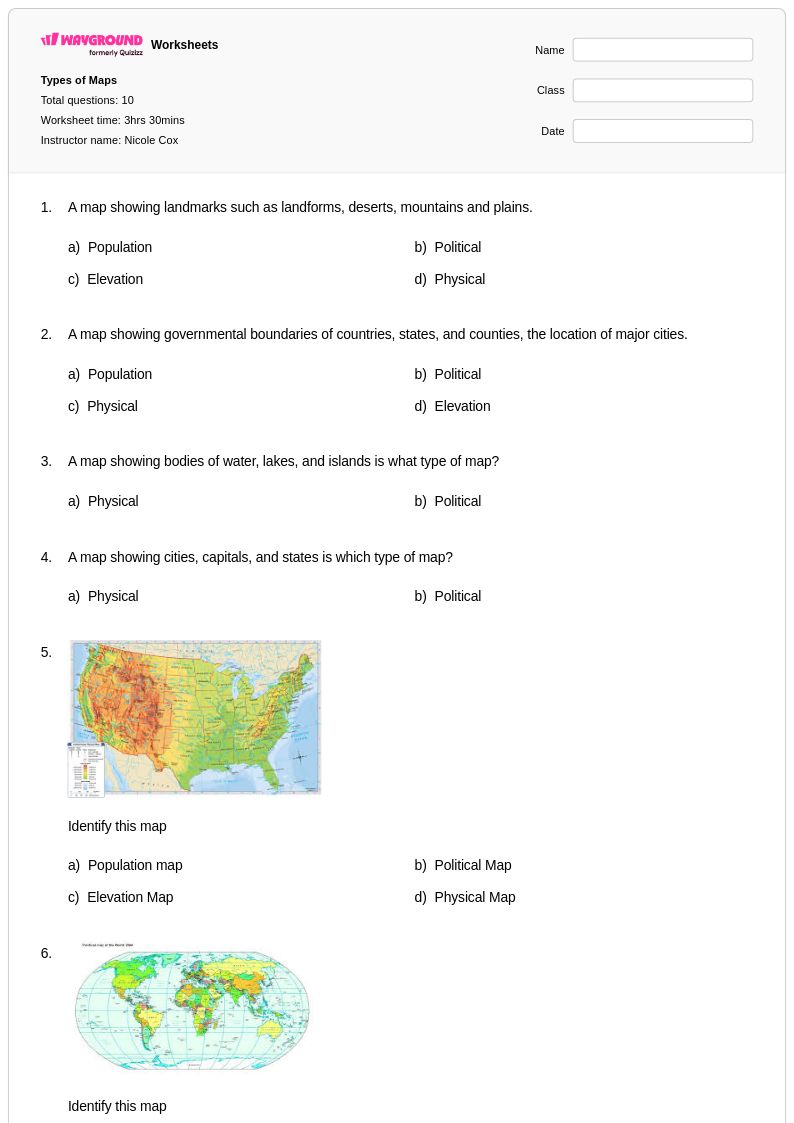
10 Q
3rd
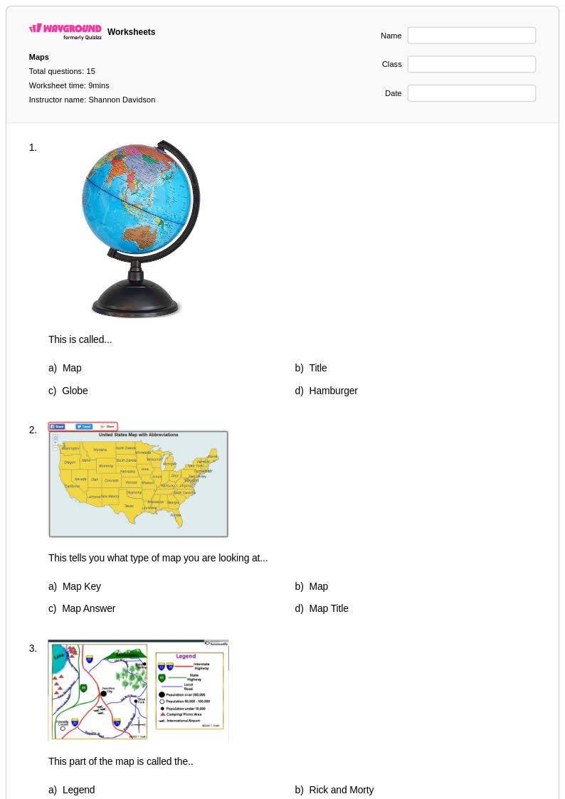
15 Q
3rd
12 Q
3rd
10 Q
3rd
10 Q
3rd
13 Q
3rd
15 Q
3rd
15 Q
3rd - 4th
20 Q
1st - 5th
24 Q
1st - 5th
16 Q
1st - 5th

6 Q
3rd
10 Q
3rd
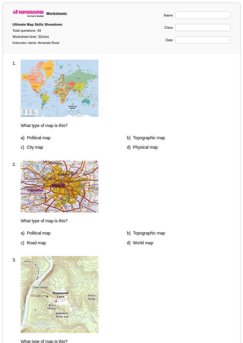
39 Q
3rd
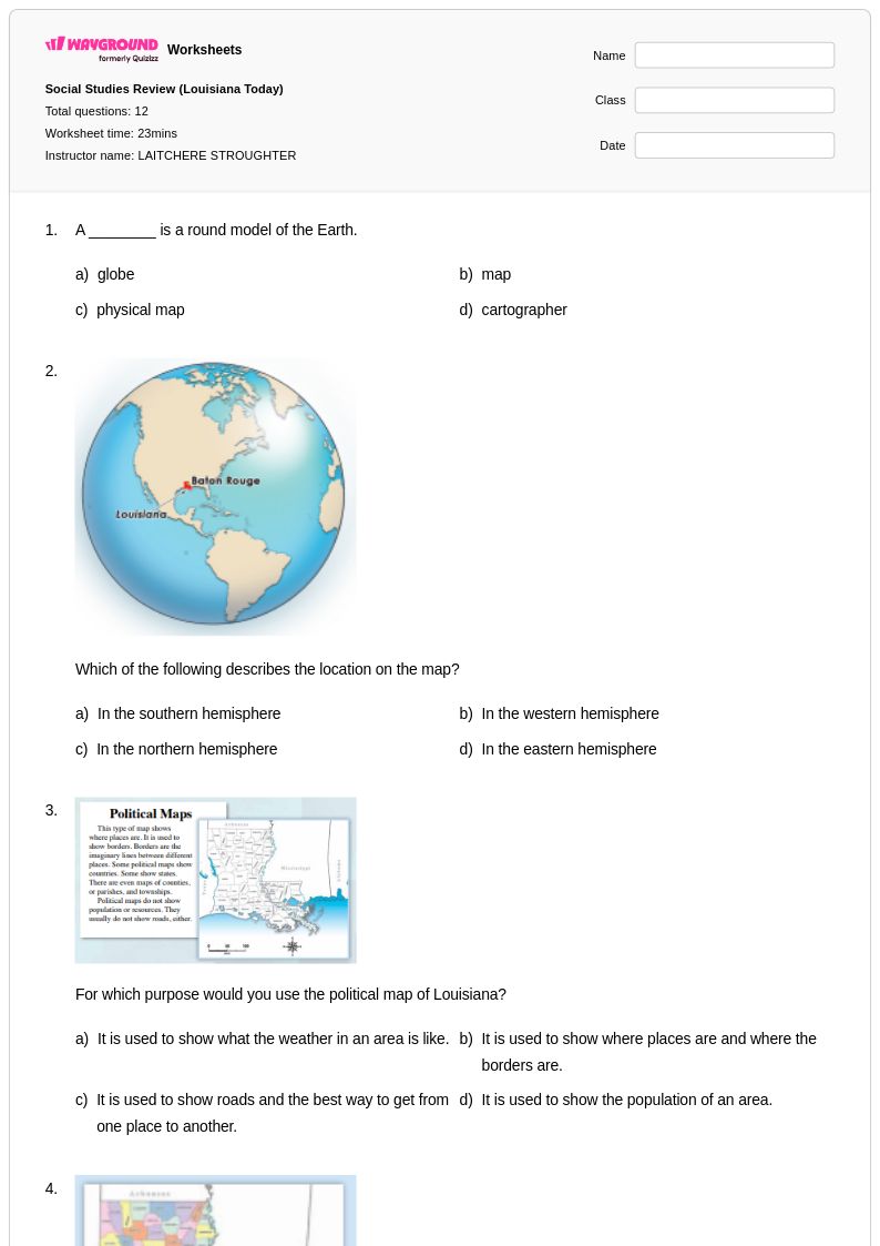
12 Q
3rd
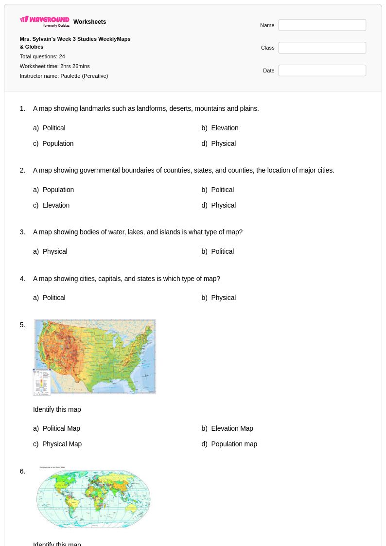
24 Q
3rd
14 Q
3rd
12 Q
1st - 4th
12 Q
3rd

21 Q
3rd
14 Q
3rd
18 Q
3rd
14 Q
3rd
Explore Other Subject Worksheets for year 3
Explore printable Physical Maps worksheets for Year 3
Physical maps worksheets for Year 3 students available through Wayground (formerly Quizizz) provide essential foundational practice in understanding Earth's natural features and landforms. These comprehensive printables help young learners develop critical geographic skills including identifying mountains, rivers, oceans, deserts, and plains while building spatial awareness and map reading abilities. Each worksheet collection includes detailed answer keys and free practice problems that reinforce key concepts such as elevation representation through colors and symbols, understanding topographic features, and recognizing how physical geography influences human settlement patterns. Students engage with age-appropriate activities that strengthen their ability to interpret map legends, distinguish between different landform types, and connect physical features to their real-world locations.
Wayground (formerly Quizizz) empowers educators with millions of teacher-created physical maps resources specifically designed for Year 3 instruction, featuring robust search and filtering capabilities that align with state geography standards. Teachers can easily differentiate instruction through customizable worksheets available in both printable pdf formats and interactive digital versions, allowing for seamless integration into diverse classroom environments. The platform's extensive collection supports comprehensive lesson planning by offering varied difficulty levels for remediation and enrichment opportunities, while flexible customization tools enable educators to modify content based on specific learning objectives and student needs. These resources streamline the process of providing consistent skill practice in physical geography concepts, helping teachers effectively assess student understanding of landforms, elevation, and spatial relationships through structured worksheet activities.
FAQs
How do I teach students to read a physical map?
What exercises help students practice reading physical maps?
What mistakes do students commonly make when interpreting physical maps?
How can I differentiate physical maps instruction for students at different skill levels?
How do I use Wayground's physical maps worksheets in my classroom?