
20 Q
4th
18 Q
4th
11 Q
4th - 5th
17 Q
4th
15 Q
3rd - 4th
20 Q
4th - 8th
20 Q
1st - 5th
8 Q
4th
24 Q
1st - 5th
13 Q
4th
14 Q
4th
16 Q
1st - 5th
13 Q
4th
31 Q
4th
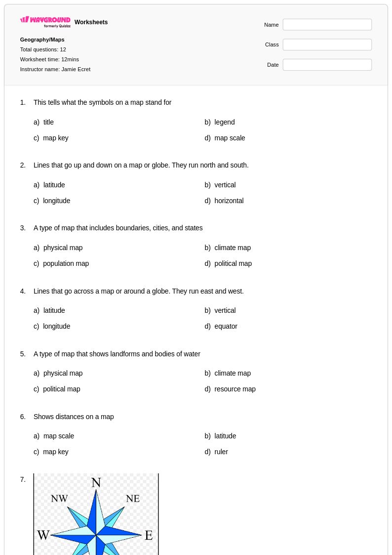
12 Q
1st - 4th
51 Q
4th
18 Q
4th
26 Q
4th
20 Q
4th
12 Q
4th - 5th
10 Q
4th
41 Q
4th
17 Q
4th - Uni
16 Q
4th
Explore Other Subject Worksheets for year 4
Explore printable Physical Maps worksheets for Year 4
Physical maps worksheets for Year 4 students available through Wayground (formerly Quizizz) provide comprehensive practice with understanding and interpreting the natural features of Earth's surface. These educational resources help fourth-grade learners develop essential map-reading skills by focusing on topographical elements such as mountains, rivers, plains, deserts, and ocean basins. Students engage with practice problems that require them to identify elevation changes, recognize landform symbols, and understand how physical features are represented through colors, contour lines, and relief shading. The printable worksheets come with detailed answer keys that allow teachers to efficiently assess student comprehension while providing immediate feedback on geographic literacy development. These free resources strengthen spatial thinking abilities and build foundational knowledge necessary for more advanced geographic concepts in later grades.
Wayground (formerly Quizizz) supports educators with an extensive collection of teacher-created physical maps worksheets that address diverse classroom needs through sophisticated search and filtering capabilities. The platform's millions of educational resources enable teachers to locate materials specifically aligned with grade-level standards and differentiate instruction based on individual student abilities. Flexible customization tools allow educators to modify existing worksheets or create targeted practice activities for remediation and enrichment purposes. These comprehensive materials are available in both printable pdf formats for traditional classroom use and digital formats for interactive learning environments. Teachers can efficiently plan geography lessons, assess student progress, and provide additional skill practice through this robust collection of physical maps resources designed to support Year 4 social studies curriculum objectives.
FAQs
How do I teach students to read a physical map?
What exercises help students practice reading physical maps?
What mistakes do students commonly make when interpreting physical maps?
How can I differentiate physical maps instruction for students at different skill levels?
How do I use Wayground's physical maps worksheets in my classroom?