
24 Q
9th
12 Q
9th
25 Q
9th
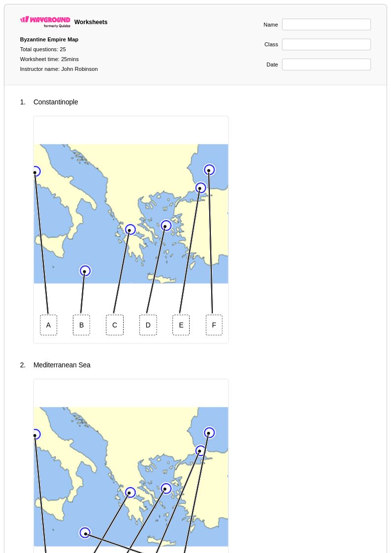
25 Q
9th - Uni
15 Q
7th - Uni
15 Q
7th - Uni
25 Q
7th - Uni
11 Q
9th - 12th
15 Q
7th - Uni
15 Q
7th - Uni
20 Q
9th
25 Q
7th - Uni
22 Q
9th
15 Q
9th
15 Q
9th - Uni
30 Q
9th
15 Q
9th - Uni
15 Q
7th - Uni
15 Q
7th - Uni
15 Q
7th - Uni
25 Q
7th - Uni
15 Q
6th - Uni
10 Q
9th - 12th
21 Q
9th - 12th
Explore Byzantine Empire Mapping Worksheets by Grades
Explore Other Subject Worksheets for class 9
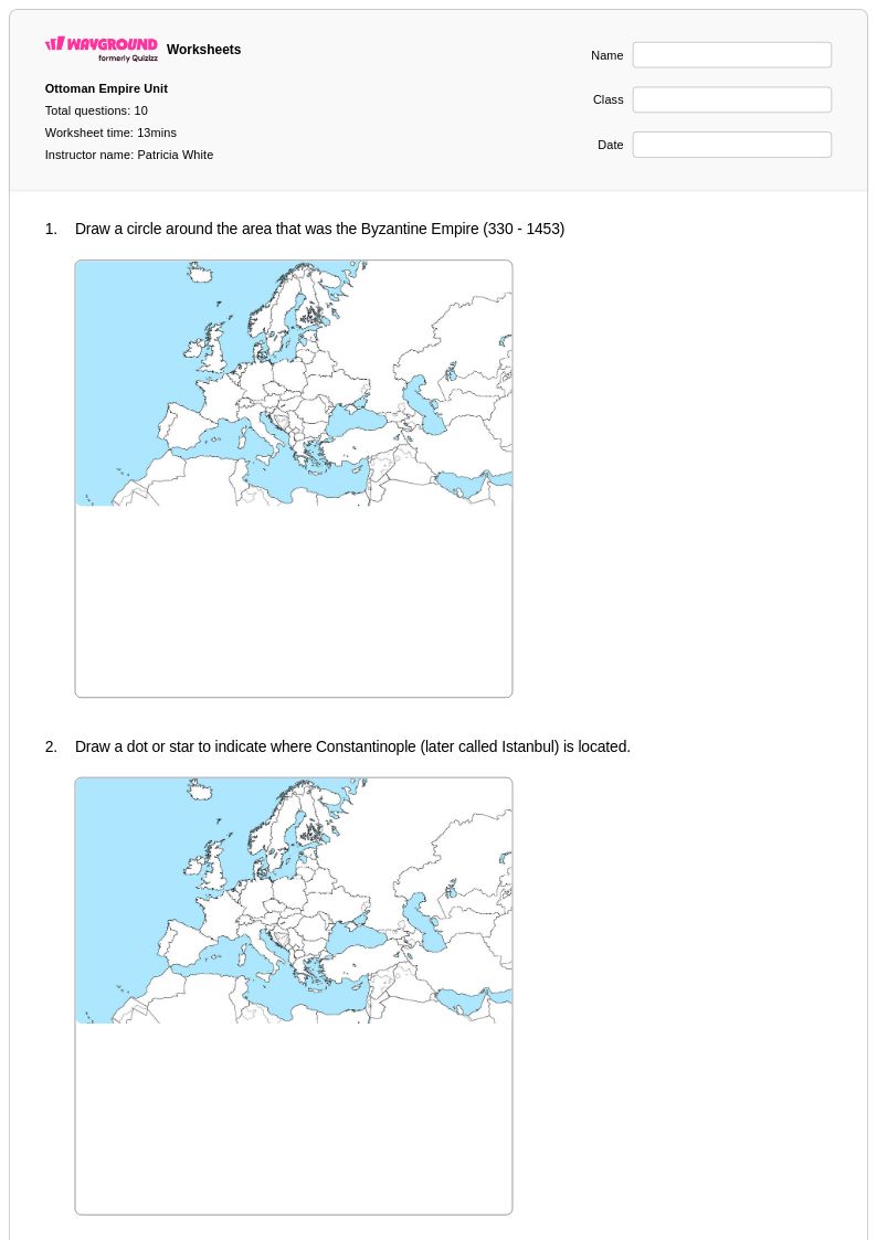
Explore printable Byzantine Empire Mapping worksheets for Class 9
Byzantine Empire mapping worksheets for Class 9 students available through Wayground (formerly Quizizz) provide comprehensive geographic and historical analysis tools that develop critical spatial reasoning skills essential for advanced social studies learning. These carefully designed printables challenge students to identify key Byzantine territories, trace the empire's expansion and contraction over time, and analyze the strategic importance of Constantinople's location at the crossroads of Europe and Asia. Each worksheet includes detailed practice problems that require students to interpret historical maps, correlate geographic features with political developments, and understand how the Byzantine Empire's unique position influenced its cultural synthesis of Roman, Greek, and Christian traditions. The accompanying answer key ensures accurate assessment while supporting independent learning, and the free pdf format makes these resources accessible for both classroom instruction and homework assignments.
Wayground (formerly Quizizz) empowers educators with millions of teacher-created Byzantine Empire mapping resources that streamline lesson planning and enhance differentiated instruction for Class 9 history courses. The platform's robust search and filtering capabilities allow teachers to quickly locate worksheets aligned with specific curriculum standards, while customization tools enable modification of content difficulty and format to meet diverse learning needs. These digital and printable resources support targeted skill practice in cartographic interpretation, chronological reasoning, and geographic analysis, making them invaluable for remediation of struggling students and enrichment of advanced learners. Teachers can seamlessly integrate these Byzantine Empire mapping activities into comprehensive units on medieval civilizations, utilizing the flexible pdf format for both in-class collaborative work and individual assessment, while drawing from the extensive collection to provide varied practice opportunities that reinforce spatial understanding of this pivotal empire's historical significance.
FAQs
How do I teach Byzantine Empire geography to middle or high school students?
What map skills do Byzantine Empire mapping worksheets help students practice?
What misconceptions do students commonly have about the Byzantine Empire's geography?
How can I use Byzantine Empire mapping worksheets to assess student understanding?
How do I use Wayground's Byzantine Empire mapping worksheets in my classroom?