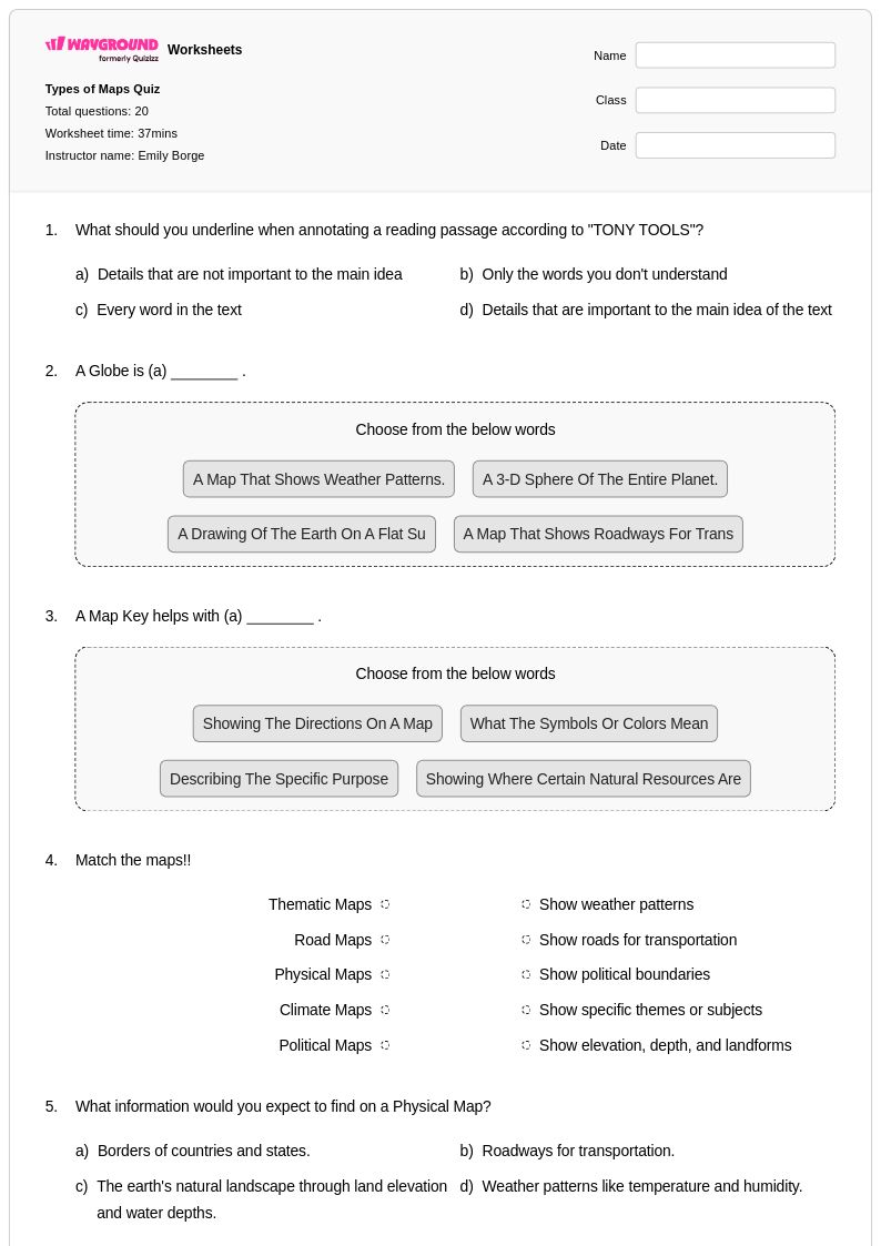
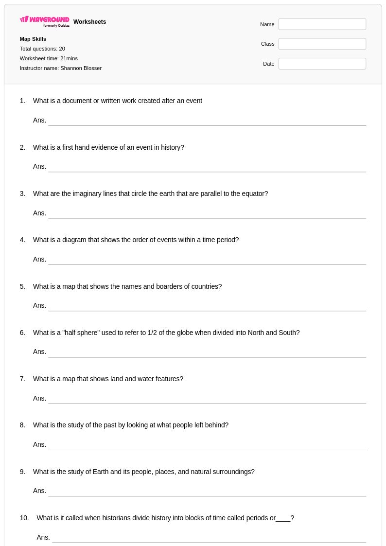
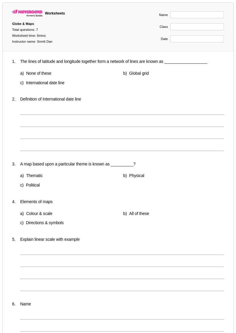
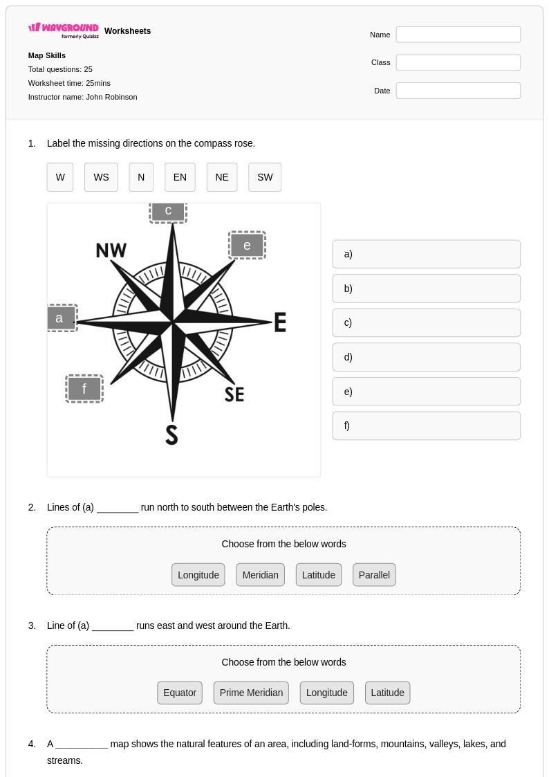
Enhance your Class 5 students' map grid skills with our comprehensive collection of free printable worksheets and practice problems that teach coordinate systems, grid references, and spatial navigation through engaging PDF activities with complete answer keys.
Map grid worksheets for Class 5 students available through Wayground (formerly Quizizz) provide essential practice in understanding coordinate systems and spatial referencing skills that form the foundation of geographic literacy. These comprehensive printables focus on teaching students how to locate places using alphanumeric grid references, understand the relationship between rows and columns on maps, and develop precision in reading coordinates. Students work through carefully designed practice problems that progress from basic grid identification to more complex tasks involving plotting points, finding locations using letter-number combinations, and interpreting grid-based information on various map types. Each worksheet collection includes a complete answer key and is available as free pdf downloads, making it easy for educators to incorporate systematic grid skills practice into their social studies curriculum while building students' confidence with fundamental mapping concepts.
Wayground (formerly Quizizz) supports educators with an extensive collection of teacher-created map grid resources that streamline lesson planning and provide targeted skill development opportunities for Class 5 students. The platform's millions of educational materials include worksheets that align with social studies standards and offer robust search and filtering capabilities, allowing teachers to quickly locate resources that match their specific instructional needs and student ability levels. These differentiation tools enable educators to customize practice sessions for remediation or enrichment, while the flexible format options support both digital classroom integration and traditional printable activities. Teachers can efficiently plan sequential lessons that build grid reading proficiency, assess student understanding through varied practice problems, and provide immediate feedback using the comprehensive answer keys, ensuring that every student develops the spatial reasoning skills necessary for advanced geographic study.
FAQs
How do I teach map grid coordinates to students who have never used a grid before?
Start by introducing the concept of alphanumeric grid references using a simple, familiar context such as a classroom seating chart or a basic town map before moving to geographic maps. Teach students the convention of reading across (columns) before reading up (rows) using the phrase 'go along the corridor, then up the stairs.' Once students can locate grid squares reliably, introduce coordinate pairs and progress toward latitude and longitude. Scaffolding from concrete to abstract is essential for building lasting spatial reasoning skills.
What practice exercises help students get better at reading map grids?
Effective practice moves from basic grid identification to multi-step tasks such as plotting coordinates, measuring distances between grid references, and analyzing geographic patterns within mapped regions. Worksheets that vary the context, such as city maps, physical geography maps, and thematic maps, help students generalize the skill rather than memorizing a single format. Progressing through problems of increasing complexity builds both accuracy and confidence in spatial reasoning.
What mistakes do students commonly make when using map grid coordinates?
The most frequent error is reversing the order of coordinates, reading the y-axis value before the x-axis value instead of following the standard horizontal-then-vertical convention. Students also commonly place a point on the grid line itself rather than within the correct grid square, especially at early stages. A third common misconception is confusing alphanumeric grid references with true coordinate pairs, which becomes problematic when students transition to latitude and longitude. Targeted practice that explicitly addresses each of these errors helps prevent them from becoming entrenched habits.
How do I use map grid worksheets in my classroom?
Map grid worksheets on Wayground are available as printable PDFs for traditional classroom use and in digital formats for technology-integrated learning environments, making them suitable for in-class work, homework, and remote learning. Teachers can also host worksheets as a quiz directly on Wayground, allowing for interactive digital practice with automatic grading. Each worksheet includes a comprehensive answer key, supporting both independent student practice and teacher-led instruction. Wayground's accommodation settings allow teachers to enable features such as extended time or read-aloud support for individual students without disrupting the experience for the rest of the class.
How do map grid skills connect to broader geography and STEM learning?
Map grid literacy forms the foundation of geographic literacy, underpinning students' ability to interpret maps, understand latitude and longitude, and engage with geographic information systems (GIS) later in their education. Spatial reasoning developed through grid practice also supports STEM skills including data visualization, coordinate geometry in mathematics, and navigation concepts in science and engineering contexts. Building fluency with grid systems early gives students the tools to approach complex geographic and analytical tasks with confidence.
How can I differentiate map grid instruction for students at different skill levels?
For struggling learners, begin with large, clearly labeled grids using alphanumeric references and limit the number of answer choices to reduce cognitive load. For on-level students, introduce coordinate pairs and tasks that require plotting and distance calculation. Advanced learners can be challenged with multi-step problems that involve analyzing geographic patterns or working with real-world latitude and longitude data. On Wayground, teachers can apply accommodations such as reduced answer choices or extended time to individual students, allowing a single worksheet to serve an entire mixed-ability class without requiring separate materials.